Old Maps of Paragould, Arkansas
Explore 18 old maps of Paragould, spanning from 1939 to today. These high-resolution historic maps reveal how streets, neighborhoods, landmarks, and natural features evolved over time — perfect for genealogy, metal detecting, research, and local history exploration.
What you can do with these maps:
- See how Paragould changed over time: Compare historical maps to modern-day views to trace roads, homesites, rail lines & more.
- View detailed metadata: Each map includes creators, publishers, year, scale, and archive source.
- Overlay maps with satellite & LiDAR: Visualize the past alongside modern tools to explore terrain & human change.
- Trusted historical sources: Maps sourced from the USGS, Library of Congress, and other archives.
- Access maps your way: View online, download high-res files, or order prints for personal or research use.
Start exploring old maps of Paragould to uncover forgotten places, hidden landmarks, and the deep history beneath your feet.
Paragould, AR maps
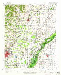
(18)- 1939 Map of Jonesboro, 1942 Print
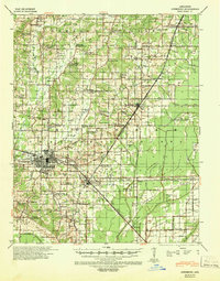 1939 Jonesboro1942 Print · USGSCovers Paragould, including Jonesboro, Bay, and other nearby areas
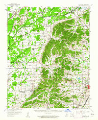
 - 1940 Map of Gainesville, 1942 Print
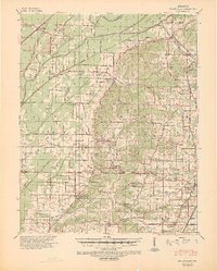 1940 Gainesville1942 Print · USGSCovers Paragould, including Oak Grove Heights, Lafe, and other nearby areas2 unique versions available
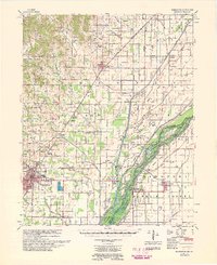
 - 1940 Map of Marmaduke, 1942 Print
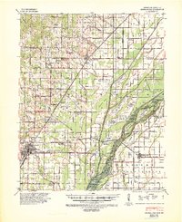 1940 Marmaduke1942 Print · USGSCovers Paragould, including Marmaduke, Oak Grove Heights, and other nearby areas3 unique versions available
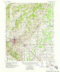
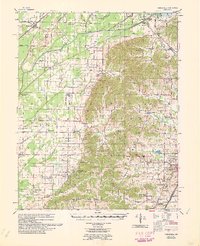
 - 1953 Map of Memphis, 1966 Print
 1953 Memphis1966 Print · USGSCovers Paragould, including Memphis, Jonesboro, and other nearby areas3 unique versions available
 - 1956 Map of Memphis
 1956 Memphis1956 Print · USGSCovers Paragould, including Memphis, Jonesboro, and other nearby areas
 - 1957 Map of Poplar Bluff, 1968 Print
 1957 Poplar Bluff1968 Print · USGSCovers Paragould, including Poplar Bluff, West Plains, and other nearby areas3 unique versions available
 - 1958 Map of Jonesboro
 1958 Jonesboro1958 Print · USGSCovers Paragould, including Jonesboro, Bay, and other nearby areas2 unique versions available
 - 1958 Map of Marmaduke, 1962 Print
 1958 Marmaduke1962 Print · USGSCovers Paragould, including Marmaduke, Oak Grove Heights, and other nearby areas2 unique versions available
 - 1958 Map of Gainesville, 1962 Print
 1958 Gainesville1962 Print · USGSCovers Paragould, including Oak Grove Heights, Lafe, and other nearby areas2 unique versions available
 - 1959 Map of Poplar Bluff
 1959 Poplar Bluff1959 Print · USGSCovers Paragould, including Poplar Bluff, West Plains, and other nearby areas
 - 1959 Map of Marmaduke
 1959 Marmaduke1959 Print · USGSCovers Paragould, including Marmaduke, Oak Grove Heights, and other nearby areas
 - 1960 Map of Gainesville
 1960 Gainesville1960 Print · USGSCovers Paragould, including Oak Grove Heights, Lafe, and other nearby areas
 - 1960 Map of Poplar Bluff
 1960 Poplar Bluff1960 Print · USGSCovers Paragould, including Poplar Bluff, West Plains, and other nearby areas
 - 1983 Map of Brookland, 1984 Print
 1983 Brookland1984 Print · USGSCovers Paragould, including Jonesboro, Brookland, and other nearby areas
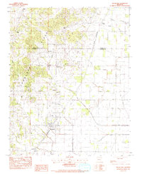
 - 1983 Map of Paragould East, 1984 Print
 1983 Paragould East1984 Print · USGSCovers Paragould, including Oak Grove Heights, Coffman, and other nearby areas2 unique versions available
 - 1984 Map of Paragould West
 1984 Paragould West1984 Print · USGSCovers Paragould, including Oak Grove Heights, Pine Knot, and other nearby areas3 unique versions available
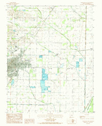
 - 1984 Map of Paragould
 1984 Paragould1984 Print · USGSCovers Paragould, including Kennett, Pocahontas, and other nearby areas2 unique versions available
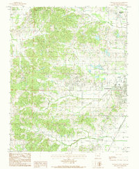
 - 1986 Map of Jonesboro
 1986 Jonesboro1986 Print · USGSCovers Paragould, including Jonesboro, Osceola, and other nearby areas2 unique versions available
End of results
Showing maps 1-18 of 18
Top cities near Paragould
- Jonesboro historical maps
- Lake City historical maps
- Rector historical maps
- Brookland historical maps
- Monette historical maps
- Marmaduke historical maps
See more
Top neighborhoods of Paragould
- Center Hill historical maps
- Fairview historical maps
- Green High historical maps
- Rock Hill historical maps
Frequently asked questions
- What are the different types of historical maps available for Paragould?
- What is the oldest map of Paragould?
- Where can I purchase historical maps of Paragould for my home or office?
- Where can I download high-res historical maps of Paragould?
- Are there historical topographic maps available for Paragould?
- Is there historical aerial imagery available for Paragould?
- Where are historical maps of Paragould sourced from?