Old Maps of Schug, Arkansas for Genealogy
Trace your family roots with 11 historic maps of Schug. These high-res maps reveal old neighborhoods, homesites, landmarks, and streets — helping you uncover where your ancestors lived and how the area evolved over time.
- Explore historic neighborhoods: Identify where your relatives may have lived in the 1800s or 1900s.
- Compare maps over time: Trace the changes in streets, buildings, and landmarks for multi-generational research.
- Perfect for genealogy & ancestry research: Used by family historians and researchers to map out lineage and migration.
These maps are an incredible resource for exploring your personal connection to Schug's past.
Schug, AR maps
(11)- 1941 Map of Leachville, 1943 Print
 1941 Leachville1943 Print · USGSNortheast Arkansas and the Missouri bootheel border region appear here in the early 1940s as a landscape of river-bottom settlements and new drainage canals. Genealogists can trace family roots through numerous local schools like Turkey Run Sch and churches such as Walnut Grove Ch & Cem.
 - 1953 Map of Memphis, 1966 Print
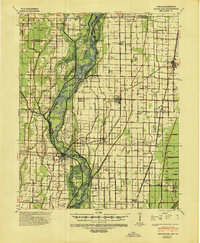
 1953 Memphis1966 Print · USGSEastern Arkansas and the Memphis riverfront are shown here during the mid-century period of regional growth and river management. Local historians can trace the paths of the Chicago Rock Island & Pacific RR through Forrest City or locate river landmarks like President's Island.3 unique versions available
 - 1956 Map of Leachville
 1956 Leachville1956 Print · USGSThe Arkansas-Missouri borderlands in the mid-1950s show a region shaped by major drainage projects and the railroad economy. Genealogists and historians can trace family locations near Leachville, Black Oak, and several country schools like Milligan Ridge Sch.2 unique versions available
 - 1956 Map of Memphis
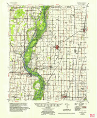
 1956 Memphis1956 Print · USGSThe Mississippi Delta and the bluffs of West Tennessee meet in the mid-fifties, showing a landscape defined by massive river systems and rail hubs. Researchers can trace the path of Crowleys Ridge or locate vanished river landings near Centennial Island and Island No 35.
 - 1983 Map of Dixie, 1984 Print
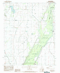 1983 Dixie1984 Print · USGSNortheastern Arkansas in the late seventies and early eighties shows a landscape shaped by massive water management projects and river bottom agriculture. Researchers can trace rural communities like Schug and Dixie, along with remote landmarks like Burnt Hill Ch and Miller Cem near the St Francis River.
 - 1986 Map of Jonesboro
 1986 Jonesboro1986 Print · USGSNortheast Arkansas in the mid-eighties shows a landscape of intensive drainage and railroad junctions centered on the rise of Crowley's Ridge. Researchers can trace the rail corridors of the St Louis Southwestern Railway and explore the unique geography of Hatchie Coon Island and the Mississippi River floodplain.2 unique versions available
 - 2011 Map of Dixie, 2011 Print
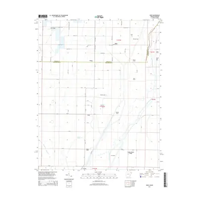
 2011 Dixie2011 Print · USGSCovers Schug, including Lester, Upper Poplar Ridge, and other nearby areas
 - 2014 Map of Dixie, 2014 Print
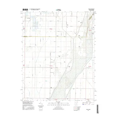
 2014 Dixie2014 Print · USGSCovers Schug, including Lester, Upper Poplar Ridge, and other nearby areas
 - 2017 Map of Dixie, 2017 Print
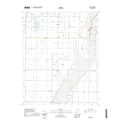
 2017 Dixie2017 Print · USGSCovers Schug, including Lester, Upper Poplar Ridge, and other nearby areas
 - 2020 Map of Dixie, 2020 Print
 2020 Dixie2020 Print · USGSCovers Schug, including Lester, Upper Poplar Ridge, and other nearby areas
 - 2024 Map of Dixie, 2024 Print
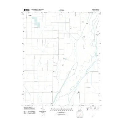
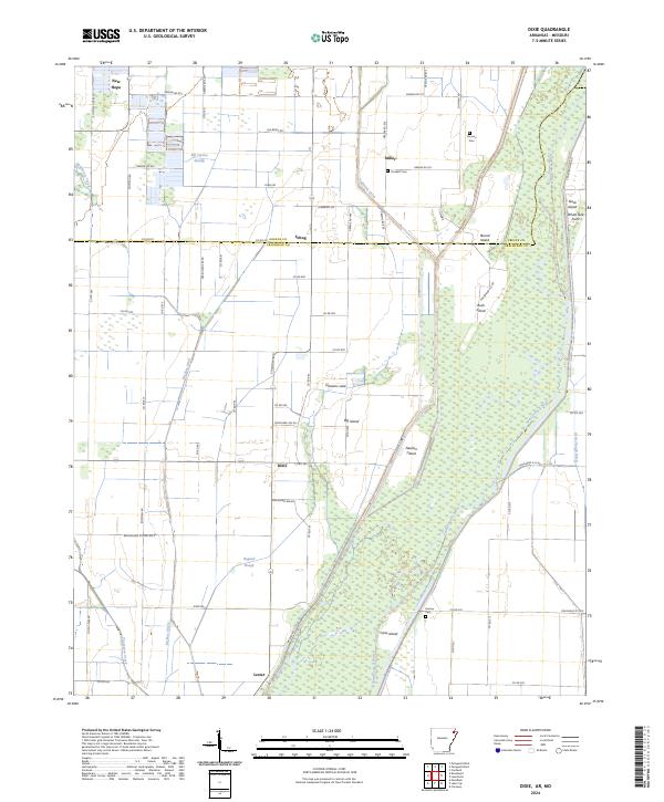 2024 Dixie2024 Print · USGSIn the river bottomlands of northeast Arkansas, this survey shows a landscape defined by the winding Saint Francis River and its many islands. Researchers can locate community centers like Dixie and Miller or trace family lineage through Parsons Cem and Crockett Cem.
End of results
Showing maps 1-11 of 11
Top cities near Schug
- Jonesboro historical maps
- Paragould historical maps
- Leachville historical maps
- Lake City historical maps
- Bay historical maps
- Brookland historical maps
See more
Frequently asked questions
- What are the different types of historical maps available for Schug?
- What is the oldest map of Schug?
- Where can I purchase historical maps of Schug for my home or office?
- Where can I download high-res historical maps of Schug?
- Are there historical topographic maps available for Schug?
- Is there historical aerial imagery available for Schug?
- Where are historical maps of Schug sourced from?