Old Maps of Hope, Arkansas for Genealogy
Trace your family roots with 18 historic maps of Hope. These high-res maps reveal old neighborhoods, homesites, landmarks, and streets — helping you uncover where your ancestors lived and how the area evolved over time.
- Explore historic neighborhoods: Identify where your relatives may have lived in the 1800s or 1900s.
- Compare maps over time: Trace the changes in streets, buildings, and landmarks for multi-generational research.
- Perfect for genealogy & ancestry research: Used by family historians and researchers to map out lineage and migration.
These maps are an incredible resource for exploring your personal connection to Hope's past.
Hope, AR maps
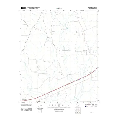
(18)- 1951 Map of Sheppard, 1952 Print
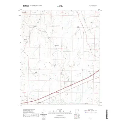
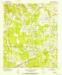 1951 Sheppard1952 Print · USGSHempstead County at the start of the fifties shows a landscape of rail-connected settlements and rural parish life. Researchers can find old community hubs like Guernsey High Sch, the Bright Star Cem, and the junction at Sheppard.4 unique versions available
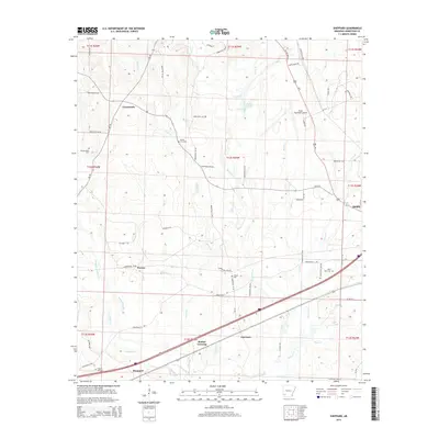
 - 1951 Map of Hope, 1952 Print
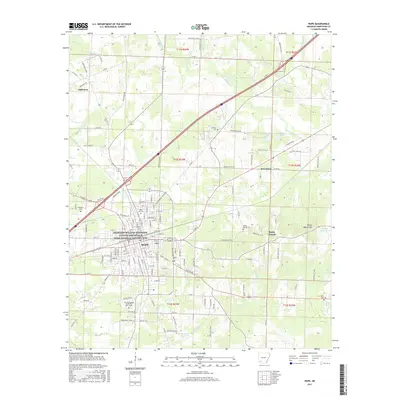
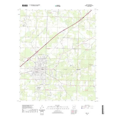
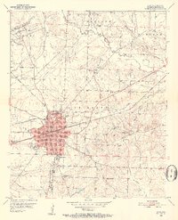 1951 Hope1952 Print · USGSHempstead County at mid-century is centered on the busy rail junction of Hope as it appeared before major highway expansion. Genealogists and local historians can trace specific community anchors like the Chester Hospital, Rose Hill Cemetery, and the University of Arkansas Experiment Station.4 unique versions available
 - 1953 Map of El Dorado, 1967 Print
 1953 El Dorado1967 Print · USGSSouth Arkansas in the mid-1960s was a landscape of industrial growth and river-fed commerce. Researchers can trace the extensive Oil and Gas Fields around Magnolia, the expansive U S Naval Ammunition Depot, and the busy rail lines of the Missouri Pacific.3 unique versions available
 - 1957 Map of El Dorado
 1957 El Dorado1957 Print · USGSSouth Arkansas in the mid-1950s was a critical hub of military logistics and rail-river commerce. Genealogists and historians can trace family land across the Arkansas Louisiana border and locate sites like the U.S. Naval Ammunition Depot or the rail junctions at Magnolia and Camden.
 - 1958 Map of El Dorado
 1958 El Dorado1958 Print · USGSSouthern Arkansas and the Louisiana borderlands are shown during a period of heavy rail traffic and defense industry activity. Researchers can trace the legacy of the U. S. Naval Ammunition Depot or locate family roots in Smackover, Huttig, and Nashville.3 unique versions available
 - 1960 Map of El Dorado
 1960 El Dorado1960 Print · USGSSouth Central Arkansas in the late fifties was a hub of energy production and defense industry. Researchers can trace the extensive Oil and Gas Fields around El Dorado or locate family landmarks like Old Park Cem and New Hope Church.
 - 1986 Map of Hope
 1986 Hope1986 Print · USGSSouthwest Arkansas in the mid-eighties was a landscape of rail-connected towns and timbered ridges. Researchers can trace the Missouri Pacific Railroad corridor through Hope or locate local landmarks like De Ann Cem and Poison Springs State Forest.2 unique versions available
 - 1989 Map of El Dorado, 1990 Print
 1989 El Dorado1990 Print · USGSThe Arkansas-Louisiana borderlands in the late eighties show a landscape of heavy industry and wildlife conservation centered on the Ouachita River. Researchers can trace the legacy of timber and transport via the Missouri Pacific RR, Poison Springs State Forest, and the vast Felsenthal Pool.
 - 2011 Map of Hope, 2011 Print
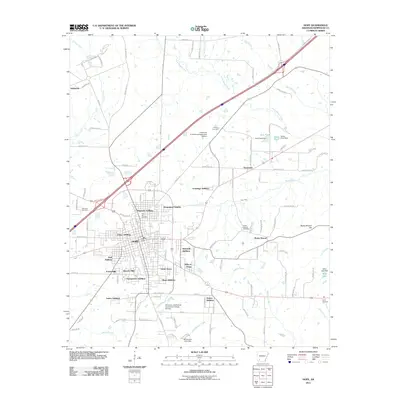 2011 Hope2011 Print · USGSCovers Hope, including Perrytown, Oakhaven, and other nearby areas
 - 2011 Map of Sheppard, 2011 Print
 2011 Sheppard2011 Print · USGSCovers Hope, including Powers, Sheppard, and other nearby areas
 - 2014 Map of Sheppard, 2014 Print
 2014 Sheppard2014 Print · USGSCovers Hope, including Powers, Sheppard, and other nearby areas
 - 2014 Map of Hope, 2014 Print
 2014 Hope2014 Print · USGSCovers Hope, including Perrytown, Oakhaven, and other nearby areas
 - 2017 Map of Sheppard, 2017 Print
 2017 Sheppard2017 Print · USGSCovers Hope, including Powers, Sheppard, and other nearby areas
 - 2017 Map of Hope, 2017 Print
 2017 Hope2017 Print · USGSCovers Hope, including Perrytown, Oakhaven, and other nearby areas
 - 2020 Map of Sheppard, 2020 Print
 2020 Sheppard2020 Print · USGSCovers Hope, including Powers, Sheppard, and other nearby areas
 - 2020 Map of Hope, 2020 Print
 2020 Hope2020 Print · USGSCovers Hope, including Perrytown, Oakhaven, and other nearby areas
 - 2024 Map of Sheppard, 2024 Print
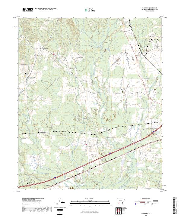 2024 Sheppard2024 Print · USGSHempstead County remains a landscape of creek-side settlements and family heritage in this recent survey. Researchers can locate historic burial sites like Wilson Cem and Flowers Hill Cem or trace the environs of Guernsey and Crossroads.
 - 2024 Map of Hope, 2024 Print
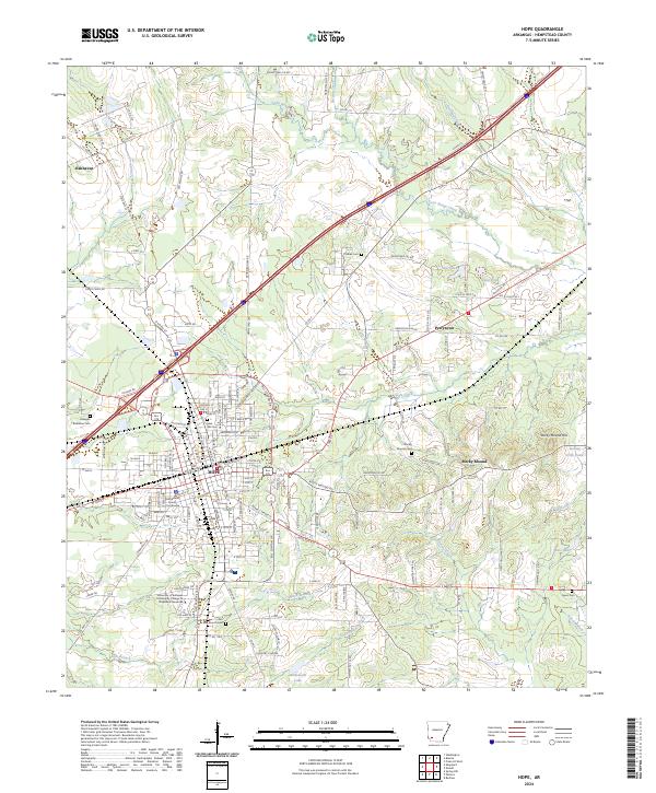 2024 Hope2024 Print · USGSThe Hempstead County seat and its surrounding rural timberlands are shown here in the mid-2020s. Researchers can locate numerous family burial sites such as Phillips Cem and Hanegan Robinson Cem or trace the geography of Rocky Mound Hill.
End of results
Showing maps 1-18 of 18
Top cities near Hope
- Prescott historical maps
- Emmet historical maps
- Blevins historical maps
- Perrytown historical maps
- Washington historical maps
- Bodcaw historical maps
See more
Top neighborhoods of Hope
- Frisco Addition historical maps
- Hills of Hope historical maps
- Forest Hills historical maps
- Southridge Estates historical maps
- Eastridge Addition historical maps
- Georgetown Addition historical maps
See more
Frequently asked questions
- What are the different types of historical maps available for Hope?
- What is the oldest map of Hope?
- Where can I purchase historical maps of Hope for my home or office?
- Where can I download high-res historical maps of Hope?
- Are there historical topographic maps available for Hope?
- Is there historical aerial imagery available for Hope?
- Where are historical maps of Hope sourced from?