Old Maps of Dierks, Arkansas
Explore 30 old maps of Dierks, spanning from 1906 to today. These high-resolution historic maps reveal how streets, neighborhoods, landmarks, and natural features evolved over time — perfect for genealogy, metal detecting, research, and local history exploration.
What you can do with these maps:
- See how Dierks changed over time: Compare historical maps to modern-day views to trace roads, homesites, rail lines & more.
- View detailed metadata: Each map includes creators, publishers, year, scale, and archive source.
- Overlay maps with satellite & LiDAR: Visualize the past alongside modern tools to explore terrain & human change.
- Trusted historical sources: Maps sourced from the USGS, Library of Congress, and other archives.
- Access maps your way: View online, download high-res files, or order prints for personal or research use.
Start exploring old maps of Dierks to uncover forgotten places, hidden landmarks, and the deep history beneath your feet.
Dierks, AR maps
(30)- 1906 Map of Caddo Gap
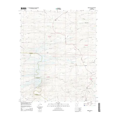
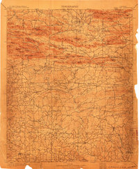 1906 Caddo Gap1906 Print · USGSWest-central Arkansas at the dawn of the twentieth century shows a rugged landscape defined by the Ouachita ridges and early mountain industries. Researchers can trace defunct mining communities like Slatington and Fancy Hill, or locate long-gone railway stops at Hickory Station and Brocktown.3 unique versions available
 - 1913 Map of De Queen
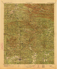 1913 De Queen1913 Print · USGSThe southern Ouachita Mountains and the Arkansas-Oklahoma borderlands appear here in the early twentieth century as the railroad transformed the timber and mining industries. Researchers can trace historic sites like the Welcome Home School, the Kansas City Southern RR corridor, and the early streets of De Queen.4 unique versions available
 - 1950 Map of Mcalester
 1950 Mcalester1950 Print · USGSThe Ouachita Mountains and the coal country of Southeast Oklahoma are shown here in the late 1940s. Genealogists and historians can trace the rail-driven growth of McAlester, Wilburton, and Antlers alongside the rugged terrain of Kiamichi Mountain.2 unique versions available
 - 1955 Map of Little Rock, 1978 Print
 1955 Little Rock1978 Print · USGSCentral Arkansas in the mid-fifties exhibits a landscape of growing cities, massive military installations, and mountain reservoirs. Genealogists and historians can trace the industrial Bauxite Mines, regional rail lines, and local landmarks like Antioch Church.
 - 1956 Map of Little Rock
 1956 Little Rock1956 Print · USGSCentral Arkansas in the mid-fifties shows a landscape defined by burgeoning military bases and the timber-and-mineral wealth of the Ouachitas. Genealogists and researchers can trace old rail lines like the Missouri Pacific and find established communities such as Bauxite, Sheridan, and Mabelvale.
 - 1960 Map of Little Rock
 1960 Little Rock1960 Print · USGSCentral Arkansas in the late fifties shows a landscape of growing military bases and massive new reservoirs. Local historians can trace the mid-century expansion of Little Rock and Hot Springs alongside the industrial works at Bauxite and the Pine Bluff Arsenal.
 - 1962 Map of McAlester
 1962 McAlester1962 Print · USGSSoutheastern Oklahoma and western Arkansas are shown here during the early sixties, a time of transition for the region's mountain communities and timberlands. Researchers can trace the paths of the Kansas City Southern RR through Heavener or locate settlements like Talihina and Broken Bow near the Kiamichi Mountains.2 unique versions available
 - 1964 Map of Little Rock
 1964 Little Rock1964 Print · USGSCentral Arkansas in the mid-sixties is a landscape of mountain ridges, industrial rail lines, and growing military hubs. Researchers can trace the development of Bauxite and Hot Springs or locate rural landmarks like Sparkman and the Pine Bluff Arsenal.
 - 1965 Map of McAlester
 1965 McAlester1965 Print · USGSSoutheastern Oklahoma and western Arkansas appear here in the mid-1960s, showing the intersection of the timber industry and the growing reservoir system. Genealogists can trace family roots through settlements like Antlers, Idabel, and Kiowa or follow the historic routes of the Kansas City Southern Ry.3 unique versions available
 - 1966 Map of Dierks Dam, 1967 Print
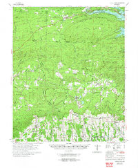
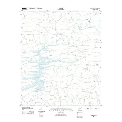
 1966 Dierks Dam1967 Print · USGSThe Saline River valley is captured during the mid-sixties as it prepared for the construction of Dierks Dam. Researchers can trace soon-to-be-submerged landmarks like Mail Ford or locate rural family sites near Euclid and Burg.
 - 1966 Map of Dierks, 1967 Print
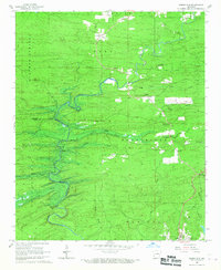
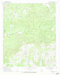
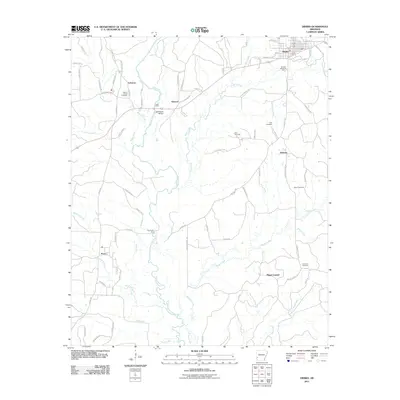
 1966 Dierks1967 Print · USGSThe rail and river geography of Howard and Sevier Counties comes into focus during the mid-sixties. Genealogists and local historians can trace family sites near Dierks, Provo, and Bethany, or locate rural landmarks like Oak Hill Ch and Potts Cem.
 - 1970 Map of Center Point, 1972 Print
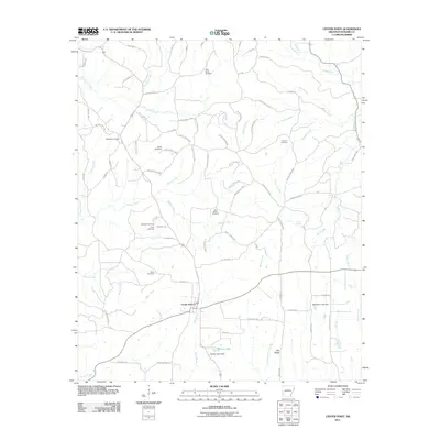
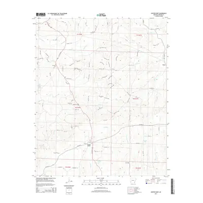
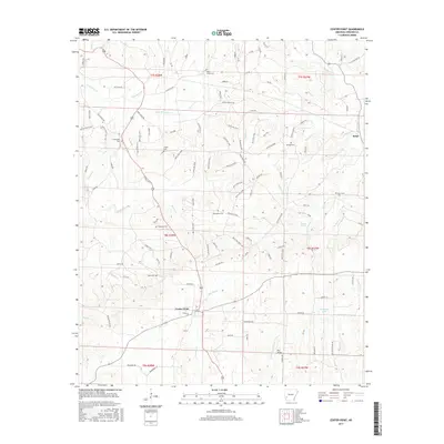
 1970 Center Point1972 Print · USGSHoward County's rural character is on full display in the early seventies, showing a landscape of family-named creeks and ridge-top settlements. Genealogists and historians can trace local roots at Wesley Chapel, Holly Creek Cemetery, and the community of Briar.2 unique versions available
 - 1972 Map of Center Point, 1973 Print
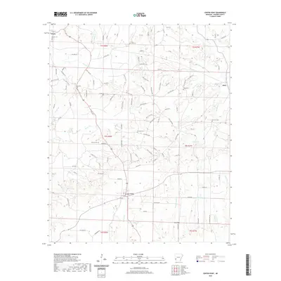
 1972 Center Point1973 Print · USGSHoward and Pike counties are captured here in the early seventies, just as the region's timber and rail industries shaped the local landscape. Researchers can trace the routes of the Mississippi Southwestern Railroad and locate historic community centers like Corinth, Highland, and the Antioch Cem.
 - 1986 Map of Arkadelphia
 1986 Arkadelphia1986 Print · USGSSouthwest Arkansas in the mid-eighties shows a landscape of timbered ridges and significant new reservoirs. Researchers can trace rural schoolhouses and churches like Sunshine Sch and Hempwallace Ch alongside the famous Crater of Diamonds State Park.2 unique versions available
 - 1986 Map of De Queen
 1986 De Queen1986 Print · USGSThe Arkansas-Oklahoma borderlands are shown here in the mid-1980s, highlighting the complex water systems and mountain ridges of the Ouachita region. Genealogists and historians can trace rail routes like the Kansas City Southern and find old community sites such as Ultima Thule or Oak Grove Ch.2 unique versions available
 - 2011 Map of Center Point, 2011 Print
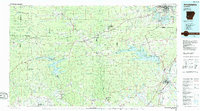
 2011 Center Point2011 Print · USGSCovers Dierks, including Center Point, Howard County, and other nearby areas
 - 2011 Map of Dierks, 2011 Print
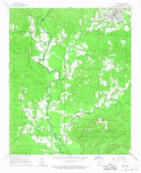
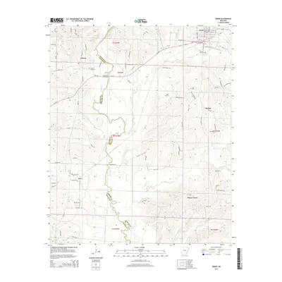
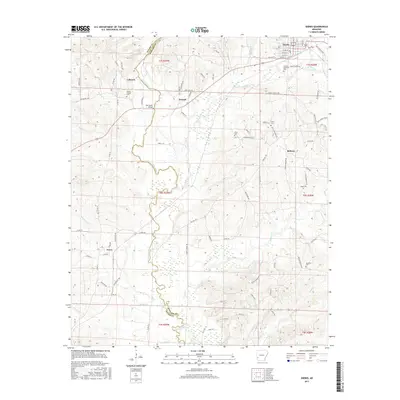
 2011 Dierks2011 Print · USGSCovers Dierks, including Mount Carmel, Lebanon, and other nearby areas
 - 2011 Map of Dierks Dam, 2011 Print
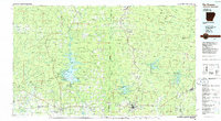
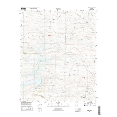
 2011 Dierks Dam2011 Print · USGSCovers Dierks, including Davis Ford, Euclid, and other nearby areas
 - 2014 Map of Dierks Dam, 2014 Print
 2014 Dierks Dam2014 Print · USGSCovers Dierks, including Davis Ford, Euclid, and other nearby areas
 - 2014 Map of Dierks, 2014 Print
 2014 Dierks2014 Print · USGSCovers Dierks, including Mount Carmel, Lebanon, and other nearby areas
 - 2014 Map of Center Point, 2014 Print
 2014 Center Point2014 Print · USGSCovers Dierks, including Center Point, Howard County, and other nearby areas
 - 2017 Map of Dierks, 2017 Print
 2017 Dierks2017 Print · USGSCovers Dierks, including Mount Carmel, Lebanon, and other nearby areas
 - 2017 Map of Dierks Dam, 2017 Print
 2017 Dierks Dam2017 Print · USGSCovers Dierks, including Davis Ford, Euclid, and other nearby areas
 - 2017 Map of Center Point, 2017 Print
 2017 Center Point2017 Print · USGSCovers Dierks, including Center Point, Howard County, and other nearby areas
 - 2020 Map of Center Point, 2020 Print
 2020 Center Point2020 Print · USGSCovers Dierks, including Center Point, Howard County, and other nearby areas
Showing maps 1-25 of 30
Top cities near Dierks
Frequently asked questions
- What are the different types of historical maps available for Dierks?
- What is the oldest map of Dierks?
- Where can I purchase historical maps of Dierks for my home or office?
- Where can I download high-res historical maps of Dierks?
- Are there historical topographic maps available for Dierks?
- Is there historical aerial imagery available for Dierks?
- Where are historical maps of Dierks sourced from?