1900s (20th Century) Maps of Garnett, Arkansas
Explore 7 historic maps of Garnett from the 1900s (20th Century). These maps offer a rare glimpse into what life looked like during the 1900s — showing old roads, neighborhoods, homes, and landmarks that have changed or disappeared over time.
Whether you're researching your family's past, planning a metal detecting trip, or studying how Garnett's landscape evolved across the 1900s, these high-resolution maps are a powerful tool for exploring the history of this region.
- Focus on a specific era: All maps on this page are from the 1900s, giving you a focused view of this time period.
- See what’s changed: Compare century-old streets, trails, and buildings to today's modern landscape using overlays and satellite layers.
- Research with precision: Use these maps for genealogy, historical research, land use analysis, or educational projects.
- View, download, or print: Maps are fully viewable online in high resolution, and can be downloaded or printed for your own records.
Start exploring Garnett's history through authentic maps from the 1900s. This is your window into the past.
Garnett, AR maps
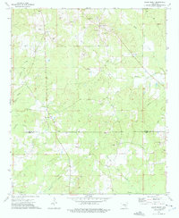
(7)- 1935 Map of Feenyville
 1935 Feenyville1935 Print · USGSLincoln County in the mid-1930s reveals a landscape of dispersed settlements and early Arkansas transit corridors. Genealogists and historians can locate rural landmarks like Pine Hill Sch, the ancient Indian Mounds, and the Cross Road Sta near Garnett.
 - 1953 Map of Greenwood, 1966 Print
 1953 Greenwood1966 Print · USGSThe Mississippi Delta in the mid-fifties is captured here as a thriving network of river towns, railroads, and oxbow lakes. Researchers can trace the legacy of the Illinois Central Railroad and locate landmarks like the State Penal Farm and Greenville Air Force Base.5 unique versions available
 - 1956 Map of Greenwood
 1956 Greenwood1956 Print · USGSThe Mississippi Delta in the mid-fifties is captured here during a period of significant military and agricultural activity. Researchers can trace the rail lines of the Illinois Central RR, find the Greenville Air Force Base, or locate the State Penal Farm.
 - 1973 Map of Relfs Bluff, 1975 Print
 1973 Relfs Bluff1975 Print · USGSSoutheast Arkansas in the mid-1970s was a landscape of timber, gravel, and quiet country crossroads along the Lincoln and Drew County line. Genealogists and historians can trace family locations near Relfs Bluff, Mountain Home Ch, and the Maxwell Cem.
 - 1975 Map of Lonoke SE, 1977 Print
 1975 Lonoke SE1977 Print · USGSPrairie farmlands and wooded drainages define this mid-1970s aerial survey just outside of the regional hub. Genealogists and local historians can trace land use patterns and road networks as they existed decades ago near Carlisle.
 - 1978 Map of Star City
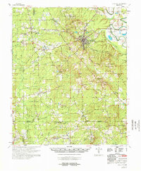 1978 Star City1978 Print · USGSThe rural landscapes of Lincoln and Cleveland counties are captured here in the late seventies, centered on the hub of Star City. Genealogists can trace family names and local landmarks through sites like Strangers Rest Ch, Bush Cem, and the old settlement at Feenyville.
 - 1986 Map of Dumas
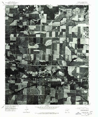
 1986 Dumas1986 Print · USGSSoutheast Arkansas in the mid-eighties shows a landscape defined by the winding Mississippi River and the Missouri Pacific Railroad corridor. Genealogists can trace family roots through river towns like Arkansas City and the rail-junction history of McGehee.2 unique versions available
End of results
Showing maps 1-7 of 7
Top cities near Garnett
- Monticello historical maps
- Star City historical maps
- Gould historical maps
- Wilmar historical maps
- Grady historical maps
Frequently asked questions
- What are the different types of historical maps available for Garnett?
- What is the oldest map of Garnett?
- Where can I purchase historical maps of Garnett for my home or office?
- Where can I download high-res historical maps of Garnett?
- Are there historical topographic maps available for Garnett?
- Is there historical aerial imagery available for Garnett?
- Where are historical maps of Garnett sourced from?