Old Maps of Ophir, Arkansas for Academic Research
Study the evolution of Ophir with 15 high-resolution historic maps. Whether you're teaching, researching, or modeling changes in land use, these maps provide essential visual documentation of urban, environmental, and geographic change.
- Analyze long-term change: Track patterns in development, transportation, and natural features.
- Ideal for environmental or urban studies: Support academic projects with primary historical map data.
- Use in the classroom or lab: Educators and researchers rely on these maps to bring historical context to life.
These maps are a powerful tool for teaching, research, and visualizing how Ophir has changed over the decades.
Ophir, AR maps
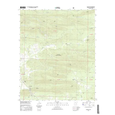
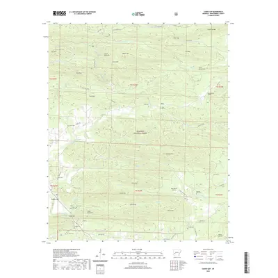
(15)- 1906 Map of Caddo Gap
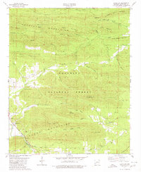
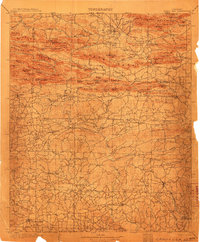 1906 Caddo Gap1906 Print · USGSWest-central Arkansas at the dawn of the twentieth century shows a rugged landscape defined by the Ouachita ridges and early mountain industries. Researchers can trace defunct mining communities like Slatington and Fancy Hill, or locate long-gone railway stops at Hickory Station and Brocktown.3 unique versions available
 - 1936 Map of Glenwood
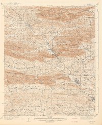
 1936 Glenwood1936 Print · USGSThe Montgomery and Pike county borders meet in this mid-1930s survey of the Arkansas timber and mountain country. Researchers can trace the Missouri Pacific rail line through Glenwood and locate family landmarks like Shockey Chapel and Jones Mill.
 - 1942 Map of Glenwood
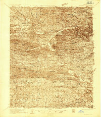
 1942 Glenwood1942 Print · USGSThe Ouachita foothills in the mid-1930s are captured here as timber and rail lines defined the valleys around Glenwood. Researchers can trace old family sites and rural infrastructure like the Womble Ranger Sta, Caddo Hill Sch, and Oak Grove Ch.4 unique versions available
 - 1949 Map of Glenwood, 1983 Print
 1949 Glenwood1983 Print · USGSThe Ouachita highlands of southwest Arkansas are shown here during the late 1930s, as timber railroads and mountain communities defined the region. Researchers can trace family roots at Shockey Chapel, Caddo Hill Sch, or along the Missouri Pacific rail line.
 - 1955 Map of Little Rock, 1978 Print
 1955 Little Rock1978 Print · USGSCentral Arkansas in the mid-fifties exhibits a landscape of growing cities, massive military installations, and mountain reservoirs. Genealogists and historians can trace the industrial Bauxite Mines, regional rail lines, and local landmarks like Antioch Church.
 - 1956 Map of Little Rock
 1956 Little Rock1956 Print · USGSCentral Arkansas in the mid-fifties shows a landscape defined by burgeoning military bases and the timber-and-mineral wealth of the Ouachitas. Genealogists and researchers can trace old rail lines like the Missouri Pacific and find established communities such as Bauxite, Sheridan, and Mabelvale.
 - 1960 Map of Little Rock
 1960 Little Rock1960 Print · USGSCentral Arkansas in the late fifties shows a landscape of growing military bases and massive new reservoirs. Local historians can trace the mid-century expansion of Little Rock and Hot Springs alongside the industrial works at Bauxite and the Pine Bluff Arsenal.
 - 1964 Map of Little Rock
 1964 Little Rock1964 Print · USGSCentral Arkansas in the mid-sixties is a landscape of mountain ridges, industrial rail lines, and growing military hubs. Researchers can trace the development of Bauxite and Hot Springs or locate rural landmarks like Sparkman and the Pine Bluff Arsenal.
 - 1979 Map of Caddo Gap, 1980 Print
 1979 Caddo Gap1980 Print · USGSThe Ouachita foothills near the close of the 1970s reveal a landscape of mountain ridges and river-bottom settlements. Researchers can locate remote family landmarks like Family Cem, trace the Missouri Pacific rail line, and find local gathering spots such as Liberty Ch.
 - 1986 Map of Arkadelphia
 1986 Arkadelphia1986 Print · USGSSouthwest Arkansas in the mid-eighties shows a landscape of timbered ridges and significant new reservoirs. Researchers can trace rural schoolhouses and churches like Sunshine Sch and Hempwallace Ch alongside the famous Crater of Diamonds State Park.2 unique versions available
 - 2011 Map of Caddo Gap, 2011 Print
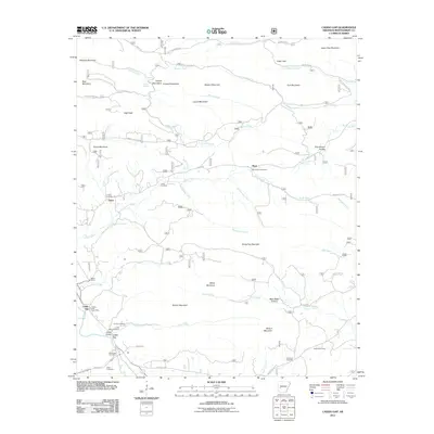 2011 Caddo Gap2011 Print · USGSCovers Ophir, including Plata, Caddo Gap, and other nearby areas
 - 2014 Map of Caddo Gap, 2014 Print
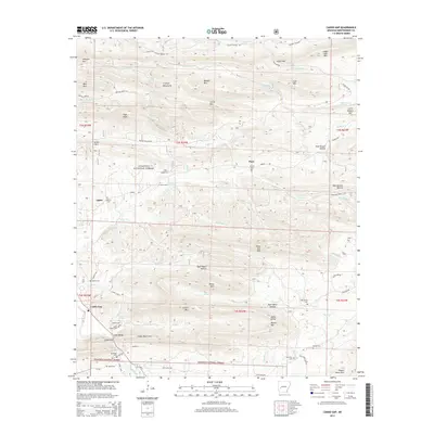 2014 Caddo Gap2014 Print · USGSCovers Ophir, including Plata, Caddo Gap, and other nearby areas
 - 2017 Map of Caddo Gap, 2017 Print
 2017 Caddo Gap2017 Print · USGSCovers Ophir, including Plata, Caddo Gap, and other nearby areas
 - 2020 Map of Caddo Gap, 2020 Print
 2020 Caddo Gap2020 Print · USGSCovers Ophir, including Plata, Caddo Gap, and other nearby areas
 - 2024 Map of Caddo Gap, 2024 Print
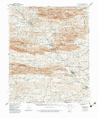
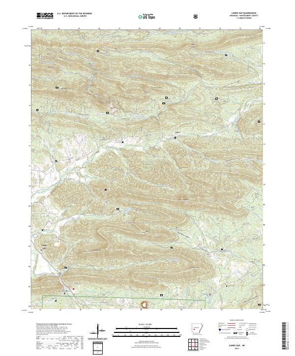 2024 Caddo Gap2024 Print · USGSThe Ouachita foothills near Montgomery County are documented in this recent survey, showing the deep-seated relationship between the upland terrain and valley settlements. Researchers can locate numerous family burial grounds and landmarks like Caddo Gap, Bethel Cem, and the Ouachita National Forest.
End of results
Showing maps 1-15 of 15
Top cities near Ophir
- Mount Ida historical maps
- Amity historical maps
- Norman historical maps
- Oden historical maps
- Black Springs historical maps
- Daisy historical maps
Frequently asked questions
- What are the different types of historical maps available for Ophir?
- What is the oldest map of Ophir?
- Where can I purchase historical maps of Ophir for my home or office?
- Where can I download high-res historical maps of Ophir?
- Are there historical topographic maps available for Ophir?
- Is there historical aerial imagery available for Ophir?
- Where are historical maps of Ophir sourced from?