Old Maps of Rock Creek, Little Rock
Explore 18 old maps of Rock Creek, spanning from 1891 to today. These high-resolution historic maps reveal how streets, neighborhoods, landmarks, and natural features evolved over time — perfect for genealogy, metal detecting, research, and local history exploration.
What you can do with these maps:
- See how Rock Creek changed over time: Compare historical maps to modern-day views to trace roads, homesites, rail lines & more.
- View detailed metadata: Each map includes creators, publishers, year, scale, and archive source.
- Overlay maps with satellite & LiDAR: Visualize the past alongside modern tools to explore terrain & human change.
- Trusted historical sources: Maps sourced from the USGS, Library of Congress, and other archives.
- Access maps your way: View online, download high-res files, or order prints for personal or research use.
Start exploring old maps of Rock Creek to uncover forgotten places, hidden landmarks, and the deep history beneath your feet.
Rock Creek, Little Rock maps
(18)- 1891 Map of Little Rock
 1891 Little Rock1891 Print · USGSLittle Rock and the central Arkansas river valley are shown in detail during the 1890s, when rail travel and river trade dominated the local economy. Genealogists can trace early homesteads and communities near Argenta, the Indian Mounds at Toltec, and Sweet Home.
 - 1893 Map of Little Rock
 1893 Little Rock1893 Print · USGSLittle Rock and the Arkansas River valley are shown here in the early 1890s, just as the regional rail network was maturing. Genealogists can trace family roots through old settlements like Argenta, Shilcott, and Collegeville, or locate archaeological sites such as the Indian Mounds.5 unique versions available
 - 1943 Map of Pinnacle Mtn, 1946 Print
 1943 Pinnacle Mtn1946 Print · USGSPulaski County at the end of the war shows a landscape of river-bend settlements and rising ridges. Genealogists can trace family names at the Brimmette Cem and Pankey Cem or locate old school sites like Round Hill Sch.
 - 1954 Map of Pinnacle Mountain, 1957 Print
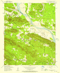 1954 Pinnacle Mountain1957 Print · USGSThe foothills of the Ouachitas meet the Arkansas River mid-century, where industry and rural life intersect. Genealogists and historians can trace family locations near the Maumelle Ordnance Works, Joe T Robinson School, and Natural Steps.
 - 1955 Map of Little Rock, 1978 Print
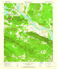
 1955 Little Rock1978 Print · USGSCentral Arkansas in the mid-fifties exhibits a landscape of growing cities, massive military installations, and mountain reservoirs. Genealogists and historians can trace the industrial Bauxite Mines, regional rail lines, and local landmarks like Antioch Church.
 - 1956 Map of Little Rock
 1956 Little Rock1956 Print · USGSCentral Arkansas in the mid-fifties shows a landscape defined by burgeoning military bases and the timber-and-mineral wealth of the Ouachitas. Genealogists and researchers can trace old rail lines like the Missouri Pacific and find established communities such as Bauxite, Sheridan, and Mabelvale.
 - 1960 Map of Little Rock
 1960 Little Rock1960 Print · USGSCentral Arkansas in the late fifties shows a landscape of growing military bases and massive new reservoirs. Local historians can trace the mid-century expansion of Little Rock and Hot Springs alongside the industrial works at Bauxite and the Pine Bluff Arsenal.
 - 1961 Map of Pinnacle Mountain, 1962 Print
 1961 Pinnacle Mountain1962 Print · USGSThe peaks of the Arkansas River Valley stand tall in the early sixties, as suburban growth reaches toward the river's edge. Researchers can trace family history at the Old Soldiers Cem, visit the County Prison Farm, or locate the Pumping Station near Natural Steps.4 unique versions available
 - 1964 Map of Little Rock
 1964 Little Rock1964 Print · USGSCentral Arkansas in the mid-sixties is a landscape of mountain ridges, industrial rail lines, and growing military hubs. Researchers can trace the development of Bauxite and Hot Springs or locate rural landmarks like Sparkman and the Pine Bluff Arsenal.
 - 1975 Map of Pinnacle Mountain, 1976 Print
 1975 Pinnacle Mountain1976 Print · USGSCentral Arkansas in the mid-seventies shows a landscape of sharp relief and growing communities along the water. Researchers can trace the development near Pinnacle Mountain and the winding confluence of the Arkansas River and Maumelle River.
 - 1985 Map of Little Rock, 1988 Print
 1985 Little Rock1988 Print · USGSLittle Rock and its surrounding river valley are shown in the mid-eighties as the region balanced urban expansion with its industrial and military roots. Genealogists and historians can locate dozens of institutions and family landmarks, including Mount Holly Cem, the Bauxite Mines, and Central High Sch.
 - 1986 Map of Pinnacle Mountain
 1986 Pinnacle Mountain1986 Print · USGSPulaski County at the peak of the 1980s displays a landscape where the suburbs of Little Rock meet the rugged heights of the Fulk Mountains. Genealogists can locate numerous family burial grounds including Old Soldiers Cem, Grimmette Cem, and Ives Cem.
 - 1994 Map of Pinnacle Mountain, 2000 Print
 1994 Pinnacle Mountain2000 Print · USGSGreater Little Rock expanded toward the Arkansas River during the 1990s as suburban growth met the ancient peaks of the Ouachita foothills. Researchers can trace family history at the Old Soldiers Cem, Natural Steps, and the former Maumelle Station.
 - 2011 Map of Pinnacle Mountain, 2011 Print
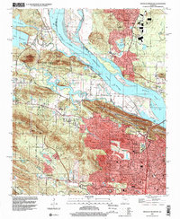
 2011 Pinnacle Mountain2011 Print · USGSCovers Rock Creek, including Little Rock, North Little Rock, and other nearby areas
 - 2014 Map of Pinnacle Mountain, 2014 Print
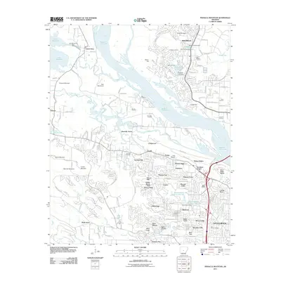
 2014 Pinnacle Mountain2014 Print · USGSCovers Rock Creek, including Little Rock, North Little Rock, and other nearby areas
 - 2017 Map of Pinnacle Mountain, 2017 Print
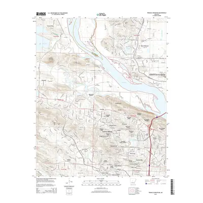
 2017 Pinnacle Mountain2017 Print · USGSCovers Rock Creek, including Little Rock, North Little Rock, and other nearby areas
 - 2020 Map of Pinnacle Mountain, 2020 Print
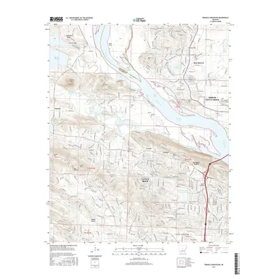
 2020 Pinnacle Mountain2020 Print · USGSCovers Rock Creek, including Little Rock, North Little Rock, and other nearby areas
 - 2024 Map of Pinnacle Mountain, 2024 Print
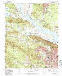
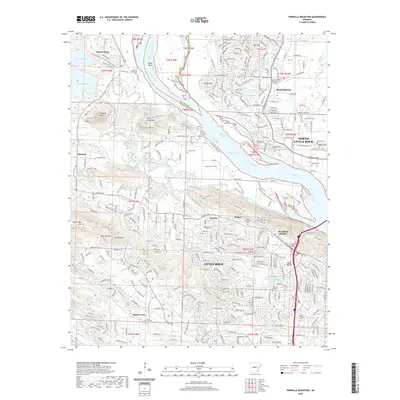
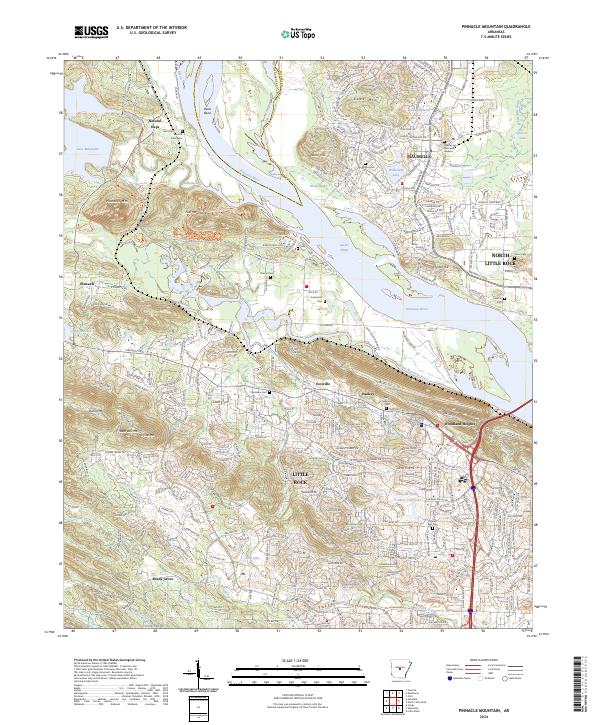 2024 Pinnacle Mountain2024 Print · USGSThe Arkansas River valley near Little Rock underwent significant suburban transformation in the early twenty-first century. Family history researchers can trace local lineage through numerous sites like Natural Steps Cem, Grimmette Cem, and Ivesville.
End of results
Showing maps 1-18 of 18
Top cities near Rock Creek
- Little Rock historical maps
- North Little Rock historical maps
- Benton historical maps
- Sherwood historical maps
- Maumelle historical maps
- Bryant historical maps
See more
Frequently asked questions
- What are the different types of historical maps available for Rock Creek?
- What is the oldest map of Rock Creek?
- Where can I purchase historical maps of Rock Creek for my home or office?
- Where can I download high-res historical maps of Rock Creek?
- Are there historical topographic maps available for Rock Creek?
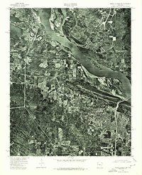
- Is there historical aerial imagery available for Rock Creek?
- Where are historical maps of Rock Creek sourced from?