Old Maps of Wrightsville, Arkansas
Explore 27 old maps of Wrightsville, spanning from 1891 to today. These high-resolution historic maps reveal how streets, neighborhoods, landmarks, and natural features evolved over time — perfect for genealogy, metal detecting, research, and local history exploration.
What you can do with these maps:
- See how Wrightsville changed over time: Compare historical maps to modern-day views to trace roads, homesites, rail lines & more.
- View detailed metadata: Each map includes creators, publishers, year, scale, and archive source.
- Overlay maps with satellite & LiDAR: Visualize the past alongside modern tools to explore terrain & human change.
- Trusted historical sources: Maps sourced from the USGS, Library of Congress, and other archives.
- Access maps your way: View online, download high-res files, or order prints for personal or research use.
Start exploring old maps of Wrightsville to uncover forgotten places, hidden landmarks, and the deep history beneath your feet.
Wrightsville, AR maps
(27)- 1891 Map of Little Rock
 1891 Little Rock1891 Print · USGSLittle Rock and the central Arkansas river valley are shown in detail during the 1890s, when rail travel and river trade dominated the local economy. Genealogists can trace early homesteads and communities near Argenta, the Indian Mounds at Toltec, and Sweet Home.
 - 1893 Map of Little Rock
 1893 Little Rock1893 Print · USGSLittle Rock and the Arkansas River valley are shown here in the early 1890s, just as the regional rail network was maturing. Genealogists can trace family roots through old settlements like Argenta, Shilcott, and Collegeville, or locate archaeological sites such as the Indian Mounds.5 unique versions available
 - 1935 Map of Sweet Home
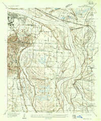 1935 Sweet Home1935 Print · USGSSoutheast of Little Rock during the mid-thirties, the river plain was defined by large-scale institutional farms and military camps. Genealogists can trace family connections at All Souls Rest Cem, St Stephens Cem, and the Union Industrial Agricultural College.
 - 1940 Map of Woodson, 1945 Print
 1940 Woodson1945 Print · USGSPulaski County at the start of the 1940s reveals a riverside landscape of bayous and railroad towns. Researchers can trace rural life through landmarks like Gospel Temple Ch, the State Industrial School, and Campbell Cem.2 unique versions available
 - 1945 Map of Sweet Home, 1946 Print
 1945 Sweet Home1946 Print · USGSThe southern outskirts of Little Rock and the river bottoms come alive in the mid-forties, showing a landscape of industry and community. Genealogists can trace family roots through College Station, Higgins, and Zion Wheel Ch or locate burials at Cornerstone Cem.3 unique versions available
 - 1954 Map of Woodson, 1957 Print
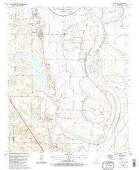
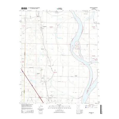
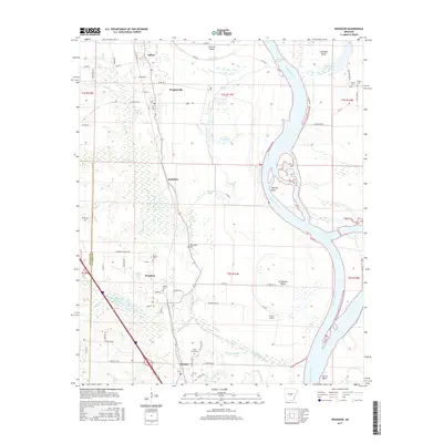
 1954 Woodson1957 Print · USGSIn the mid-fifties, the riverfront communities south of Little Rock were shaped by the winding Arkansas River and the busy Missouri Pacific railroad. Genealogists and local historians can locate several family burial grounds and country parishes, such as Kuykendall Cemetery, Virginia Church, and Nelson School.3 unique versions available
 - 1954 Map of Sweet Home, 1957 Print
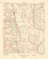
 1954 Sweet Home1957 Print · USGSSoutheast of Little Rock in the mid-fifties, this area shows a landscape shaped by the Arkansas River and industrial growth. Researchers can find family-named locations such as College Station, trace the Missouri Pacific rail lines, and locate rural landmarks like Zion Hill Cemetery and Browns Gin.
 - 1955 Map of Little Rock, 1978 Print
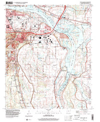
 1955 Little Rock1978 Print · USGSCentral Arkansas in the mid-fifties exhibits a landscape of growing cities, massive military installations, and mountain reservoirs. Genealogists and historians can trace the industrial Bauxite Mines, regional rail lines, and local landmarks like Antioch Church.
 - 1956 Map of Little Rock
 1956 Little Rock1956 Print · USGSCentral Arkansas in the mid-fifties shows a landscape defined by burgeoning military bases and the timber-and-mineral wealth of the Ouachitas. Genealogists and researchers can trace old rail lines like the Missouri Pacific and find established communities such as Bauxite, Sheridan, and Mabelvale.
 - 1960 Map of Little Rock
 1960 Little Rock1960 Print · USGSCentral Arkansas in the late fifties shows a landscape of growing military bases and massive new reservoirs. Local historians can trace the mid-century expansion of Little Rock and Hot Springs alongside the industrial works at Bauxite and the Pine Bluff Arsenal.
 - 1961 Map of Sweet Home, 1962 Print
 1961 Sweet Home1962 Print · USGSSoutheast of Little Rock in the early sixties, the river valley shows a mix of growing industrial hubs and small residential communities. Genealogists can locate family landmarks like Freeman Cemetery and rural churches such as Pilgrim Rest Church or St Stephens Church.4 unique versions available
 - 1964 Map of Little Rock
 1964 Little Rock1964 Print · USGSCentral Arkansas in the mid-sixties is a landscape of mountain ridges, industrial rail lines, and growing military hubs. Researchers can trace the development of Bauxite and Hot Springs or locate rural landmarks like Sparkman and the Pine Bluff Arsenal.
 - 1975 Map of Sweet Home, 1976 Print
 1975 Sweet Home1976 Print · USGSThe Arkansas capital and its riverfront are captured in the mid-seventies just as the urban landscape met the fertile floodplains. Genealogists and researchers can trace the roads and properties around Sweet Home and the banks of the Arkansas River.
 - 1985 Map of Little Rock, 1988 Print
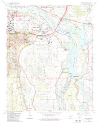
 1985 Little Rock1988 Print · USGSLittle Rock and its surrounding river valley are shown in the mid-eighties as the region balanced urban expansion with its industrial and military roots. Genealogists and historians can locate dozens of institutions and family landmarks, including Mount Holly Cem, the Bauxite Mines, and Central High Sch.
 - 1986 Map of Sweet Home
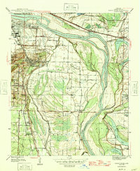
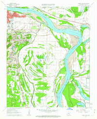
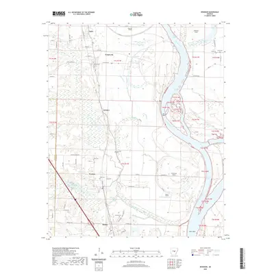
 1986 Sweet Home1986 Print · USGSThe Arkansas River corridor south of Little Rock is shown in the mid-1980s as a bustling industrial and transport hub. Genealogists can trace families around Sweet Home and College Station, while historians can locate the David D Terry Lock and Dam and Baucum Cem.
 - 1987 Map of Woodson, 1988 Print
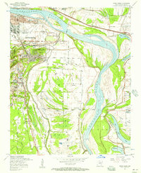
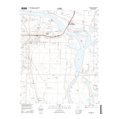
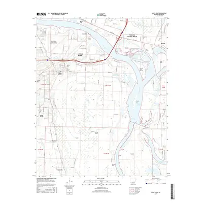
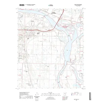
 1987 Woodson1988 Print · USGSThe Arkansas River lowlands south of Little Rock come into focus in the mid-1980s, where river bends and bayous meet rural settlements. Researchers can trace the layout of Wrightsville, find family sites at Kuykendall Cem, or locate local landmarks like Gospel Temple Ch.2 unique versions available
 - 1994 Map of Sweet Home, 2000 Print
 1994 Sweet Home2000 Print · USGSSoutheast of the state capital in the 1990s, this area shows the intersection of major river commerce and long-standing communities. Genealogists and local historians can locate Cornerstone Cem, College Station, and the historic Harris Ch near the river's edge.
 - 2011 Map of Sweet Home, 2011 Print
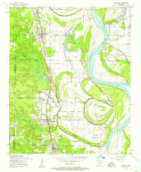
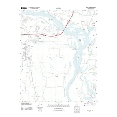 2011 Sweet Home2011 Print · USGSCovers Wrightsville, including Little Rock, North Little Rock, and other nearby areas
 - 2011 Map of Woodson, 2011 Print
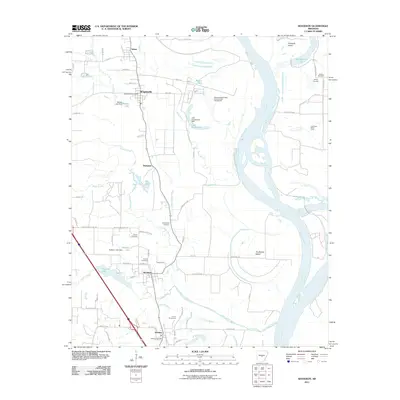 2011 Woodson2011 Print · USGSCovers Wrightsville, including Hensley, Woodson, and other nearby areas
 - 2014 Map of Woodson, 2014 Print
 2014 Woodson2014 Print · USGSCovers Wrightsville, including Hensley, Woodson, and other nearby areas
 - 2014 Map of Sweet Home, 2014 Print
 2014 Sweet Home2014 Print · USGSCovers Wrightsville, including Little Rock, North Little Rock, and other nearby areas
 - 2017 Map of Woodson, 2017 Print
 2017 Woodson2017 Print · USGSCovers Wrightsville, including Hensley, Woodson, and other nearby areas
 - 2017 Map of Sweet Home, 2017 Print
 2017 Sweet Home2017 Print · USGSCovers Wrightsville, including Little Rock, North Little Rock, and other nearby areas
 - 2020 Map of Sweet Home, 2020 Print
 2020 Sweet Home2020 Print · USGSCovers Wrightsville, including Little Rock, North Little Rock, and other nearby areas
 - 2020 Map of Woodson, 2020 Print
 2020 Woodson2020 Print · USGSCovers Wrightsville, including Hensley, Woodson, and other nearby areas
Showing maps 1-25 of 27
Top cities near Wrightsville
- Little Rock historical maps
- North Little Rock historical maps
- Jacksonville historical maps
- Sherwood historical maps
- Maumelle historical maps
- England historical maps
See more
Top neighborhoods of Wrightsville
Frequently asked questions
- What are the different types of historical maps available for Wrightsville?
- What is the oldest map of Wrightsville?
- Where can I purchase historical maps of Wrightsville for my home or office?
- Where can I download high-res historical maps of Wrightsville?
- Are there historical topographic maps available for Wrightsville?
- Is there historical aerial imagery available for Wrightsville?
- Where are historical maps of Wrightsville sourced from?