Old Maps of Union Hill, Arkansas for Metal Detecting
Plan your next treasure hunt with 14 historic maps of Union Hill. Find old homesites, ghost towns, trails, and gathering spots that may be lost to time — perfect for identifying promising metal detecting locations.
- Locate forgotten sites: Uncover places like long-lost settlements, abandoned rail lines, or gathering spots.
- Plan better hunts: Use map overlays combined with LiDAR or satellite views to narrow in on historically rich areas.
- Made for detectorists: Thousands of hobbyists use these maps to discover relics, coins, and hidden history.
Use these historic maps to boost your research and find new opportunities beneath the surface of Union Hill.
Union Hill, AR maps
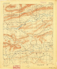
(14)- 1887 Map of Mount Ida #2
 1887 Mount Ida #21887 Print · USGSThe Ouachita highlands of western Arkansas are seen here in the late nineteenth century, dominated by a series of parallel ridges and river valleys. Researchers can pinpoint early settlements like Olio and Parks or trace the course of the Fourche La Fave River.
 - 1890 Map of Mount Ida
 1890 Mount Ida1890 Print · USGSMontgomery and Scott counties are shown in the late nineteenth century, dominated by the ridges of the Ouachita Mountains and the winding Washita or Ouachita River. Genealogists and historians can trace early settlements like Mt. Ida, Oden, and the mining camp at Silver City.7 unique versions available
 - 1955 Map of Little Rock, 1978 Print
 1955 Little Rock1978 Print · USGSCentral Arkansas in the mid-fifties exhibits a landscape of growing cities, massive military installations, and mountain reservoirs. Genealogists and historians can trace the industrial Bauxite Mines, regional rail lines, and local landmarks like Antioch Church.
 - 1956 Map of Little Rock
 1956 Little Rock1956 Print · USGSCentral Arkansas in the mid-fifties shows a landscape defined by burgeoning military bases and the timber-and-mineral wealth of the Ouachitas. Genealogists and researchers can trace old rail lines like the Missouri Pacific and find established communities such as Bauxite, Sheridan, and Mabelvale.
 - 1960 Map of Little Rock
 1960 Little Rock1960 Print · USGSCentral Arkansas in the late fifties shows a landscape of growing military bases and massive new reservoirs. Local historians can trace the mid-century expansion of Little Rock and Hot Springs alongside the industrial works at Bauxite and the Pine Bluff Arsenal.
 - 1960 Map of Parks, 1961 Print
 1960 Parks1961 Print · USGSScott County, Arkansas, is captured here in the early sixties, a landscape defined by the ridgelines of the Ouachita Mountains. Genealogists and local historians can trace family locations near Parks and Ballard, or find rural landmarks like Mt Moriah Ch and the Friendship Cem.2 unique versions available
 - 1964 Map of Little Rock
 1964 Little Rock1964 Print · USGSCentral Arkansas in the mid-sixties is a landscape of mountain ridges, industrial rail lines, and growing military hubs. Researchers can trace the development of Bauxite and Hot Springs or locate rural landmarks like Sparkman and the Pine Bluff Arsenal.
 - 1982 Map of Lake Ouachita
 1982 Lake Ouachita1982 Print · USGSThe Ouachita Mountains of West Central Arkansas are shown here during the early eighties, a time of established recreation and protected timberlands. Researchers can locate small communities like Buckville (PO) and Pencil Bluff or trace the drainage of the Fourche La Fave River.
 - 1985 Map of Freedom Mountain, 1986 Print
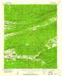
 1985 Freedom Mountain1986 Print · USGSThe Ouachita Mountains of Scott County are shown in the mid-1980s as a landscape of timber and isolated valley settlements. Genealogists and researchers can locate Union Hill, the Dutch Creek Ch, and family landmarks like Spanish Oak Ridge.
 - 2011 Map of Freedom Mountain, 2011 Print
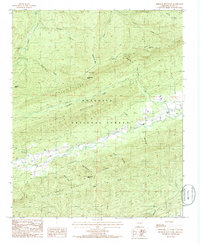
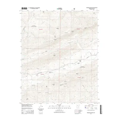
 2011 Freedom Mountain2011 Print · USGSCovers Union Hill, including Olio, Scott County, and other nearby areas
 - 2014 Map of Freedom Mountain, 2014 Print
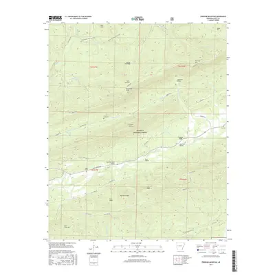
 2014 Freedom Mountain2014 Print · USGSCovers Union Hill, including Olio, Scott County, and other nearby areas
 - 2017 Map of Freedom Mountain, 2017 Print
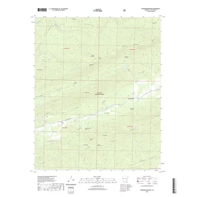
 2017 Freedom Mountain2017 Print · USGSCovers Union Hill, including Olio, Scott County, and other nearby areas
 - 2020 Map of Freedom Mountain, 2020 Print
 2020 Freedom Mountain2020 Print · USGSCovers Union Hill, including Olio, Scott County, and other nearby areas
 - 2024 Map of Freedom Mountain, 2024 Print
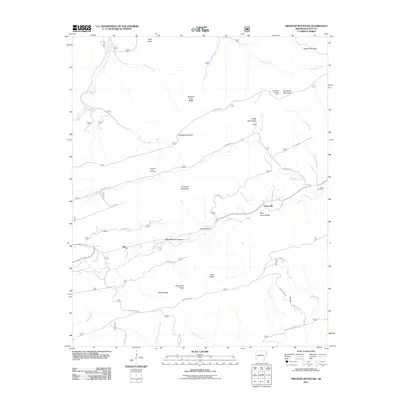
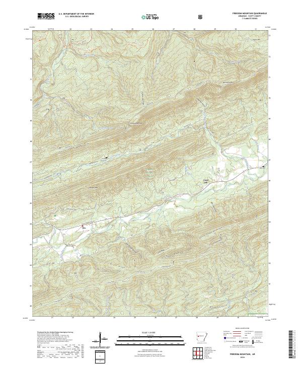 2024 Freedom Mountain2024 Print · USGSScott County in the modern day remains a landscape of high ridges and narrow creek valleys within the Ouachita National Forest. Genealogists and hikers can trace family sites at Freedom Creek Cem, the community of Olio, and the heights of Petit Jean Mountain.
End of results
Showing maps 1-14 of 14
Top cities near Union Hill
Frequently asked questions
- What are the different types of historical maps available for Union Hill?
- What is the oldest map of Union Hill?
- Where can I purchase historical maps of Union Hill for my home or office?
- Where can I download high-res historical maps of Union Hill?
- Are there historical topographic maps available for Union Hill?
- Is there historical aerial imagery available for Union Hill?
- Where are historical maps of Union Hill sourced from?