Old Maps of Huttig, Arkansas for Academic Research
Study the evolution of Huttig with 16 high-resolution historic maps. Whether you're teaching, researching, or modeling changes in land use, these maps provide essential visual documentation of urban, environmental, and geographic change.
- Analyze long-term change: Track patterns in development, transportation, and natural features.
- Ideal for environmental or urban studies: Support academic projects with primary historical map data.
- Use in the classroom or lab: Educators and researchers rely on these maps to bring historical context to life.
These maps are a powerful tool for teaching, research, and visualizing how Huttig has changed over the decades.
Huttig, AR maps
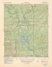
(16)- 1934 Map of Felsenthal, 1954 Print
 1934 Felsenthal1954 Print · USGSThe Ouachita and Saline River basins are captured here in the early 1930s as logging and rail shaped the Arkansas-Louisiana border. Trace the industrial footprint of the Logging RR and Missouri Pacific RR alongside local centers like Felsenthal, Huttig, and Smith Chapel.2 unique versions available
 - 1937 Map of Felsenthal
 1937 Felsenthal1937 Print · USGSThe Ouachita River bottomlands come to life in the mid-1930s, showing a landscape of logging railroads and river bends. Trace family roots through Lapile Cem, Huttig, and Felsenthal, or locate vanished landmarks like Cooter Sch and Dollar Junction.
 - 1938 Map of Felsenthal
 1938 Felsenthal1938 Print · USGSThe river bottoms of south Arkansas and north Louisiana are seen here in the late 1930s, showing a landscape defined by the winding Ouachita River. Genealogists and historians can locate the old townsite of Felsenthal, rural landmarks like Smiths Chapel, and the river landing at Prairie Island Ldg.
 - 1939 Map of Felsenthal
 1939 Felsenthal1939 Print · USGSThe river bottomlands of southern Arkansas and northern Louisiana come alive in the late thirties as the timber industry reshapes the landscape. Researchers can trace the sprawling rail lines of the Missouri Pacific, the industrial layout of Huttig, and rural sites like Smith Chapel or the Macedonian Cem.2 unique versions available
 - 1953 Map of El Dorado, 1967 Print
 1953 El Dorado1967 Print · USGSSouth Arkansas in the mid-1960s was a landscape of industrial growth and river-fed commerce. Researchers can trace the extensive Oil and Gas Fields around Magnolia, the expansive U S Naval Ammunition Depot, and the busy rail lines of the Missouri Pacific.3 unique versions available
 - 1957 Map of El Dorado
 1957 El Dorado1957 Print · USGSSouth Arkansas in the mid-1950s was a critical hub of military logistics and rail-river commerce. Genealogists and historians can trace family land across the Arkansas Louisiana border and locate sites like the U.S. Naval Ammunition Depot or the rail junctions at Magnolia and Camden.
 - 1958 Map of El Dorado
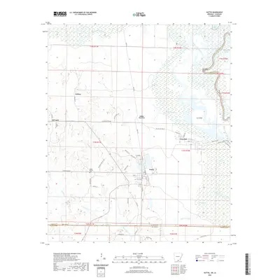
 1958 El Dorado1958 Print · USGSSouthern Arkansas and the Louisiana borderlands are shown during a period of heavy rail traffic and defense industry activity. Researchers can trace the legacy of the U. S. Naval Ammunition Depot or locate family roots in Smackover, Huttig, and Nashville.3 unique versions available
 - 1960 Map of El Dorado
 1960 El Dorado1960 Print · USGSSouth Central Arkansas in the late fifties was a hub of energy production and defense industry. Researchers can trace the extensive Oil and Gas Fields around El Dorado or locate family landmarks like Old Park Cem and New Hope Church.
 - 1981 Map of Huttig
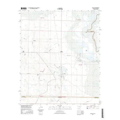
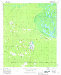 1981 Huttig1981 Print · USGSThe Ouachita River borderlands near the Arkansas-Louisiana line come into focus during this early 1980s survey. Researchers can trace the timber and rail roots of Huttig or find local landmarks like the Old Lapile Cem and the Huttig Lookout Tower.
 - 1985 Map of El Dorado, 1986 Print
 1985 El Dorado1986 Print · USGSSouth-central Arkansas and the Louisiana borderlands appear here in the mid-1980s, defined by the energy industry and river bottomlands. Genealogists and historians can locate rural landmarks like Old Parkers Chapel Cem, the Smackover Gas Field, and the El Dorado & Wesson RR.2 unique versions available
 - 1989 Map of El Dorado, 1990 Print
 1989 El Dorado1990 Print · USGSThe Arkansas-Louisiana borderlands in the late eighties show a landscape of heavy industry and wildlife conservation centered on the Ouachita River. Researchers can trace the legacy of timber and transport via the Missouri Pacific RR, Poison Springs State Forest, and the vast Felsenthal Pool.
 - 2011 Map of Huttig, 2011 Print
 2011 Huttig2011 Print · USGSCovers Huttig, including Felsenthal, Dollar Junction, and other nearby areas
 - 2014 Map of Huttig, 2014 Print
 2014 Huttig2014 Print · USGSCovers Huttig, including Felsenthal, Dollar Junction, and other nearby areas
 - 2017 Map of Huttig, 2017 Print
 2017 Huttig2017 Print · USGSCovers Huttig, including Felsenthal, Dollar Junction, and other nearby areas
 - 2020 Map of Huttig, 2020 Print
 2020 Huttig2020 Print · USGSCovers Huttig, including Felsenthal, Dollar Junction, and other nearby areas
 - 2024 Map of Huttig, 2024 Print
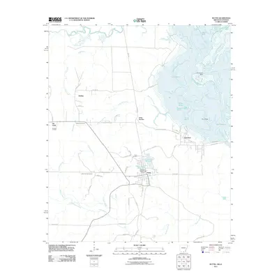
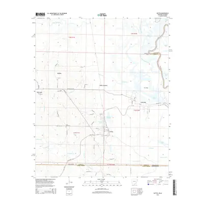
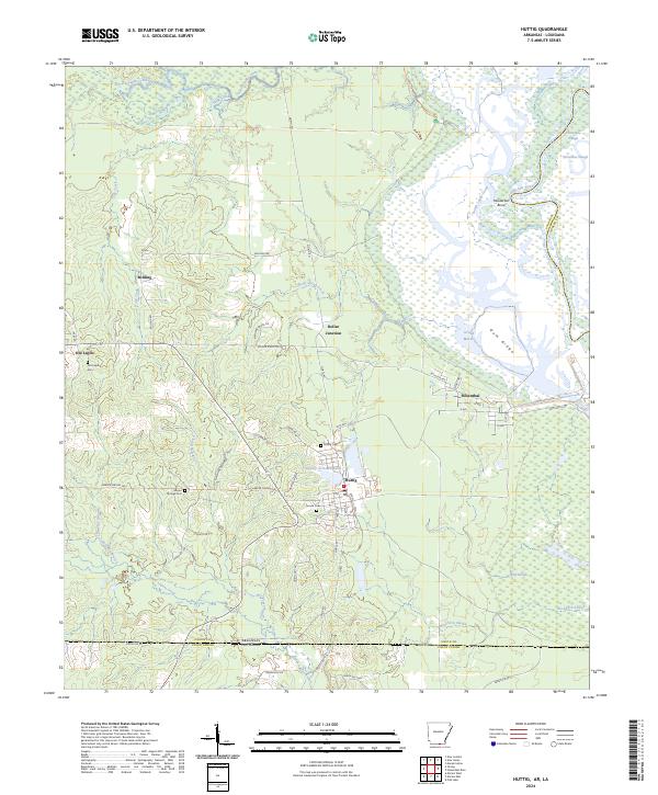 2024 Huttig2024 Print · USGSThe Arkansas-Louisiana state line comes alive in the early 2020s as it tracks the wetlands and timberlands surrounding Huttig. Genealogists can locate family landmarks like Old Lapile Cem, Harper Springs Cem, and the old settlement at Dollar Junction.
End of results
Showing maps 1-16 of 16
Top cities near Huttig
- Crossett historical maps
- Farmerville historical maps
- Marion historical maps
- Strong historical maps
- Felsenthal historical maps
Frequently asked questions
- What are the different types of historical maps available for Huttig?
- What is the oldest map of Huttig?
- Where can I purchase historical maps of Huttig for my home or office?
- Where can I download high-res historical maps of Huttig?
- Are there historical topographic maps available for Huttig?
- Is there historical aerial imagery available for Huttig?
- Where are historical maps of Huttig sourced from?