
Historical Maps of La Quinta
Journey back in time with 29 historical maps of La Quinta, dating from 1904 to present day. Explore and discover the history of La Quinta through detailed topographic maps, featuring cities, landmarks, and geographical changes. Dive deeper into each map with our interactive high-resolution viewer and extensive library data. Every map in our collection is also available for purchase as a framed or unframed museum-quality print for those interested interested in bringing a part of history into their home. Begin your historical adventure now!
La Quinta maps (29)
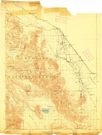
- 1904 Map of Indio
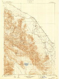
 1904 Indio1904 Print · USGSCovers portions of La Quinta, including California, and others.
 - 1904 Map of Indio, 1910 Print
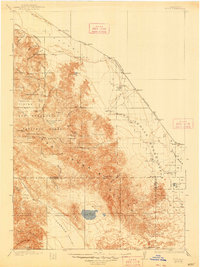
 1904 Indio1910 Print · USGSCovers portions of La Quinta, including California, and others.
 - 1904 Map of Indio, 1917 Print
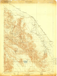 1904 Indio1917 Print · USGSCovers portions of La Quinta, including California, and others.
 - 1904 Map of Indio, 1925 Print
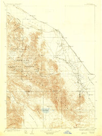 1904 Indio1925 Print · USGSCovers portions of La Quinta, including California, and others.
 - 1904 Map of Indio, 1930 Print
 1904 Indio1930 Print · USGSCovers portions of La Quinta, including California, and others.
 - 1904 Map of Indio, 1939 Print
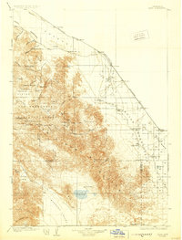
 1904 Indio1939 Print · USGSCovers portions of La Quinta, including California, and others.
 - 1904 Map of Indio, 1948 Print
 1904 Indio1948 Print · USGSCovers portions of La Quinta, including California, and others.
 - 1941 Map of Toro Peak, 1954 Print
 1941 Toro Peak1954 Print · USGSCovers portions of La Quinta, including Riverside County, and others.
 - 1944 Map of Toro peak
 1944 Toro peak1944 Print · USGSCovers portions of La Quinta, including Riverside County, and others.
 - 1947 Map of Santa Ana, 1949 Print
 1947 Santa Ana1949 Print · USGSCovers portions of La Quinta, including Santa Ana, Los Angeles County, and others.
Showing maps 1-10 of 29
Explore maps of related cities
See more
Explore maps of related counties
- Alameda County, CA
- Alpine County, CA
- Amador County, CA
- Butte County, CA
- Calaveras County, CA
- Colusa County, CA
See more
Frequently asked questions
Can I purchase a physical print of a historical map of La Quinta?
Why are historical maps of La Quinta important for research and professional purposes?
What types of historical maps are available for La Quinta?
What advanced features do you offer for professional use?
How can I find a specific historical map of La Quinta?
How can I contribute a historical map of La Quinta that's not in your collection?
What is the oldest map of La Quinta in your collection?
How can I download a map of La Quinta?