2020s Maps of Sutter Creek, California
Explore 2 historic maps of Sutter Creek from the 2020s. These maps offer a rare glimpse into what life looked like during the 2020s — showing old roads, neighborhoods, homes, and landmarks that have changed or disappeared over time.
Whether you're researching your family's past, planning a metal detecting trip, or studying how Sutter Creek's landscape evolved across the 2020s, these high-resolution maps are a powerful tool for exploring the history of this region.
- Focus on a specific era: All maps on this page are from the 2020s, giving you a focused view of this time period.
- See what’s changed: Compare century-old streets, trails, and buildings to today's modern landscape using overlays and satellite layers.
- Research with precision: Use these maps for genealogy, historical research, land use analysis, or educational projects.
- View, download, or print: Maps are fully viewable online in high resolution, and can be downloaded or printed for your own records.
Start exploring Sutter Creek's history through authentic maps from the 2020s. This is your window into the past.
Sutter Creek, CA maps
(2)- 2021 Map of Amador City, 2021 Print
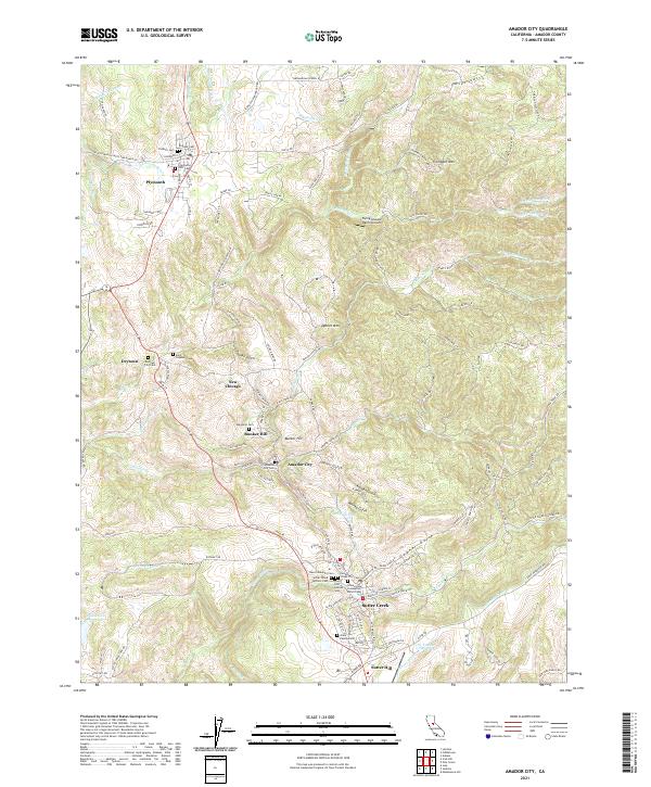 2021 Amador City2021 Print · USGSAmador County’s gold country comes into sharp focus during this recent era, mapping the historic streetscapes and cemetery locations of several legendary mining towns. Researchers can trace family roots through numerous sites like Sutter Creek City Cemetery, New Chicago, and Indian Gulch.
 - 2022 Map of Jackson, 2022 Print
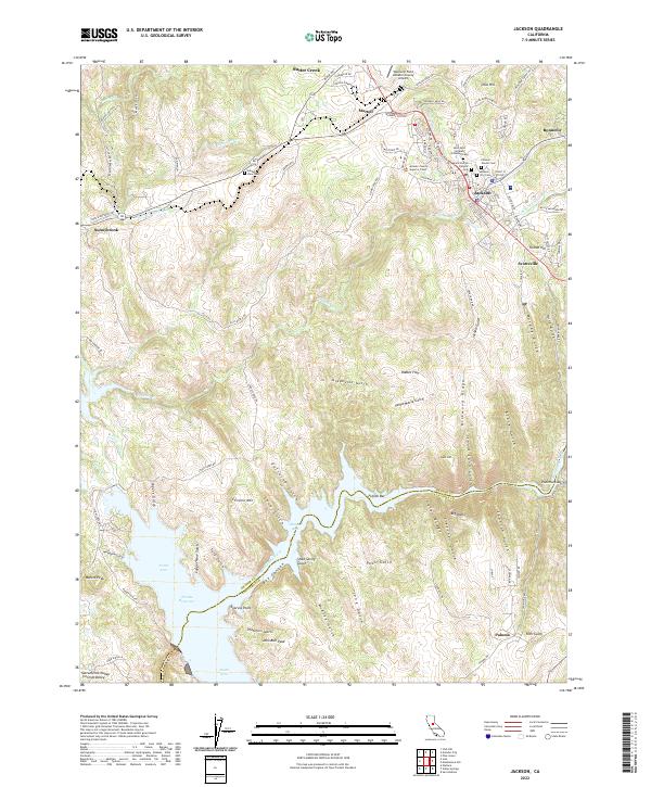 2022 Jackson2022 Print · USGSAmador County's gold country comes alive through its diverse burial grounds and historic mining roads in this modern survey. Researchers can trace family roots at the Saint Sava Serbian Orthodox Cem, Pioneer Jewish Cem, or China Graveyard near Jackson.
End of results
Showing maps 1-2 of 2
Top cities near Sutter Creek
Top neighborhoods of Sutter Creek
Frequently asked questions
- What are the different types of historical maps available for Sutter Creek?
- What is the oldest map of Sutter Creek?
- Where can I purchase historical maps of Sutter Creek for my home or office?
- Where can I download high-res historical maps of Sutter Creek?
- Are there historical topographic maps available for Sutter Creek?
- Is there historical aerial imagery available for Sutter Creek?
- Where are historical maps of Sutter Creek sourced from?