Old Maps of Bonnie View, California
Explore 10 old maps of Bonnie View, spanning from 1951 to today. These high-resolution historic maps reveal how streets, neighborhoods, landmarks, and natural features evolved over time — perfect for genealogy, metal detecting, research, and local history exploration.
What you can do with these maps:
- See how Bonnie View changed over time: Compare historical maps to modern-day views to trace roads, homesites, rail lines & more.
- View detailed metadata: Each map includes creators, publishers, year, scale, and archive source.
- Overlay maps with satellite & LiDAR: Visualize the past alongside modern tools to explore terrain & human change.
- Trusted historical sources: Maps sourced from the USGS, Library of Congress, and other archives.
- Access maps your way: View online, download high-res files, or order prints for personal or research use.
Start exploring old maps of Bonnie View to uncover forgotten places, hidden landmarks, and the deep history beneath your feet.
Bonnie View, CA maps
(10)- 1951 Map of Stonyford, 1953 Print
 1951 Stonyford1953 Print · USGSColusa and Glenn counties were still characterized by remote forest outposts and mineral springs in the early fifties. Local historians can trace family sites like Brittan Ranch or search for the Ruby King Mine and the historical Stonyford Rancheria (Site).3 unique versions available
 - 1957 Map of Ukiah, 1966 Print
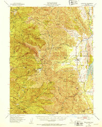
 1957 Ukiah1966 Print · USGSNorthern California's diverse terrain comes into focus in the mid-1950s, from the rugged timberlands of the Jackson State Forest to the productive Sacramento Valley. Genealogists and historians can trace the rail lines of the Northwestern Pacific or locate early valley settlements like Arbuckle and Paskenta.3 unique versions available
 - 1960 Map of Ukiah
 1960 Ukiah1960 Print · USGSNorthern California during the late fifties reveals a landscape of deep timber forests and valley agriculture before modern expansion. Trace the historic rail lines of the California Western RR and the Northwestern Pacific RR through settlements like Fort Bragg and Ukiah.2 unique versions available
 - 1968 Map of St. John Mtn., 1969 Print
 1968 St. John Mtn.1969 Print · USGSUpper Glenn County was a landscape of remote lookouts and wilderness camps in the late sixties. Researchers can trace the path of old jeep trails through the Mendocino National Forest to landmarks like Meyers Cabin and Upper Nye Camp.2 unique versions available
 - 1994 Map of Lakeport
 1994 Lakeport1994 Print · USGSCoastal mountains meet the fertile Sacramento Valley in the 1990s, where the waters of Clear Lake define the western landscape. Researchers can trace the industrial footprint of the Sulphur Bank Mine, follow the Southern Pacific RR tracks, or locate old settlements like Fouts Springs and Lodoga.
 - 1996 Map of St. John Mountain, 2001 Print
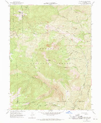
 1996 St. John Mountain2001 Print · USGSGlenn County and the surrounding wilderness are captured here during the mid-1990s. Researchers can locate remote high-country landmarks like Meyers Cabin, trace the headwaters of Stony Creek, and find isolated spots such as Bonnie View and Upper Nye Camp.
 - 2012 Map of Saint John Mountain, 2012 Print
 2012 Saint John Mountain2012 Print · USGSCovers Bonnie View, including Lake County, Glenn County, and other nearby areas
 - 2015 Map of Saint John Mountain, 2015 Print
 2015 Saint John Mountain2015 Print · USGSCovers Bonnie View, including Lake County, Glenn County, and other nearby areas
 - 2018 Map of Saint John Mountain, 2018 Print
 2018 Saint John Mountain2018 Print · USGSCovers Bonnie View, including Lake County, Glenn County, and other nearby areas
 - 2022 Map of Saint John Mountain, 2022 Print
 2022 Saint John Mountain2022 Print · USGSThe high ridges of the Mendocino National Forest are captured here at the meeting of Lake, Glenn, and Colusa counties. Researchers can trace historic backcountry routes like Meyers Trl and identify landmarks like Saint John Mtn and Bonnie View.
End of results
Showing maps 1-10 of 10
Top cities near Bonnie View
Frequently asked questions
- What are the different types of historical maps available for Bonnie View?
- What is the oldest map of Bonnie View?
- Where can I purchase historical maps of Bonnie View for my home or office?
- Where can I download high-res historical maps of Bonnie View?
- Are there historical topographic maps available for Bonnie View?
- Is there historical aerial imagery available for Bonnie View?
- Where are historical maps of Bonnie View sourced from?