Old Maps of Friant, California for Academic Research
Study the evolution of Friant with 17 high-resolution historic maps. Whether you're teaching, researching, or modeling changes in land use, these maps provide essential visual documentation of urban, environmental, and geographic change.
- Analyze long-term change: Track patterns in development, transportation, and natural features.
- Ideal for environmental or urban studies: Support academic projects with primary historical map data.
- Use in the classroom or lab: Educators and researchers rely on these maps to bring historical context to life.
These maps are a powerful tool for teaching, research, and visualizing how Friant has changed over the decades.
Friant, CA maps
(17)- 1922 Map of Friant
 1922 Friant1922 Print · USGSFresno County at the edge of the Sierra foothills is captured here during the heyday of the railroad and early copper mining. Researchers can trace the legacy of rural education at Pollasky School or locate the Fresno Copper Mine and Gordon Siding.2 unique versions available
 - 1946 Map of Friant, 1947 Print
 1946 Friant1947 Print · USGSThe San Joaquin River frontier was being reshaped by industrial engineering in the late 1940s. Genealogists and historians can trace the foundations of the regional water system at Friant Dam and find local landmarks like Gordon, Millerton Sch, and the Southern Pacific rail line.
 - 1946 Map of Clovis, 1955 Print
 1946 Clovis1955 Print · USGSPost-war Fresno County comes to life as the newly completed Friant Dam transforms the valley landscape. Trace the origins of irrigation at Friant-Kern Canal or locate family landmarks like Hammer Field and Nees Colony Sch.
 - 1947 Map of Friant
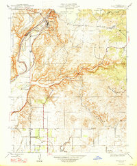 1947 Friant1947 Print · USGSThe foothills of Fresno and Madera counties come alive in the late 1940s as the massive Friant Dam reshapes the landscape. Local historians can trace the Southern Pacific rail line and discover rural landmarks like the Millerton Sch and Gordon.
 - 1948 Map of Fresno
 1948 Fresno1948 Print · USGSThe San Joaquin Valley and the High Sierra met during a period of rapid post-war growth and industrial expansion. Genealogists and researchers can trace family lines through small rail towns like Calwa City, find early aviation sites at Fresno-Chandler, or locate the Fresno Copper Mine.
 - 1955 Map of Fresno
 1955 Fresno1955 Print · USGSThe Central Valley and High Sierra meet in this mid-fifties study of California’s agricultural and wilderness heart. Researchers can trace the rail-side growth of Sanger, Selma, and Reedley or locate high-altitude landmarks like Mt Whitney and Hume Lake.
 - 1956 Map of Fresno
 1956 Fresno1956 Print · USGSThe Central Valley and High Sierra meet in this mid-fifties survey of a rapidly developing California interior. Researchers can trace the rail-and-water networks of Visalia, the footprint of Tulare Lake, and the remote heights of Sequoia National Park.
 - 1958 Map of Fresno
 1958 Fresno1958 Print · USGSThe Central Valley and High Sierra meet in this mid-century survey of the California heartland. Researchers can trace the rail-and-road network connecting Fresno and Visalia or locate high-country landmarks like Mt Whitney and Sequoia National Park.
 - 1960 Map of Fresno
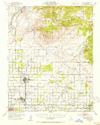
 1960 Fresno1960 Print · USGSThe San Joaquin Valley's mid-century agricultural boom meets the high peaks of the Sierra Nevada in this detailed survey. Genealogists and historians can trace the rail-driven growth of Fresno, Tulare, and Visalia or locate family roots in smaller towns like Raisin City and Calwa City.2 unique versions available
 - 1962 Map of Fresno, 1968 Print
 1962 Fresno1968 Print · USGSThe Central Valley and High Sierra meet in this mid-century survey, capturing the region's massive irrigation systems and mountain wilderness. Researchers can trace the rail corridors of the Southern Pacific and locate landmarks like the Tulare Lake Bed and Mount Whitney.3 unique versions available
 - 1964 Map of Friant, 1965 Print
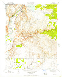
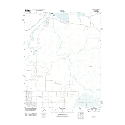
 1964 Friant1965 Print · USGSThe San Joaquin River valley was being reshaped by large-scale water projects in the mid-1960s. You can trace the engineering of the Friant Dam and Friant Kern Canal alongside local landmarks like Winchell Cove Cemetery and the Southern Pacific railroad line.3 unique versions available
 - 1966 Map of Fresno
 1966 Fresno1966 Print · USGSCentral California in the mid-1960s showcases a high-production agricultural valley rising into the granite peaks of the High Sierra. Researchers can trace irrigation networks, rail spurs like the Southern Pacific, and landmarks from Mount Whitney to the Lemoore Naval Air Station.
 - 1982 Map of Fresno, 1983 Print
 1982 Fresno1983 Print · USGSThe San Joaquin Valley's agricultural and urban landscape is captured here in the early eighties as Fresno expanded northward. Researchers can trace the rail lines of the Southern Pacific RR and identify landmarks like Raisin City and Kingsburg.2 unique versions available
 - 2012 Map of Friant, 2012 Print
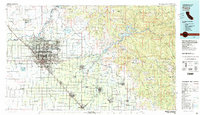
 2012 Friant2012 Print · USGSCovers Friant, including Fresno, Clovis, and other nearby areas
 - 2015 Map of Friant, 2015 Print
 2015 Friant2015 Print · USGSCovers Friant, including Fresno, Clovis, and other nearby areas
 - 2018 Map of Friant, 2018 Print
 2018 Friant2018 Print · USGSCovers Friant, including Fresno, Clovis, and other nearby areas
 - 2021 Map of Friant, 2021 Print
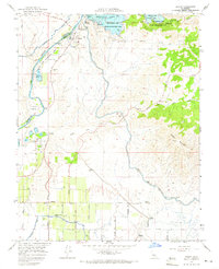
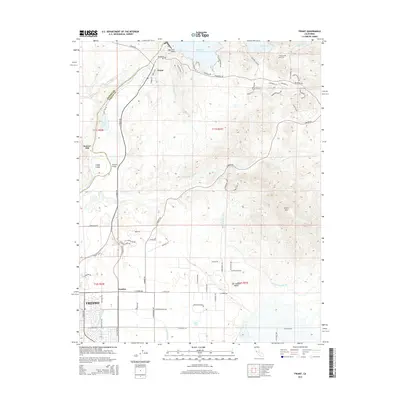
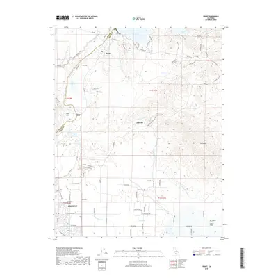
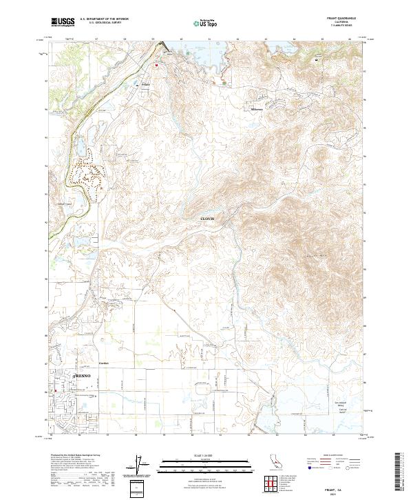 2021 Friant2021 Print · USGSThe foothills of the San Joaquin Valley meet the Sierra Nevada here in the early 2020s. Trace the intricate canal systems like the Friant-Kern Canal and locate local landmarks such as Winchell Cove Cem and the Clovis Community College Center.
End of results
Showing maps 1-17 of 17
Top cities near Friant
Frequently asked questions
- What are the different types of historical maps available for Friant?
- What is the oldest map of Friant?
- Where can I purchase historical maps of Friant for my home or office?
- Where can I download high-res historical maps of Friant?
- Are there historical topographic maps available for Friant?
- Is there historical aerial imagery available for Friant?
- Where are historical maps of Friant sourced from?