Old Maps of Mercey Hot Springs, California for Academic Research
Study the evolution of Mercey Hot Springs with 16 high-resolution historic maps. Whether you're teaching, researching, or modeling changes in land use, these maps provide essential visual documentation of urban, environmental, and geographic change.
- Analyze long-term change: Track patterns in development, transportation, and natural features.
- Ideal for environmental or urban studies: Support academic projects with primary historical map data.
- Use in the classroom or lab: Educators and researchers rely on these maps to bring historical context to life.
These maps are a powerful tool for teaching, research, and visualizing how Mercey Hot Springs has changed over the decades.
Mercey Hot Springs, CA maps
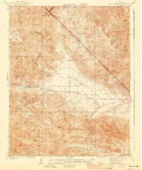
(16)- 1913 Map of Panoche
 1913 Panoche1913 Print · USGSThe San Joaquin Valley and its ranching foothills appear in the early twentieth century before modern expansion. Genealogists can find remote rural schools and outposts like Mercy School, Laguna Seca Ranch, and the Mercy Mine.4 unique versions available
 - 1944 Map of Panoche Valley
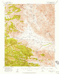
 1944 Panoche Valley1944 Print · USGSPanoche Valley and the high ridges of the Diablo Range are captured here during the 1940s, showcasing the region's rural ranching and mining history. Genealogists and historians can locate old landmarks like Panoche Sch, Llanada, and the Le Grant Mine nestled among the hills.2 unique versions available
 - 1948 Map of Santa Cruz
 1948 Santa Cruz1948 Print · USGSThe Central Coast and San Joaquin Valley meet in this mid-century look at the region's agricultural and military geography. Genealogists and historians can trace the paths of El Camino Real, locate family farms near Hollister, or study the footprint of the Fort Ord Military Reservation.2 unique versions available
 - 1955 Map of Santa Cruz
 1955 Santa Cruz1955 Print · USGSCoastal Monterey Bay and the fertile Salinas Valley are captured here during the post-war expansion of the mid-fifties. Researchers can trace the era's rail-and-road network via the Southern Pacific lines and find landmarks like Fort Ord or the Lonoak School.
 - 1956 Map of Panoche Valley, 1957 Print
 1956 Panoche Valley1957 Print · USGSMid-century San Benito and Fresno counties come alive in this map of ranchlands and remote mining outposts. Researchers can trace family-named sites and early industry at Mercey Hot Springs, the Panoche School, and the Juniper Mine.2 unique versions available
 - 1957 Map of Santa Cruz
 1957 Santa Cruz1957 Print · USGSCentral California comes into sharp focus during the late fifties, from the fog-swept Monterey Bay to the sun-drenched San Joaquin Valley. Genealogists and historians can trace the mid-century footprints of Fort Ord Military Reservation, the Southern Pacific line, and the historic streets of San Juan Bautista.
 - 1958 Map of Santa Cruz
 1958 Santa Cruz1958 Print · USGSCoastal California and the central valleys are shown during the mid-fifties, capturing a landscape of massive military reserves and vital rail arteries. Genealogists and historians can trace the Southern Pacific line through Salinas or explore the early footprints of the Fort Ord Military Reservation and San Juan Bautista.2 unique versions available
 - 1965 Map of Santa Cruz, 1968 Print
 1965 Santa Cruz1968 Print · USGSThe Central Coast and San Joaquin Valley meet here during the mid-sixties, capturing the growth of agricultural and coastal hubs. Trace the historic Southern Pacific RR lines and locate sites like the Presidio of Monterey or Pinnacles National Monument.
 - 1969 Map of Mercey Hot Springs, 1972 Print
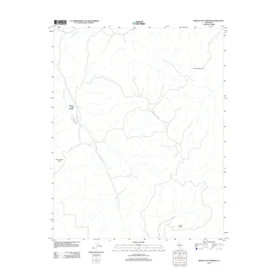
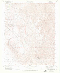 1969 Mercey Hot Springs1972 Print · USGSThe Fresno and San Benito borderlands in the late sixties come into focus through this survey of the Little Panoche Valley. Researchers can trace the layout of Mercey Hot Springs, locate a mid-century Landing Strip, and follow the remote Jeep Trails through the Panoche Hills.2 unique versions available
 - 1974 Map of Monterey, 1977 Print
 1974 Monterey1977 Print · USGSThe Central Coast and San Joaquin Valley meet in this mid-seventies survey of the Monterey region. Genealogists and historians can locate Spanish-era sites like the San Antonio de Padua Mission, early industrial markers such as the New Idria Mine, and coastal landmarks like the Point Sur Lighthouse.
 - 1982 Map of Mendota, 1983 Print
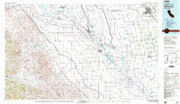 1982 Mendota1983 Print · USGSThe Central Valley's massive water-moving infrastructure is in full view during the early eighties, from the San Joaquin River to the California Aqueduct. Researchers can trace the Southern Pacific rail lines through towns like Mendota, Firebaugh, and Tranquillity.2 unique versions available
 - 2000 Map of Mercey Hot Springs, 2002 Print
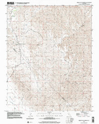 2000 Mercey Hot Springs2002 Print · USGSThe Fresno and San Benito county line comes alive in the late twentieth century, showing a remote landscape of mineral springs and high ridges. Researchers can trace the layout of Mercey Hot Springs or locate the Landing Strip and high-altitude Mine sites.
 - 2012 Map of Mercey Hot Springs, 2012 Print
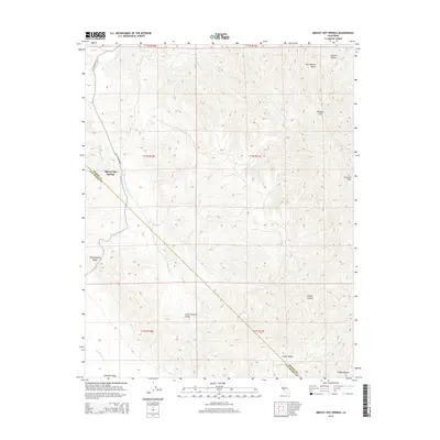
 2012 Mercey Hot Springs2012 Print · USGSCovers Mercey Hot Springs, including Fresno County, San Benito County, and other nearby areas
 - 2015 Map of Mercey Hot Springs, 2015 Print
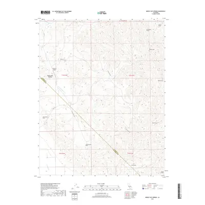
 2015 Mercey Hot Springs2015 Print · USGSCovers Mercey Hot Springs, including Fresno County, San Benito County, and other nearby areas
 - 2018 Map of Mercey Hot Springs, 2018 Print
 2018 Mercey Hot Springs2018 Print · USGSCovers Mercey Hot Springs, including Fresno County, San Benito County, and other nearby areas
 - 2021 Map of Mercey Hot Springs, 2021 Print
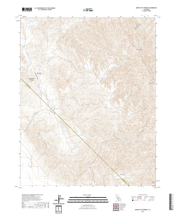 2021 Mercey Hot Springs2021 Print · USGSThe Fresno and San Benito county line runs through this rugged section of the Diablo Range in the early 2020s. Local historians and land researchers can trace the roads and watercourses surrounding Mercey Hot Springs, Glaucophane Ridge, and Panoche Mtn.
End of results
Showing maps 1-16 of 16
Frequently asked questions
- What are the different types of historical maps available for Mercey Hot Springs?
- What is the oldest map of Mercey Hot Springs?
- Where can I purchase historical maps of Mercey Hot Springs for my home or office?
- Where can I download high-res historical maps of Mercey Hot Springs?
- Are there historical topographic maps available for Mercey Hot Springs?
- Is there historical aerial imagery available for Mercey Hot Springs?
- Where are historical maps of Mercey Hot Springs sourced from?