Old Maps of Copper City, California for Genealogy
Trace your family roots with 10 historic maps of Copper City. These high-res maps reveal old neighborhoods, homesites, landmarks, and streets — helping you uncover where your ancestors lived and how the area evolved over time.
- Explore historic neighborhoods: Identify where your relatives may have lived in the 1800s or 1900s.
- Compare maps over time: Trace the changes in streets, buildings, and landmarks for multi-generational research.
- Perfect for genealogy & ancestry research: Used by family historians and researchers to map out lineage and migration.
These maps are an incredible resource for exploring your personal connection to Copper City's past.
Copper City, CA maps
(10)- 1952 Map of Hull Mountain, 1954 Print
 1952 Hull Mountain1954 Print · USGSThe high ridges of Mendocino National Forest are captured here in the early 1950s, showing a landscape shaped by forest service outposts and remote mountain camps. Researchers can find old backcountry locations like Plaskett Guard Sta, Millsap Cabin, and the high meadows of Black Butte.3 unique versions available
 - 1957 Map of Ukiah, 1966 Print
 1957 Ukiah1966 Print · USGSNorthern California's diverse terrain comes into focus in the mid-1950s, from the rugged timberlands of the Jackson State Forest to the productive Sacramento Valley. Genealogists and historians can trace the rail lines of the Northwestern Pacific or locate early valley settlements like Arbuckle and Paskenta.3 unique versions available
 - 1960 Map of Ukiah
 1960 Ukiah1960 Print · USGSNorthern California during the late fifties reveals a landscape of deep timber forests and valley agriculture before modern expansion. Trace the historic rail lines of the California Western RR and the Northwestern Pacific RR through settlements like Fort Bragg and Ukiah.2 unique versions available
 - 1967 Map of Plaskett meadows, 1969 Print
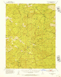
 1967 Plaskett meadows1969 Print · USGSThe high Mendocino range in the late sixties remained a land of rugged pack trails and seasonal wilderness camps. Researchers can trace historic access routes and named locations like Copper City, Jenks Place, and the remote Garnett Camp.2 unique versions available
 - 1987 Map of Willows, 1988 Print
 1987 Willows1988 Print · USGSThe northern Sacramento Valley meets the Coast Range in the late eighties, showing a landscape defined by water and transit. Researchers can trace the Southern Pacific railroad past Artois and Corning, or locate family-named landmarks like Larkins Childrens Rancho and Snaden Island.2 unique versions available
 - 1995 Map of Plaskett Meadows, 2001 Print
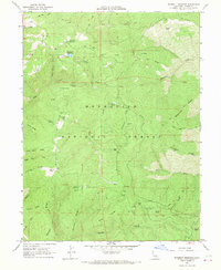
 1995 Plaskett Meadows2001 Print · USGSMendocino National Forest in the mid-1990s shows a high-country landscape of remote mountain camps and historic homestead sites. Trace the locations of Copper City, Jenks Place, and Walker Cabin among the peaks of Black Butte and Hardin Ridge.
 - 2012 Map of Plaskett Meadows, 2012 Print
 2012 Plaskett Meadows2012 Print · USGSCovers Copper City, including Jenks Place, Lone Star, and other nearby areas
 - 2015 Map of Plaskett Meadows, 2015 Print
 2015 Plaskett Meadows2015 Print · USGSCovers Copper City, including Jenks Place, Lone Star, and other nearby areas
 - 2018 Map of Plaskett Meadows, 2018 Print
 2018 Plaskett Meadows2018 Print · USGSCovers Copper City, including Jenks Place, Lone Star, and other nearby areas
 - 2021 Map of Plaskett Meadows, 2021 Print
 2021 Plaskett Meadows2021 Print · USGSHigh ridges and forest glades define this Glenn County landscape within the Mendocino National Forest during the early twenty-first century. Researchers can trace the routes of Forest Highway Seven and locate landmarks like Plaskett Meadows and Black Butte.
End of results
Showing maps 1-10 of 10
Frequently asked questions
- What are the different types of historical maps available for Copper City?
- What is the oldest map of Copper City?
- Where can I purchase historical maps of Copper City for my home or office?
- Where can I download high-res historical maps of Copper City?
- Are there historical topographic maps available for Copper City?
- Is there historical aerial imagery available for Copper City?
- Where are historical maps of Copper City sourced from?