Old Maps of Waseck, California for Hiking & Exploration
Hike through history with 13 historic maps of Waseck. Explore old trails, ghost towns, and forgotten backroads — perfect for outdoor adventurers and local explorers.
- Rediscover forgotten places: Map out old mining camps, roads, and footpaths that no longer exist on modern maps.
- Layer with modern tools: Combine with LiDAR or satellite views to plan hikes through historical terrain.
- Made for exploration: Popular among hikers, overlanders, and local history lovers.
Use these maps to find adventure and explore the hidden past of Waseck.
Waseck, CA maps
(13)- 1925 Map of Hoopa
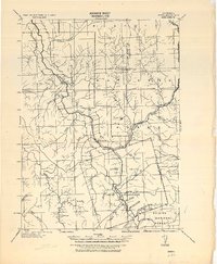 1925 Hoopa1925 Print · USGSNorthwestern California in the mid-twenties centers on the vital corridors of the Klamath River and the Hoopa Valley Indian Reservation. Genealogists and historians can trace riverside settlements and landmarks like Martins Ferry, Weitchpec, and Orleans.
 - 1945 Map of Coyote Peak
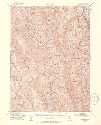
 1945 Coyote Peak1945 Print · USGSCoastal mountain ridges and river crossings define this Humboldt County landscape in the 1940s. Genealogists and local historians can trace family landholdings like the Hooker Ranch and Tomlinson Bros Ranch near the Hoopa Indian Reservation.
 - 1948 Map of Weed, 1950 Print
 1948 Weed1950 Print · USGSNorthern California and Southern Oregon are captured here during the post-war era, documenting the mountain-and-valley economies of the Klamath and Cascade ranges. Trace the legacy of local mining and timber at the King Solomon Mine, find old schools like Siskiyou County School, and follow the historic Southern Pacific RR route.2 unique versions available
 - 1950 Map of Weed
 1950 Weed1950 Print · USGSSiskiyou County and the surrounding Klamath mountains appear in the mid-century before extensive modern development. Genealogists and local historians can locate remote outposts like the Lee Brown Ranch and the specialized settlement of Darlingtonia.
 - 1952 Map of Coyote Peak, 1954 Print
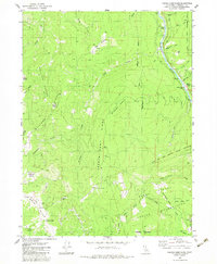
 1952 Coyote Peak1954 Print · USGSHumboldt County ranching and tribal lands are documented here in the early fifties, from the ridges above Redwood Creek to the river banks. Genealogists can trace family holdings and rural education at the Anton Lyons Ranch, Bald Hills School, and Rube Ranch.5 unique versions available
 - 1958 Map of Weed, 1963 Print
 1958 Weed1963 Print · USGSThe Northern California high country of the late fifties is defined by the towering presence of Mt Shasta and the logging railroads of the Siskiyou range. Genealogists and researchers can trace remote mining sites like the China Mine and mountain settlements such as Sawyers Bar and Seiad Valley.3 unique versions available
 - 1963 Map of Weed
 1963 Weed1963 Print · USGSNorthern California during the early 1960s shows a landscape of steep mountain ranges and river-fed valleys at the height of the timber era. Researchers can trace the routes of the McCloud River RR, locate remote sites like the Holiday Mine, or find ancestral markers at the Scott Valley Cem.
 - 1983 Map of Hoopa
 1983 Hoopa1983 Print · USGSThe Klamath and Trinity Rivers converge in the early eighties at Weitchpec, carving through a landscape of national forests and the Hoopa Indian Reservation. Researchers can trace remote settlements like Orleans and Cecilville or locate landmarks like Tish Tang Creek and English Peak.
 - 1983 Map of French Camp Ridge
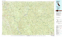
 1983 French Camp Ridge1983 Print · USGSThe Klamath River and Hoopa Valley Indian Reservation lands are captured here in the early 1980s, showcasing a network of high-country prairies and remote ranches. Researchers can trace historical sites like Martins Ferry (Site), the local Cem, and the Rube Ranch.2 unique versions available
 - 2012 Map of French Camp Ridge, 2012 Print
 2012 French Camp Ridge2012 Print · USGSCovers Waseck, including Humboldt County, United States, and other nearby areas
 - 2015 Map of French Camp Ridge, 2015 Print
 2015 French Camp Ridge2015 Print · USGSCovers Waseck, including Humboldt County, United States, and other nearby areas
 - 2018 Map of French Camp Ridge, 2018 Print
 2018 French Camp Ridge2018 Print · USGSCovers Waseck, including Humboldt County, United States, and other nearby areas
 - 2021 Map of French Camp Ridge, 2021 Print
 2021 French Camp Ridge2021 Print · USGSHumboldt County’s high ridges and river canyons are detailed here in the early 2020s, where the Klamath River meets protected parkland. Researchers can locate the Yurok Veterans Cem, trace the settlement of Waseck, and explore landmarks like Coyote Peak.
End of results
Showing maps 1-13 of 13
Frequently asked questions
- What are the different types of historical maps available for Waseck?
- What is the oldest map of Waseck?
- Where can I purchase historical maps of Waseck for my home or office?
- Where can I download high-res historical maps of Waseck?
- Are there historical topographic maps available for Waseck?
- Is there historical aerial imagery available for Waseck?
- Where are historical maps of Waseck sourced from?