1920s Maps of Beverly Hills, California
Explore 8 historic maps of Beverly Hills from the 1920s. These maps offer a rare glimpse into what life looked like during the 1920s — showing old roads, neighborhoods, homes, and landmarks that have changed or disappeared over time.
Whether you're researching your family's past, planning a metal detecting trip, or studying how Beverly Hills's landscape evolved across the 1920s, these high-resolution maps are a powerful tool for exploring the history of this region.
- Focus on a specific era: All maps on this page are from the 1920s, giving you a focused view of this time period.
- See what’s changed: Compare century-old streets, trails, and buildings to today's modern landscape using overlays and satellite layers.
- Research with precision: Use these maps for genealogy, historical research, land use analysis, or educational projects.
- View, download, or print: Maps are fully viewable online in high resolution, and can be downloaded or printed for your own records.
Start exploring Beverly Hills's history through authentic maps from the 1920s. This is your window into the past.
Beverly Hills, CA maps
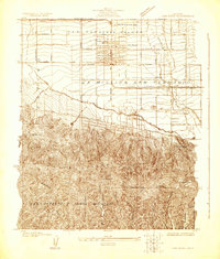
(8)- 1920 Map of Santa Monica
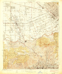
 1920 Santa Monica1920 Print · USGSThe Los Angeles basin and San Fernando Valley are captured here just after the war as agriculture gives way to early suburban sprawl. Genealogists and historians can trace the early grids of Beverly Hills, Sawtelle, and Van Nuys alongside the sprawling Salt Lake Oil Fields.
 - 1921 Map of Santa Monica
 1921 Santa Monica1921 Print · USGSLos Angeles and the San Fernando Valley are captured here just as the suburban boom began to accelerate. Genealogists and researchers can trace the rail-connected origins of Lankershim, Universal City, and the Salt Lake Oil Fields.3 unique versions available
 - 1924 Map of Van Nuys
 1924 Van Nuys1924 Print · USGSThe San Fernando Valley is shown in the mid-1920s as early citrus groves and ranch lands began giving way to organized town grids. Researchers can trace the original routes of the Pacific Electric and find landmarks like the Encino Country Club and Guernsey.
 - 1924 Map of Hollywood
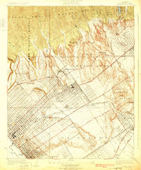
 1924 Hollywood1924 Print · USGSLos Angeles and Hollywood are captured during a decade of explosive growth, when oil derricks and electric rail lines still dominated the landscape. Genealogists and transit historians can trace the Pacific Electric Santa Monica Line through Beverly Hills and locate early landmarks like Fairfax School.
 - 1925 Map of Sawtelle
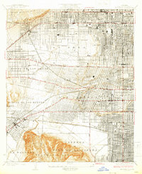
 1925 Sawtelle1925 Print · USGSWest Los Angeles in the mid-twenties shows a landscape of grand ranchos and early suburban grids. You can trace the Pacific Electric rail lines connecting Sawtelle and Beverley Hills or locate the sprawling Soldiers Home and its cemetery.2 unique versions available
 - 1926 Map of Van Nuys
 1926 Van Nuys1926 Print · USGSThe San Fernando Valley is shown during its mid-twenties growth, before the post-war suburban boom transformed its citrus and ranch lands. Trace the early townites of Van Nuys and Encino, or follow the winding Mulholland Highway through the Santa Monica Mountains.4 unique versions available
 - 1926 Map of Hollywood
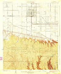
 1926 Hollywood1926 Print · USGSMid-1920s Los Angeles is captured here during a period of incredible growth, where extensive oil fields and interurban rail lines still defined the landscape. Genealogists and historians can trace the early development of Beverly Hills, the dense Oil Wells of La Brea, and the grounds of the Hollywood Cemetery.2 unique versions available
 - 1926 Map of Burbank
 1926 Burbank1926 Print · USGSThe San Fernando Valley was transitioning from orchards to suburbs in the mid-twenties. Genealogists and historians can trace the early layouts of Lankershim, Universal City, and the Hollywood Bowl as the city boundary pushed north.3 unique versions available
End of results
Showing maps 1-8 of 8
Top cities near Beverly Hills
- Los Angeles historical maps
- Long Beach historical maps
- Glendale historical maps
- Torrance historical maps
- Pasadena historical maps
- Inglewood historical maps
See more
Top neighborhoods of Beverly Hills
Frequently asked questions
- What are the different types of historical maps available for Beverly Hills?
- What is the oldest map of Beverly Hills?
- Where can I purchase historical maps of Beverly Hills for my home or office?
- Where can I download high-res historical maps of Beverly Hills?
- Are there historical topographic maps available for Beverly Hills?
- Is there historical aerial imagery available for Beverly Hills?
- Where are historical maps of Beverly Hills sourced from?