Old Maps of Shadow Glen Estates, Los Angeles for Metal Detecting
Plan your next treasure hunt with 18 historic maps of Shadow Glen Estates. Find old homesites, ghost towns, trails, and gathering spots that may be lost to time — perfect for identifying promising metal detecting locations.
- Locate forgotten sites: Uncover places like long-lost settlements, abandoned rail lines, or gathering spots.
- Plan better hunts: Use map overlays combined with LiDAR or satellite views to narrow in on historically rich areas.
- Made for detectorists: Thousands of hobbyists use these maps to discover relics, coins, and hidden history.
Use these historic maps to boost your research and find new opportunities beneath the surface of Shadow Glen Estates.
Shadow Glen Estates, Los Angeles maps
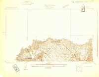
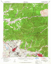
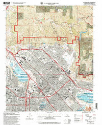
(18)- 1900 Map of Fernando
 1900 Fernando1900 Print · USGSCovers Shadow Glen Estates, including Los Angeles, Glendale, and other nearby areas7 unique versions available
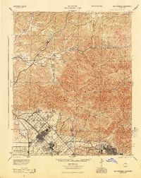
 - 1901 Map of Southern California Sheet No. 1
 1901 Southern California Sheet No. 11901 Print · USGSCovers Shadow Glen Estates, including Los Angeles, Long Beach, and other nearby areas11 unique versions available
 - 1904 Map of Southern California Sheet No. 1, 1905 Print
 1904 Southern California Sheet No. 11905 Print · USGSCovers Shadow Glen Estates, including Los Angeles, Long Beach, and other nearby areas3 unique versions available
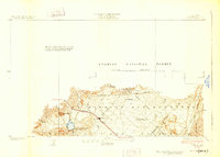
 - 1925 Map of Sylmar
 1925 Sylmar1925 Print · USGSCovers Shadow Glen Estates, including Los Angeles, Santa Clarita, and other nearby areas
 - 1928 Map of Sylmar
 1928 Sylmar1928 Print · USGSCovers Shadow Glen Estates, including Los Angeles, Santa Clarita, and other nearby areas
 - 1929 Map of Sylmar
 1929 Sylmar1929 Print · USGSCovers Shadow Glen Estates, including Los Angeles, Santa Clarita, and other nearby areas
 - 1935 Map of Sylmar
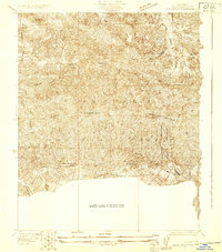
 1935 Sylmar1935 Print · USGSCovers Shadow Glen Estates, including Los Angeles, Santa Clarita, and other nearby areas3 unique versions available
 - 1940 Map of San Fernando, 1955 Print
 1940 San Fernando1955 Print · USGSCovers Shadow Glen Estates, including Los Angeles, Glendale, and other nearby areas2 unique versions available
 - 1945 Map of San Fernando
 1945 San Fernando1945 Print · USGSCovers Shadow Glen Estates, including Los Angeles, Glendale, and other nearby areas
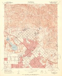
 - 1949 Map of Los Angeles
 1949 Los Angeles1949 Print · USGSCovers Shadow Glen Estates, including Los Angeles, Oxnard, and other nearby areas3 unique versions available
 - 1953 Map of San Fernando, 1954 Print
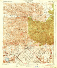
 1953 San Fernando1954 Print · USGSCovers Shadow Glen Estates, including Los Angeles, Santa Clarita, and other nearby areas3 unique versions available
 - 1955 Map of Los Angeles
 1955 Los Angeles1955 Print · USGSCovers Shadow Glen Estates, including Los Angeles, Oxnard, and other nearby areas
 - 1959 Map of Los Angeles
 1959 Los Angeles1959 Print · USGSCovers Shadow Glen Estates, including Los Angeles, Oxnard, and other nearby areas3 unique versions available
 - 1966 Map of Los Angeles
 1966 Los Angeles1966 Print · USGSCovers Shadow Glen Estates, including Los Angeles, Oxnard, and other nearby areas
 - 1966 Map of San Fernando, 1967 Print
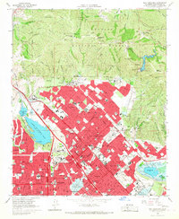 1966 San Fernando1967 Print · USGSCovers Shadow Glen Estates, including Los Angeles, Santa Clarita, and other nearby areas3 unique versions available
 - 1975 Map of Los Angeles, 1977 Print
 1975 Los Angeles1977 Print · USGSCovers Shadow Glen Estates, including Los Angeles, Oxnard, and other nearby areas2 unique versions available
 - 1979 Map of Los Angeles
 1979 Los Angeles1979 Print · USGSCovers Shadow Glen Estates, including Los Angeles, Glendale, and other nearby areas
 - 1995 Map of San Fernando, 1999 Print
 1995 San Fernando1999 Print · USGSCovers Shadow Glen Estates, including Los Angeles, Santa Clarita, and other nearby areas
End of results
Showing maps 1-18 of 18
Frequently asked questions
- What are the different types of historical maps available for Shadow Glen Estates?
- What is the oldest map of Shadow Glen Estates?
- Where can I purchase historical maps of Shadow Glen Estates for my home or office?
- Where can I download high-res historical maps of Shadow Glen Estates?
- Are there historical topographic maps available for Shadow Glen Estates?
- Is there historical aerial imagery available for Shadow Glen Estates?
- Where are historical maps of Shadow Glen Estates sourced from?