Old Maps of Sylmar Neighborhood Council District, Los Angeles for Academic Research
Study the evolution of Sylmar Neighborhood Council District with 29 high-resolution historic maps. Whether you're teaching, researching, or modeling changes in land use, these maps provide essential visual documentation of urban, environmental, and geographic change.
- Analyze long-term change: Track patterns in development, transportation, and natural features.
- Ideal for environmental or urban studies: Support academic projects with primary historical map data.
- Use in the classroom or lab: Educators and researchers rely on these maps to bring historical context to life.
These maps are a powerful tool for teaching, research, and visualizing how Sylmar Neighborhood Council District has changed over the decades.
Sylmar Neighborhood Council District, Los Angeles maps
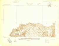
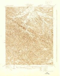
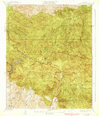
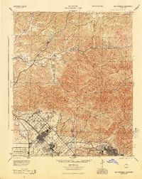
(29)- 1900 Map of Fernando
 1900 Fernando1900 Print · USGSCovers Sylmar Neighborhood Council District, including Los Angeles, Glendale, and other nearby areas7 unique versions available
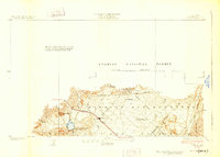
 - 1901 Map of Southern California Sheet No. 1
 1901 Southern California Sheet No. 11901 Print · USGSCovers Sylmar Neighborhood Council District, including Los Angeles, Long Beach, and other nearby areas11 unique versions available
 - 1903 Map of Camulos
 1903 Camulos1903 Print · USGSCovers Sylmar Neighborhood Council District, including Los Angeles, Santa Clarita, and other nearby areas5 unique versions available
 - 1903 Map of Santa Susana
 1903 Santa Susana1903 Print · USGSCovers Sylmar Neighborhood Council District, including Los Angeles, Santa Clarita, and other nearby areas8 unique versions available
 - 1904 Map of Southern California Sheet No. 1, 1905 Print
 1904 Southern California Sheet No. 11905 Print · USGSCovers Sylmar Neighborhood Council District, including Los Angeles, Long Beach, and other nearby areas3 unique versions available
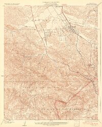
 - 1925 Map of Sylmar
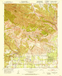
 1925 Sylmar1925 Print · USGSCovers Sylmar Neighborhood Council District, including Los Angeles, Santa Clarita, and other nearby areas
 - 1927 Map of Pacoima
 1927 Pacoima1927 Print · USGSCovers Sylmar Neighborhood Council District, including Los Angeles, San Fernando, and other nearby areas4 unique versions available
 - 1928 Map of Sylmar
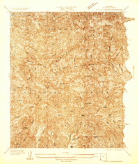
 1928 Sylmar1928 Print · USGSCovers Sylmar Neighborhood Council District, including Los Angeles, Santa Clarita, and other nearby areas
 - 1929 Map of Sylmar
 1929 Sylmar1929 Print · USGSCovers Sylmar Neighborhood Council District, including Los Angeles, Santa Clarita, and other nearby areas
 - 1929 Map of Newhall
 1929 Newhall1929 Print · USGSCovers Sylmar Neighborhood Council District, including Los Angeles, Santa Clarita, and other nearby areas
 - 1933 Map of Newhall
 1933 Newhall1933 Print · USGSCovers Sylmar Neighborhood Council District, including Los Angeles, Santa Clarita, and other nearby areas4 unique versions available
 - 1934 Map of Little Tujunga
 1934 Little Tujunga1934 Print · USGSCovers Sylmar Neighborhood Council District, including Los Angeles, Santa Clarita, and other nearby areas
 - 1935 Map of Sylmar
 1935 Sylmar1935 Print · USGSCovers Sylmar Neighborhood Council District, including Los Angeles, Santa Clarita, and other nearby areas3 unique versions available
 - 1939 Map of Little Tujunga
 1939 Little Tujunga1939 Print · USGSCovers Sylmar Neighborhood Council District, including Los Angeles, Santa Clarita, and other nearby areas3 unique versions available
 - 1940 Map of San Fernando, 1955 Print
 1940 San Fernando1955 Print · USGSCovers Sylmar Neighborhood Council District, including Los Angeles, Glendale, and other nearby areas2 unique versions available
 - 1941 Map of Santa Susana, 1964 Print
 1941 Santa Susana1964 Print · USGSCovers Sylmar Neighborhood Council District, including Los Angeles, Santa Clarita, and other nearby areas2 unique versions available
 - 1943 Map of Santa Susana
 1943 Santa Susana1943 Print · USGSCovers Sylmar Neighborhood Council District, including Los Angeles, Santa Clarita, and other nearby areas
 - 1945 Map of San Fernando
 1945 San Fernando1945 Print · USGSCovers Sylmar Neighborhood Council District, including Los Angeles, Glendale, and other nearby areas
 - 1949 Map of Los Angeles
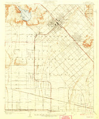
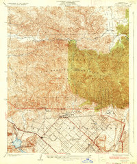
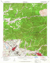
 1949 Los Angeles1949 Print · USGSCovers Sylmar Neighborhood Council District, including Los Angeles, Oxnard, and other nearby areas3 unique versions available
 - 1952 Map of Oat Mountain, 1953 Print
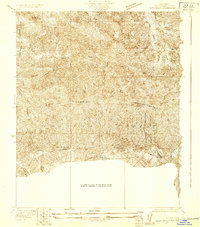
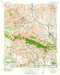
 1952 Oat Mountain1953 Print · USGSCovers Sylmar Neighborhood Council District, including Los Angeles, Santa Clarita, and other nearby areas8 unique versions available
 - 1953 Map of San Fernando, 1954 Print
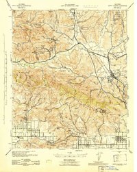
 1953 San Fernando1954 Print · USGSCovers Sylmar Neighborhood Council District, including Los Angeles, Santa Clarita, and other nearby areas3 unique versions available
 - 1955 Map of Los Angeles
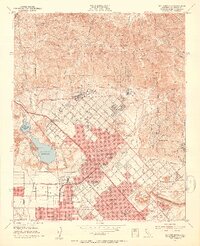
 1955 Los Angeles1955 Print · USGSCovers Sylmar Neighborhood Council District, including Los Angeles, Oxnard, and other nearby areas
 - 1959 Map of Los Angeles
 1959 Los Angeles1959 Print · USGSCovers Sylmar Neighborhood Council District, including Los Angeles, Oxnard, and other nearby areas3 unique versions available
 - 1966 Map of Los Angeles
 1966 Los Angeles1966 Print · USGSCovers Sylmar Neighborhood Council District, including Los Angeles, Oxnard, and other nearby areas
 - 1966 Map of San Fernando, 1967 Print
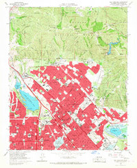 1966 San Fernando1967 Print · USGSCovers Sylmar Neighborhood Council District, including Los Angeles, Santa Clarita, and other nearby areas3 unique versions available
Showing maps 1-25 of 29
Frequently asked questions
- What are the different types of historical maps available for Sylmar Neighborhood Council District?
- What is the oldest map of Sylmar Neighborhood Council District?
- Where can I purchase historical maps of Sylmar Neighborhood Council District for my home or office?
- Where can I download high-res historical maps of Sylmar Neighborhood Council District?
- Are there historical topographic maps available for Sylmar Neighborhood Council District?
- Is there historical aerial imagery available for Sylmar Neighborhood Council District?
- Where are historical maps of Sylmar Neighborhood Council District sourced from?