Old Maps of Trancas, Malibu for Metal Detecting
Plan your next treasure hunt with 19 historic maps of Trancas. Find old homesites, ghost towns, trails, and gathering spots that may be lost to time — perfect for identifying promising metal detecting locations.
- Locate forgotten sites: Uncover places like long-lost settlements, abandoned rail lines, or gathering spots.
- Plan better hunts: Use map overlays combined with LiDAR or satellite views to narrow in on historically rich areas.
- Made for detectorists: Thousands of hobbyists use these maps to discover relics, coins, and hidden history.
Use these historic maps to boost your research and find new opportunities beneath the surface of Trancas.
Trancas, Malibu maps
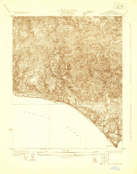
(19)- 1900 Map of Triunfo Pass
 1900 Triunfo Pass1900 Print · USGSIn the final year of the nineteenth century, the coast between Ventura and Los Angeles remained a series of massive ranchos and canyons. Genealogists and historians can trace early settlements like Newbury Park and Vejor, or follow the ancient Boundary Line across the Santa Monica Mountains.2 unique versions available
 - 1903 Map of Camulos
 1903 Camulos1903 Print · USGSSouthern California at the dawn of the twentieth century shows a landscape of ranchos and early rail towns. Trace the old routes through Simi and Camulos, or locate vanished stops like Ternez Siding and the coastal piers at Port Los Angeles.5 unique versions available
 - 1921 Map of Triunfo Pass
 1921 Triunfo Pass1921 Print · USGSThe coastal canyons and mountain passes of Ventura and Los Angeles counties are captured here at the turn of the century. Genealogists and historians can trace early settlements at Newbury Park and Triunfo, or follow the rugged drainage of Dume Canyon to the sea.3 unique versions available
 - 1929 Map of Dume Point
 1929 Dume Point1929 Print · USGSThe Malibu coast and Santa Monica Mountains appear here in the late twenties, before the arrival of modern density. Genealogists and historians can trace early family holdings like Filbert Ranch, locate the Decker Sch, and find the Madley Trading Post.
 - 1932 Map of Dume Point
 1932 Dume Point1932 Print · USGSCoastal Malibu was a realm of private ranches and narrow mountain roads in the years before the Pacific Coast Highway’s modern expansion. Genealogists and local historians can trace family-named landmarks like Rindge Ranch, the remote Decker Sch, and the Malibu Trading Sta near the shore.2 unique versions available
 - 1943 Map of Triunfo Pass
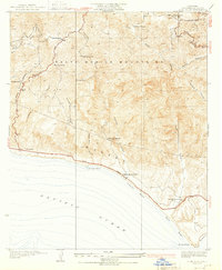
 1943 Triunfo Pass1943 Print · USGSThe Conejo Valley and Santa Monica Mountains are shown here during the early war years, when ranching and small coastal outposts defined the region. Local researchers can locate family landholdings like Fillmore Ranch or trace the early development of the Thousand Oaks Community and Newbury Park.
 - 1949 Map of Los Angeles
 1949 Los Angeles1949 Print · USGSSouthern California and the South Coast appear at the onset of the post-war boom, from the Channel Islands to the Mojave Desert. Trace early aviation sites like Lockheed Air Terminal and mining history at the Redrock Quicksilver Mine and Redrover Mine.2 unique versions available
 - 1950 Map of Point Dume, 1956 Print
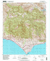
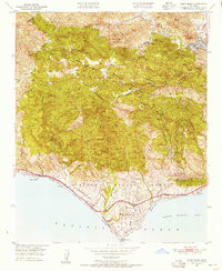 1950 Point Dume1956 Print · USGSThe coastal canyons and peaks of western Los Angeles County appear here in the early fifties, before the surge of modern residential expansion. Researchers can trace early ranch sites like Kincaid Ranch, visit Seminole Hot Springs, or locate the Castro Pk Lookout.6 unique versions available
 - 1951 Map of Point Dume
 1951 Point Dume1951 Print · USGSThe coastal mountains of Malibu and the Santa Monica range appear here in the early fifties, before the arrival of modern suburban sprawl. Researchers can trace historic landmarks like Seminole Hot Springs, the Kincaid Ranch, and the early layout of Malibu Riviera.
 - 1955 Map of Los Angeles
 1955 Los Angeles1955 Print · USGSThe mid-century transformation of Southern California comes into focus as the urban sprawl of Los Angeles meets the wilderness of the Santa Monica Mountains. Researchers can trace the development of post-war suburbs alongside historic landmarks like the Santa Barbara Lighthouse and early industrial sites such as the Good Luck Mine.
 - 1959 Map of Los Angeles
 1959 Los Angeles1959 Print · USGSCoastal California and the high desert met in a period of booming growth after the war. Researchers can trace early aviation and military history at the Point Mugu Air Missile Test Ctr or locate desert mining sites like the Double Eagle Mine.3 unique versions available
 - 1966 Map of Los Angeles
 1966 Los Angeles1966 Print · USGSSouthern California underwent a mid-century transformation as suburban grids reached the base of the San Gabriel Mountains. Researchers can trace the path of the Los Angeles Aqueduct or locate defense landmarks like Edwards Air Force Base.
 - 1975 Map of Los Angeles, 1977 Print
 1975 Los Angeles1977 Print · USGSSouthern California is captured in a period of significant growth during the mid-seventies, showing the urban sprawl from the coast to the high desert. Researchers can trace the development of the Pacific Coast Hwy and find aerospace landmarks like Edwards Air Force Base and the Flight Test Center (NASA).2 unique versions available
 - 1979 Map of Los Angeles
 1979 Los Angeles1979 Print · USGSSouthern California at the close of the 1970s reveals a sprawling network of suburban growth and massive infrastructure projects. Researchers can trace established rail lines like the Southern Pacific alongside newer settlements and landmarks like Virginia Colony and Griffith Park.
 - 1995 Map of Point Dume, 1999 Print
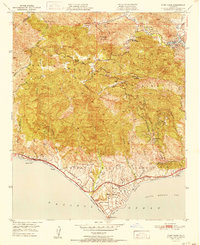
 1995 Point Dume1999 Print · USGSThe Malibu coast and inland canyons appear in the mid-nineties as a mix of preserved mountain wilderness and exclusive seaside enclaves. Researchers can trace land use from the Kincaid Ranch to the early developments at Malibu Riviera and Seminole Hot Springs.
 - 2012 Map of Point Dume, 2012 Print
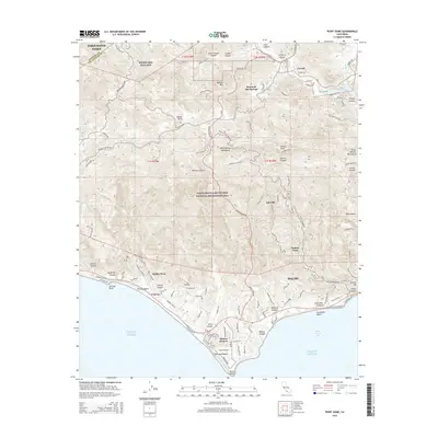
 2012 Point Dume2012 Print · USGSCovers Trancas, including Thousand Oaks, Malibu, and other nearby areas
 - 2015 Map of Point Dume, 2015 Print
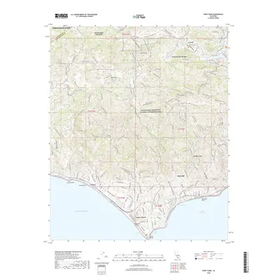
 2015 Point Dume2015 Print · USGSCovers Trancas, including Thousand Oaks, Malibu, and other nearby areas
 - 2018 Map of Point Dume, 2018 Print
 2018 Point Dume2018 Print · USGSCovers Trancas, including Thousand Oaks, Malibu, and other nearby areas
 - 2021 Map of Point Dume, 2021 Print
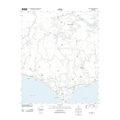
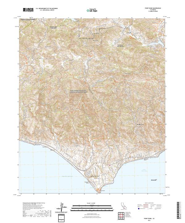 2021 Point Dume2021 Print · USGSThe Santa Monica Mountains meet the Pacific Ocean in the early twenty-first century, showing the development of coastal enclaves. Trace historic trails and modern topography through Seminole Hot Springs, Malibu Vista, and the prominent Point Dume.
End of results
Showing maps 1-19 of 19
Top cities near Trancas
- Los Angeles historical maps
- Thousand Oaks historical maps
- Simi Valley historical maps
- Camarillo historical maps
- Calabasas historical maps
- Agoura Hills historical maps
See more
Frequently asked questions
- What are the different types of historical maps available for Trancas?
- What is the oldest map of Trancas?
- Where can I purchase historical maps of Trancas for my home or office?
- Where can I download high-res historical maps of Trancas?
- Are there historical topographic maps available for Trancas?
- Is there historical aerial imagery available for Trancas?
- Where are historical maps of Trancas sourced from?