Old Maps of San Marino, California for Metal Detecting
Plan your next treasure hunt with 30 historic maps of San Marino. Find old homesites, ghost towns, trails, and gathering spots that may be lost to time — perfect for identifying promising metal detecting locations.
- Locate forgotten sites: Uncover places like long-lost settlements, abandoned rail lines, or gathering spots.
- Plan better hunts: Use map overlays combined with LiDAR or satellite views to narrow in on historically rich areas.
- Made for detectorists: Thousands of hobbyists use these maps to discover relics, coins, and hidden history.
Use these historic maps to boost your research and find new opportunities beneath the surface of San Marino.
San Marino, CA maps
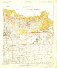
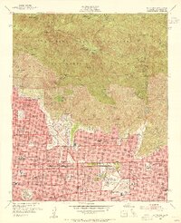
(30)- 1894 Map of Los Angeles
 1894 Los Angeles1894 Print · USGSLos Angeles was a growing rail hub at the end of the nineteenth century, balancing its agricultural heritage with new mountain resorts. Researchers can trace early neighborhoods like Boyle Heights, find the National Soldiers Home, or follow the Mt. Lowe Hotel incline.
 - 1896 Map of Pasadena
 1896 Pasadena1896 Print · USGSGreater Los Angeles was a network of rail-connected resort towns and historic missions in the late nineteenth century. You can trace early transit lines to the Raymond Hotel, locate the original Mission site, and find vanished stops like Las Casetas Sta.2 unique versions available
 - 1900 Map of Pasadena
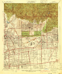
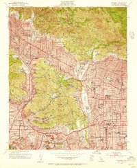
 1900 Pasadena1900 Print · USGSThe San Gabriel Valley is captured here at a pivotal moment of expansion just as the rail networks reached the foothills. Researchers can trace the layout of early Pasadena and Monrovia, locate the Echo Mountain Mt. Lowe Hotel, or find the historic Mission and Raymond Hotel.10 unique versions available
 - 1900 Map of Los Angeles
 1900 Los Angeles1900 Print · USGSGreater Los Angeles was a mosaic of expansive ranchos and emerging rail towns at the turn of the century. You can trace the early footprints of Hollywood, locate the historic Soldiers Home, and follow the mountain rails to the Echo Mountain Mt. Lowe Hotel.4 unique versions available
 - 1901 Map of Southern California Sheet No. 1
 1901 Southern California Sheet No. 11901 Print · USGSGreater Los Angeles at the dawn of the twentieth century is a landscape of growing citrus towns and a burgeoning rail network. Genealogists and historians can trace the early gridded streets of Hollywood and Pasadena or locate landmarks like Bear Lake and the Cahuilla Indian Reservation.6 unique versions available
 - 1904 Map of Southern California Sheet No. 1, 1905 Print
 1904 Southern California Sheet No. 11905 Print · USGSSouthern California at the dawn of the twentieth century shows a landscape of citrus groves and coastal towns connected by rail. Genealogists and historians can trace early settlements like San Juan Capistrano, find remote sites like the Rose Mine, and study the original water systems of the Santa Ana River.2 unique versions available
 - 1928 Map of Altadena
 1928 Altadena1928 Print · USGSGreater Pasadena and the San Gabriel Valley are shown here in the late twenties, balancing rapid suburban expansion with grand resort-era estates. Local historians can trace early rail lines like the Pacific Electric and landmarks such as the Rose Bowl and Huntington Estate.2 unique versions available
 - 1928 Map of Sierra Madre
 1928 Sierra Madre1928 Print · USGSThe San Gabriel Valley foothills were rapidly expanding in the late twenties as orchard lands gave way to suburban tracts. Genealogists and researchers can trace early homesteads and rail lines like the Pacific Electric, the Temple School, and the historic Mission San Gabriel.
 - 1933 Map of Sierra Madre
 1933 Sierra Madre1933 Print · USGSThe foothills of the San Gabriel Mountains come alive in the 1930s as residential growth meets the rugged canyons of the Angeles National Forest. Genealogists and hikers can trace early mountain retreats like Orchard Camp, Henninger Flats, and the First Water Resort.
 - 1941 Map of Sierra Madre
 1941 Sierra Madre1941 Print · USGSThe San Gabriel foothills and burgeoning valley floor are captured here just before the mid-century population explosion. Genealogists and local historians can trace the early layouts of Arcadia, Sierra Madre, and the historic Kinneloa Ranch near the Pacific Electric lines.2 unique versions available
 - 1949 Map of Los Angeles
 1949 Los Angeles1949 Print · USGSSouthern California and the South Coast appear at the onset of the post-war boom, from the Channel Islands to the Mojave Desert. Trace early aviation sites like Lockheed Air Terminal and mining history at the Redrock Quicksilver Mine and Redrover Mine.2 unique versions available
 - 1953 Map of El Monte, 1955 Print
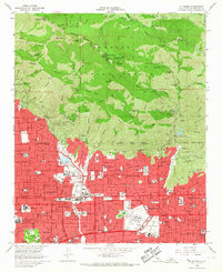
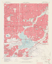
 1953 El Monte1955 Print · USGSThe San Gabriel Valley was undergoing a massive suburban transformation in the early fifties. Genealogists and local historians can trace the footprint of the San Gabriel Mission, the Pasadena-Rosemead Airport, and numerous Oil Wells before the valley's open lands were fully developed.2 unique versions available
 - 1953 Map of Mt. Wilson, 1955 Print
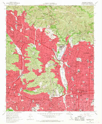
 1953 Mt. Wilson1955 Print · USGSThe foothills of the San Gabriel Mountains meet the expanding suburbs of the San Gabriel Valley during the early fifties. Researchers can trace the path of the PE Electric RR, locate the Echo Mountain (Site), and find local landmarks like Kinneloa Ranch or the Mt Alverno Convent.3 unique versions available
 - 1953 Map of Pasadena, 1955 Print
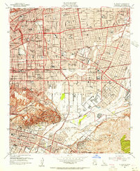
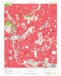
 1953 Pasadena1955 Print · USGSThe foothills of the San Gabriel Mountains meet the mid-century sprawl of Los Angeles in this detailed record of the 1950s. Genealogists and historians can locate dozens of institutions like Occidental College, Mt Lowe Military Academy, and the Rose Bowl.3 unique versions available
 - 1953 Map of Los Angeles, 1956 Print
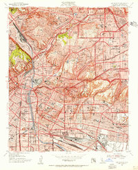 1953 Los Angeles1956 Print · USGSMid-century Los Angeles is captured here during a period of massive infrastructure growth and urban density. Genealogists and researchers can trace family roots through numerous neighborhood landmarks like Evergreen Cem, Garfield High Sch, and All Souls School.
 - 1955 Map of Los Angeles
 1955 Los Angeles1955 Print · USGSThe mid-century transformation of Southern California comes into focus as the urban sprawl of Los Angeles meets the wilderness of the Santa Monica Mountains. Researchers can trace the development of post-war suburbs alongside historic landmarks like the Santa Barbara Lighthouse and early industrial sites such as the Good Luck Mine.
 - 1959 Map of Los Angeles
 1959 Los Angeles1959 Print · USGSCoastal California and the high desert met in a period of booming growth after the war. Researchers can trace early aviation and military history at the Point Mugu Air Missile Test Ctr or locate desert mining sites like the Double Eagle Mine.3 unique versions available
 - 1966 Map of Los Angeles
 1966 Los Angeles1966 Print · USGSSouthern California underwent a mid-century transformation as suburban grids reached the base of the San Gabriel Mountains. Researchers can trace the path of the Los Angeles Aqueduct or locate defense landmarks like Edwards Air Force Base.
 - 1966 Map of Mt. Wilson, 1967 Print
 1966 Mt. Wilson1967 Print · USGSThe San Gabriel Valley and its mountain backdrop are captured in the mid-sixties during a period of significant suburban growth. Researchers can trace the layout of the Calif Institute of Technology, the historic Mt Lowe Railway path, and the landmark Mount Wilson Observatory.4 unique versions available
 - 1966 Map of El Monte, 1968 Print
 1966 El Monte1968 Print · USGSThe San Gabriel Valley is shown here at the height of its mid-century suburban boom, before the final build-out of its freeway network. Researchers can trace the heritage of San Gabriel Mission, the grounds of Rose Hills Memorial Park, and the industrial footprint of the Montebello Oil Field.8 unique versions available
 - 1966 Map of Pasadena, 1968 Print
 1966 Pasadena1968 Print · USGSMid-century Los Angeles County unfolds here during a period of rapid suburban and institutional growth. Researchers can trace the legacy of major landmarks like the Jet Propulsion Laboratory, the Rose Bowl, and the campus of Occidental College.5 unique versions available
 - 1966 Map of Los Angeles, 1968 Print
 1966 Los Angeles1968 Print · USGSLos Angeles and its eastern suburbs are shown here in the mid-sixties, a period of massive freeway expansion and urban density. Researchers can trace historic neighborhoods and landmarks like Dodger Stadium, Boyle Heights, and the expansive Evergreen Cemetery.5 unique versions available
 - 1975 Map of Los Angeles, 1977 Print
 1975 Los Angeles1977 Print · USGSSouthern California is captured in a period of significant growth during the mid-seventies, showing the urban sprawl from the coast to the high desert. Researchers can trace the development of the Pacific Coast Hwy and find aerospace landmarks like Edwards Air Force Base and the Flight Test Center (NASA).2 unique versions available
 - 1979 Map of Los Angeles
 1979 Los Angeles1979 Print · USGSSouthern California at the close of the 1970s reveals a sprawling network of suburban growth and massive infrastructure projects. Researchers can trace established rail lines like the Southern Pacific alongside newer settlements and landmarks like Virginia Colony and Griffith Park.
 - 1995 Map of Pasadena, 1999 Print
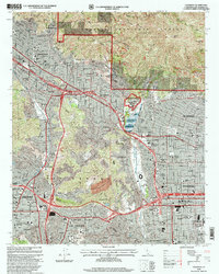 1995 Pasadena1999 Print · USGSThe San Gabriel Valley is captured in the mid-nineties as the urban sprawl of Pasadena and Glendale meets the southern canyons of the Angeles National Forest. Researchers can trace institutional landmarks like the Jet Propulsion Laboratory and the historic Rose Bowl.
Showing maps 1-25 of 30
Top cities near San Marino
- Los Angeles historical maps
- Glendale historical maps
- Pasadena historical maps
- Fullerton historical maps
- Inglewood historical maps
- Downey historical maps
See more
Frequently asked questions
- What are the different types of historical maps available for San Marino?
- What is the oldest map of San Marino?
- Where can I purchase historical maps of San Marino for my home or office?
- Where can I download high-res historical maps of San Marino?
- Are there historical topographic maps available for San Marino?
- Is there historical aerial imagery available for San Marino?
- Where are historical maps of San Marino sourced from?