Old Maps of Cascadel Woods, California
Explore 14 old maps of Cascadel Woods, spanning from 1904 to today. These high-resolution historic maps reveal how streets, neighborhoods, landmarks, and natural features evolved over time — perfect for genealogy, metal detecting, research, and local history exploration.
What you can do with these maps:
- See how Cascadel Woods changed over time: Compare historical maps to modern-day views to trace roads, homesites, rail lines & more.
- View detailed metadata: Each map includes creators, publishers, year, scale, and archive source.
- Overlay maps with satellite & LiDAR: Visualize the past alongside modern tools to explore terrain & human change.
- Trusted historical sources: Maps sourced from the USGS, Library of Congress, and other archives.
- Access maps your way: View online, download high-res files, or order prints for personal or research use.
Start exploring old maps of Cascadel Woods to uncover forgotten places, hidden landmarks, and the deep history beneath your feet.
Cascadel Woods, CA maps
(14)- 1904 Map of Kaiser
 1904 Kaiser1904 Print · USGSThe central Sierra Nevada high country is captured here during the first years of the twentieth century, showing the early logging and mining trails of the Sierra Forest Reserve. Researchers can locate historic mills and camps like Damon Mill, Tollhouse, and Ockenden before the expansion of mountain reservoirs.8 unique versions available
 - 1947 Map of Mariposa, 1948 Print
 1947 Mariposa1948 Print · USGSThe High Sierra and Owens Valley transition is captured here in the late 1940s, just as the region’s hydroelectric and tourism infrastructure was maturing. Genealogists and historians can trace old ranger stations, the Casa Diablo Mine, and rail stops along the Southern Pacific like Benton Station and Zurich.2 unique versions available
 - 1948 Map of Mariposa, 1951 Print
 1948 Mariposa1951 Print · USGSThe High Sierra and Mariposa foothills are shown here in the late 1940s as the post-war tourism and water infrastructure expanded. Genealogists and historians can locate vanished waypoints like Mormon Bar, the Glacier Point Hotel, and the granite quarries of Knowles.
 - 1953 Map of Shaver Lake, 1955 Print
 1953 Shaver Lake1955 Print · USGSThe Sierra Nevada high country comes into focus in the mid-1950s as a hub of hydroelectric power and mountain settlement. Genealogists and historians can trace families and worksites at Italian Bar, the Old Bretz Mill, and the Wish-i-Ah Sanatorium.5 unique versions available
 - 1957 Map of Mariposa, 1966 Print
 1957 Mariposa1966 Print · USGSThe High Sierra and Owens Valley appear in the mid-fifties, showing the intersection of conservation, hydroelectric power, and mountain industry. Genealogists and researchers can trace local landmarks like Yosemite Cemetery, the remote Kinsley Station, and the Pine Creek Mine.4 unique versions available
 - 1963 Map of Mariposa
 1963 Mariposa1963 Print · USGSThe High Sierra and Owens Valley meet in the early sixties, showing a landscape defined by gold-rush history and massive post-war water projects. Genealogists and researchers can trace old mining routes near Mariposa, locate the Glacier Point Hotel, and find small settlements like Coarse Gold or Knowles Junction.
 - 1980 Map of Shaver Lake
 1980 Shaver Lake1980 Print · USGSThe Sierra Nevada foothills and high country come into focus during the early eighties, showing the region's complex water and timber infrastructure. Researchers can trace the heritage of local industry at Knowles Quarry, Buchanan Mine, and the hydroelectric works around Big Creek.3 unique versions available
 - 1982 Map of Cascadel Point, 1983 Print
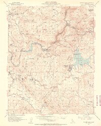
 1982 Cascadel Point1983 Print · USGSIn the early eighties, the San Joaquin River canyon was a hub of hydroelectric power and mountain settlement. Genealogists and historians can trace the community around Chawanakee Sch, the residential layout of Cascadel Woods, and old roads like Italian Bar Road.
 - 1993 Map of Cascadel Point, 2002 Print
 1993 Cascadel Point2002 Print · USGSThe High Sierra foothills come alive in the early nineties as hydroelectric power and forest recreation shape the Madera and Fresno county line. Trace the local impact of energy production and mountain life through Chawanakee Sch, Italian Bar, and Cascadel Woods.
 - 2004 Map of Cascadel Point, 2007 Print
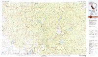
 2004 Cascadel Point2007 Print · USGSAs the hydroelectric network matured in the early 2000s, this area of the Sierra Nevada foothills maintained its remote character. Genealogists and researchers can trace local landmarks like Chawanakee Sch, the settlement at Cascadel, and the historical Italian Bar.
 - 2012 Map of Cascadel Point, 2012 Print
 2012 Cascadel Point2012 Print · USGSCovers Cascadel Woods, including Lerona, South Fork, and other nearby areas
 - 2015 Map of Cascadel Point, 2015 Print
 2015 Cascadel Point2015 Print · USGSCovers Cascadel Woods, including Lerona, South Fork, and other nearby areas
 - 2018 Map of Cascadel Point, 2018 Print
 2018 Cascadel Point2018 Print · USGSCovers Cascadel Woods, including Lerona, South Fork, and other nearby areas
 - 2021 Map of Cascadel Point, 2021 Print
 2021 Cascadel Point2021 Print · USGSMadera County's high-country terrain is captured here in the early 2020s, showing the deep canyons of the San Joaquin River and Redinger Lake. Local historians can trace old mountain routes like Italian Bar Road and locate landmarks such as Dam 7 and the heights of Cascadel Point.
End of results
Showing maps 1-14 of 14
Top cities near Cascadel Woods
Frequently asked questions
- What are the different types of historical maps available for Cascadel Woods?
- What is the oldest map of Cascadel Woods?
- Where can I purchase historical maps of Cascadel Woods for my home or office?
- Where can I download high-res historical maps of Cascadel Woods?
- Are there historical topographic maps available for Cascadel Woods?
- Is there historical aerial imagery available for Cascadel Woods?
- Where are historical maps of Cascadel Woods sourced from?