Old Maps of Hopland, California for Genealogy
Trace your family roots with 21 historic maps of Hopland. These high-res maps reveal old neighborhoods, homesites, landmarks, and streets — helping you uncover where your ancestors lived and how the area evolved over time.
- Explore historic neighborhoods: Identify where your relatives may have lived in the 1800s or 1900s.
- Compare maps over time: Trace the changes in streets, buildings, and landmarks for multi-generational research.
- Perfect for genealogy & ancestry research: Used by family historians and researchers to map out lineage and migration.
These maps are an incredible resource for exploring your personal connection to Hopland's past.
Hopland, CA maps
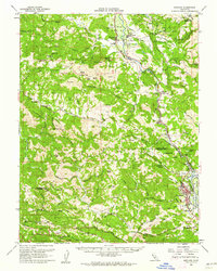
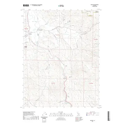
(21)- 1938 Map of Hopland
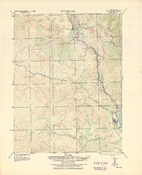 1938 Hopland1938 Print · USGSNorthern California’s Russian River valley is captured here in the 1920s, showing the early rail-and-road network between Hopland and Cloverdale. Trace old rail stops like Thorn Siding and historic locations such as Duncan Springs and Preston.
 - 1943 Map of Hopland, 1960 Print
 1943 Hopland1960 Print · USGSMendocino County ranching and the Russian River valley are captured here in the early 1940s as the rail and road networks matured. Researchers can trace family-named lands like McDowell Ranch, the Nacomis Indian Rancheria, and the operations at Thorn Siding.
 - 1944 Map of Hopland
 1944 Hopland1944 Print · USGSThe Russian River valley in the 1940s was a landscape of remote ranches and rail sidings on the Mendocino-Sonoma border. Researchers can trace the Northwestern Pacific Railroad through Pieta, find the old McDonald School, or locate the Nacomis Indian Rancheria.
 - 1947 Map of Santa Rosa
 1947 Santa Rosa1947 Print · USGSNorthern California in the late 1940s was a landscape of agricultural valleys and vital rail hubs. Trace the historic routes of the Northwestern Pacific through Healdsburg or explore the mid-century waterfronts of Vallejo and Benicia near Mare Island.
 - 1949 Map of Santa Rosa
 1949 Santa Rosa1949 Print · USGSThe North Bay and Wine Country appear here in the late 1940s, when the Northwestern Pacific RR still dominated regional transit. Genealogists and historians can trace old coastal outposts like Anchor Bay Settlement and the early layout of Santa Rosa.2 unique versions available
 - 1958 Map of Santa Rosa, 1968 Print
 1958 Santa Rosa1968 Print · USGSThe North Bay and Wine Country are captured in the mid-twentieth century as the region balanced its agricultural roots with a growing military and recreational footprint. Researchers can trace the Northwestern Pacific RR through the Russian River valley or locate landmarks like the Petaluma Adobe Historical Monument and The Geysers Resort.3 unique versions available
 - 1960 Map of Hopland, 1962 Print
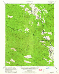
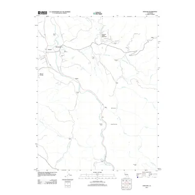
 1960 Hopland1962 Print · USGSThe Russian River corridor in Mendocino County is documented here at the start of the 1960s. Researchers can trace the dual centers of Hopland and Old Hopland, locate the Hopland Cemetery, and follow the Northwestern Pacific rail line through the valley.3 unique versions available
 - 1960 Map of Hopland, 1962 Print
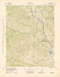
 1960 Hopland1962 Print · USGSMendocino and Sonoma counties meet in this early 1960s survey of the Russian River valley as it transitions into the coastal range. Researchers can trace the rail-and-road corridor through Old Hopland, locate the Cloverdale Rancheria, and find historical sites like the Squaw Rock Slide Historical Marker.2 unique versions available
 - 1962 Map of Santa Rosa
 1962 Santa Rosa1962 Print · USGSThe North Bay and Wine Country were entering a period of significant growth in the early sixties, anchored by established rail corridors and coastal maritime commerce. Genealogists and historians can trace the development of Santa Rosa, locate the Mare Island Naval Shipyard, and follow the Northwestern Pacific RR through the Cotati Valley.
 - 1964 Map of Santa Rosa
 1964 Santa Rosa1964 Print · USGSThe North Bay and Wine Country appear in the mid-fifties during a period of significant military and educational growth. Trace old rail lines like the Northwestern Pacific RR and explore historic sites from Petaluma to the Benicia Arsenal.
 - 1981 Map of Point Arena
 1981 Point Arena1981 Print · USGSThe Mendocino and Sonoma coastlines meet here in the early eighties, where the rift zone carves a path through the redwood country. Genealogists and researchers can trace the development of Point Arena and Guerneville or locate the newly formed Lake Sonoma behind the Warm Springs Dam.2 unique versions available
 - 1991 Map of Yorkville
 1991 Yorkville1991 Print · USGSMendocino County's high country is documented here in the early nineties, centered on the mountain settlement of Yorkville. Researchers can trace the remote water sources and peaks of the Coast Ranges, from Duncan Springs to Big Foot Mtn.
 - 2012 Map of Yorkville, 2012 Print
 2012 Yorkville2012 Print · USGSCovers Hopland, including Ingram, Yorkville, and other nearby areas
 - 2012 Map of Hopland, 2012 Print
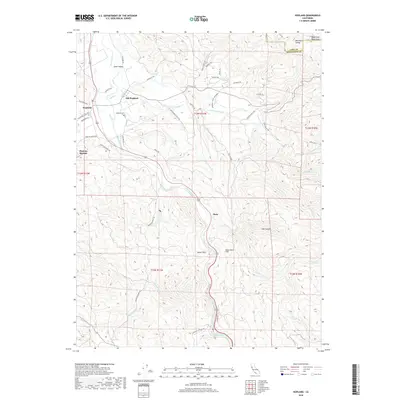
 2012 Hopland2012 Print · USGSCovers Hopland, including Oasis, Nacomis Indian Rancheria, and other nearby areas
 - 2015 Map of Yorkville, 2015 Print
 2015 Yorkville2015 Print · USGSCovers Hopland, including Ingram, Yorkville, and other nearby areas
 - 2015 Map of Hopland, 2015 Print
 2015 Hopland2015 Print · USGSCovers Hopland, including Oasis, Nacomis Indian Rancheria, and other nearby areas
 - 2018 Map of Hopland, 2018 Print
 2018 Hopland2018 Print · USGSCovers Hopland, including Oasis, Nacomis Indian Rancheria, and other nearby areas
 - 2018 Map of Yorkville, 2018 Print
 2018 Yorkville2018 Print · USGSCovers Hopland, including Ingram, Yorkville, and other nearby areas
 - 2021 Map of Hopland, 2021 Print
 2021 Hopland2021 Print · USGSCovers Hopland, including Oasis, Nacomis Indian Rancheria, and other nearby areas
 - 2021 Map of Yorkville, 2021 Print
 2021 Yorkville2021 Print · USGSSouthern Mendocino County's high ridges and creek valleys are documented in this recent survey. Researchers can trace rural settlement patterns near Yorkville and The Oaks, or locate named landmarks like Duncan Peak and Pregnant Spring.
 - 2023 Map of Hopland, 2023 Print
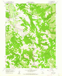
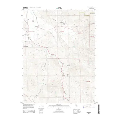
 2023 Hopland2023 Print · USGSMendocino County's Russian River corridor is captured here in the early 2020s, showing the agricultural heart of the Sanel Valley. Researchers can locate Old Hopland, the Hopland Rancheria Cem, and landmarks like Frog Woman Rock.
End of results
Showing maps 1-21 of 21
Top cities near Hopland
- Ukiah historical maps
- Cloverdale historical maps
- Lakeport historical maps
- Talmage historical maps
- Talmage historical maps
Frequently asked questions
- What are the different types of historical maps available for Hopland?
- What is the oldest map of Hopland?
- Where can I purchase historical maps of Hopland for my home or office?
- Where can I download high-res historical maps of Hopland?
- Are there historical topographic maps available for Hopland?
- Is there historical aerial imagery available for Hopland?
- Where are historical maps of Hopland sourced from?