Old Maps of Crestview, California
Explore 13 old maps of Crestview, spanning from 1914 to today. These high-resolution historic maps reveal how streets, neighborhoods, landmarks, and natural features evolved over time — perfect for genealogy, metal detecting, research, and local history exploration.
What you can do with these maps:
- See how Crestview changed over time: Compare historical maps to modern-day views to trace roads, homesites, rail lines & more.
- View detailed metadata: Each map includes creators, publishers, year, scale, and archive source.
- Overlay maps with satellite & LiDAR: Visualize the past alongside modern tools to explore terrain & human change.
- Trusted historical sources: Maps sourced from the USGS, Library of Congress, and other archives.
- Access maps your way: View online, download high-res files, or order prints for personal or research use.
Start exploring old maps of Crestview to uncover forgotten places, hidden landmarks, and the deep history beneath your feet.
Crestview, CA maps
(13)- 1914 Map of Mt. Morrison
 1914 Mt. Morrison1914 Print · USGSThe High Sierra and Mono Basin are seen here in the early twentieth century, showing a network of remote ranches and early timber camps. Researchers can trace historic sites like Mono Mills, the remote Dutch Petes Ranch, and the Casa Diablo Mine.8 unique versions available
 - 1947 Map of Mariposa, 1948 Print
 1947 Mariposa1948 Print · USGSThe High Sierra and Owens Valley transition is captured here in the late 1940s, just as the region’s hydroelectric and tourism infrastructure was maturing. Genealogists and historians can trace old ranger stations, the Casa Diablo Mine, and rail stops along the Southern Pacific like Benton Station and Zurich.2 unique versions available
 - 1948 Map of Mariposa, 1951 Print
 1948 Mariposa1951 Print · USGSThe High Sierra and Mariposa foothills are shown here in the late 1940s as the post-war tourism and water infrastructure expanded. Genealogists and historians can locate vanished waypoints like Mormon Bar, the Glacier Point Hotel, and the granite quarries of Knowles.
 - 1957 Map of Mariposa, 1966 Print
 1957 Mariposa1966 Print · USGSThe High Sierra and Owens Valley appear in the mid-fifties, showing the intersection of conservation, hydroelectric power, and mountain industry. Genealogists and researchers can trace local landmarks like Yosemite Cemetery, the remote Kinsley Station, and the Pine Creek Mine.4 unique versions available
 - 1962 Map of Cowtrack Mtn, 1964 Print
 1962 Cowtrack Mtn1964 Print · USGSThe eastern Sierra Nevada and Mono Basin are shown here in the early 1960s during a period of significant water infrastructure development. Researchers can trace the Old Railroad Grade to the Mono Mills (Site) or locate remote high-country landmarks like Johnny Meadow and Cowtrack Mountain.2 unique versions available
 - 1963 Map of Mariposa
 1963 Mariposa1963 Print · USGSThe High Sierra and Owens Valley meet in the early sixties, showing a landscape defined by gold-rush history and massive post-war water projects. Genealogists and researchers can trace old mining routes near Mariposa, locate the Glacier Point Hotel, and find small settlements like Coarse Gold or Knowles Junction.
 - 1986 Map of Crestview
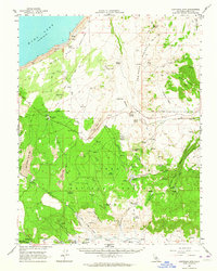
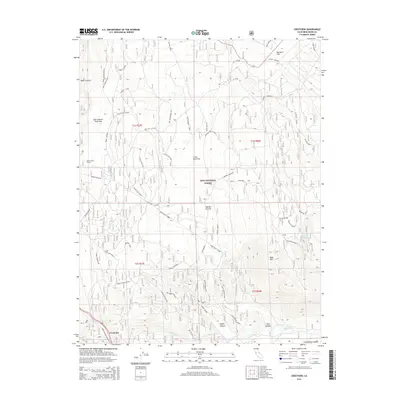
 1986 Crestview1986 Print · USGSThe volcanic Eastern Sierra highlands come into focus in this mid-eighties survey of Mono County. Researchers can trace the rugged transition from the Mono Craters to the Owens River headwaters, locating landmarks like Big Springs and the settlement at Crestview.
 - 1988 Map of Benton Range
 1988 Benton Range1988 Print · USGSThe high desert and alpine peaks of the California-Nevada border come alive in this late-century survey of the Benton Range. Researchers can trace the heritage of remote outposts like Benton and Montgomery City alongside historic workings like the Black Warrior Mine.2 unique versions available
 - 1994 Map of Crestview, 1997 Print
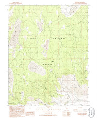
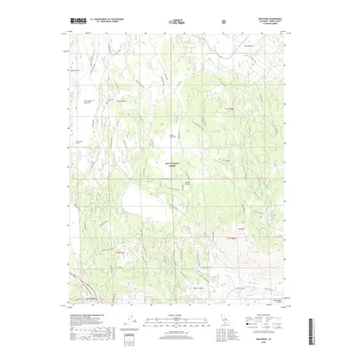
 1994 Crestview1997 Print · USGSThe Mono County landscape in the early nineties reveals a complex mix of volcanic geology and forest management. Genealogists and researchers can trace the area around Crestview and explore features like Big Springs, Bald Mountain, and the Owens River.
 - 2012 Map of Crestview, 2012 Print
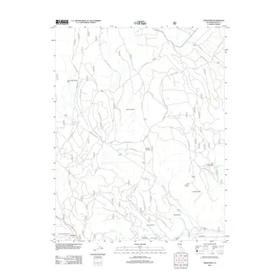 2012 Crestview2012 Print · USGSCovers Crestview, including Mono County, United States, and other nearby areas
 - 2015 Map of Crestview, 2015 Print
 2015 Crestview2015 Print · USGSCovers Crestview, including Mono County, United States, and other nearby areas
 - 2018 Map of Crestview, 2018 Print
 2018 Crestview2018 Print · USGSCovers Crestview, including Mono County, United States, and other nearby areas
 - 2021 Map of Crestview, 2021 Print
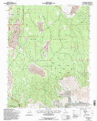
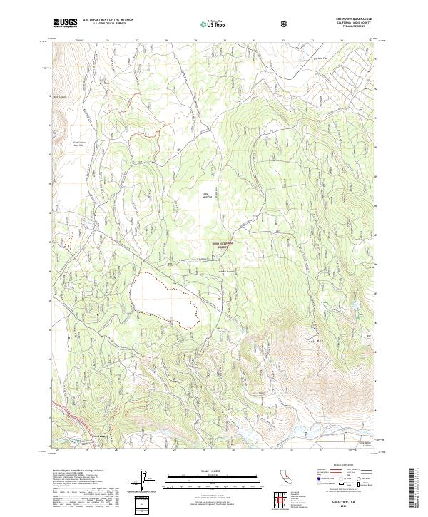 2021 Crestview2021 Print · USGSThe eastern Sierra Nevada high country is captured here during the early twenty-first century, showing the intersection of volcanic terrain and forest management. Researchers can trace historical transit lines like the Old Rail Road and find remote landmarks such as Indiana Summit and Big Springs.
End of results
Showing maps 1-13 of 13
Top cities near Crestview
Frequently asked questions
- What are the different types of historical maps available for Crestview?
- What is the oldest map of Crestview?
- Where can I purchase historical maps of Crestview for my home or office?
- Where can I download high-res historical maps of Crestview?
- Are there historical topographic maps available for Crestview?
- Is there historical aerial imagery available for Crestview?
- Where are historical maps of Crestview sourced from?