1950s Maps of Junction House, California
Explore 4 historic maps of Junction House from the 1950s. These maps offer a rare glimpse into what life looked like during the 1950s — showing old roads, neighborhoods, homes, and landmarks that have changed or disappeared over time.
Whether you're researching your family's past, planning a metal detecting trip, or studying how Junction House's landscape evolved across the 1950s, these high-resolution maps are a powerful tool for exploring the history of this region.
- Focus on a specific era: All maps on this page are from the 1950s, giving you a focused view of this time period.
- See what’s changed: Compare century-old streets, trails, and buildings to today's modern landscape using overlays and satellite layers.
- Research with precision: Use these maps for genealogy, historical research, land use analysis, or educational projects.
- View, download, or print: Maps are fully viewable online in high resolution, and can be downloaded or printed for your own records.
Start exploring Junction House's history through authentic maps from the 1950s. This is your window into the past.
Junction House, CA maps
(4)- 1950 Map of Alleghany, 1959 Print
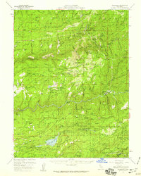 1950 Alleghany1959 Print · USGSThe Sierra Nevada gold fields appear in high detail during the mid-fifties, showing the massive hydraulic scars and active mining camps of the Yuba River forks. Genealogists and historians can locate vanished settlements like Moores Flat or trace the extensive Malakoff Diggings and Alpha Diggings.4 unique versions available
 - 1950 Map of Washington, 1960 Print
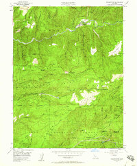 1950 Washington1960 Print · USGSGold mining and early transit routes dominate this mid-century view of the Sierra Nevada foothills. Trace the legacy of the hydraulic era at Alpha Diggings, locate the historic Donner Trail, and find remote outposts like the Zeibright Mine.5 unique versions available
 - 1951 Map of Washington
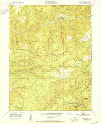 1951 Washington1951 Print · USGSThe South Fork Yuba River and its gold-mining legacy are captured here in the mid-twentieth century. Genealogists can trace early habitation at the Washington townsite and former settlements like Relief or the Lowell Hill (Site).2 unique versions available
 - 1958 Map of Chico, 1962 Print
 1958 Chico1962 Print · USGSMid-century Northern California comes to life across the Central Valley and high Sierras as the postwar economy transformed the landscape. Trace the rail lines of the Southern Pacific RR, locate family roots near Chico Cem, or explore the early layout of Paradise and Beale Air Force Base.4 unique versions available
End of results
Showing maps 1-4 of 4
Top cities near Junction House
- Grass Valley historical maps
- Nevada City historical maps
- Colfax historical maps
- Washington historical maps
Frequently asked questions
- What are the different types of historical maps available for Junction House?
- What is the oldest map of Junction House?
- Where can I purchase historical maps of Junction House for my home or office?
- Where can I download high-res historical maps of Junction House?
- Are there historical topographic maps available for Junction House?
- Is there historical aerial imagery available for Junction House?
- Where are historical maps of Junction House sourced from?