Old Maps of Canyon Dam, California for Metal Detecting
Plan your next treasure hunt with 16 historic maps of Canyon Dam. Find old homesites, ghost towns, trails, and gathering spots that may be lost to time — perfect for identifying promising metal detecting locations.
- Locate forgotten sites: Uncover places like long-lost settlements, abandoned rail lines, or gathering spots.
- Plan better hunts: Use map overlays combined with LiDAR or satellite views to narrow in on historically rich areas.
- Made for detectorists: Thousands of hobbyists use these maps to discover relics, coins, and hidden history.
Use these historic maps to boost your research and find new opportunities beneath the surface of Canyon Dam.
Canyon Dam, CA maps
(16)- 1886 Map of Lassen Peak
 1886 Lassen Peak1886 Print · USGSThe Cascades of the late nineteenth century appear here as a landscape of timber mills and volcanic peaks. Genealogists and historians can trace early mountain life at Shingletown, Prattville, and isolated industrial sites like Eureka Mill or the Caribou Bridge.
 - 1892 Map of Lassen Peak
 1892 Lassen Peak1892 Print · USGSThe volcanic highlands of the southern Cascades are captured in the late nineteenth century, showing early milling and mountain settlements. Genealogists and historians can trace pioneer sites like Prattville, the old Eureka Mill, and the crossings at Caribou Bridge.
 - 1894 Map of Lassen Peak
 1894 Lassen Peak1894 Print · USGSThe volcanic highlands of Northern California are captured here in the 1890s, shortly after the initial topographic surveys. Genealogists and historians can locate early industry and mountain outposts like Eureka Mill, Prattville, and the remote Hat Creek Post Office.8 unique versions available
 - 1955 Map of Almanor, 1957 Print
 1955 Almanor1957 Print · USGSThe high Sierra Nevada landscape is shaped by the massive reservoirs and mountain rail lines of the mid-fifties. Researchers can trace the Western Pacific route through the river canyons or locate mining history at the Dutch Hill Mine and Sunnyside Mine.4 unique versions available
 - 1955 Map of Westwood, 1959 Print
 1955 Westwood1959 Print · USGSIn the mid-fifties, the northeastern California interior supported a landscape of mountain timber and high-desert basins. Genealogists and historians can locate early settlements and industrial sites like Susanville, Herlong, and the Sierra Ordinance Depot.
 - 1958 Map of Westwood
 1958 Westwood1958 Print · USGSNorthern California in the late fifties shows a landscape of volcanic peaks and rising reservoirs. Researchers can locate the Sierra Ordinance Depot and trace mountain infrastructure through the Hat Creek Ranger Station and Stacy Siding.
 - 1959 Map of Westwood
 1959 Westwood1959 Print · USGSNortheastern California during the late 1950s was a hub of timber, military logistics, and mountain railroading. Researchers can trace the path of the Southern Pacific through the Honey Lake Valley and locate landmarks like the Sierra Ordinance Depot and Lassen Peak.
 - 1962 Map of Susanville, 1965 Print
 1962 Susanville1965 Print · USGSNortheastern California's high desert and volcanic peaks meet in the early sixties, showing the region's timber and rail hubs in transition. Local historians can trace the Southern Pacific lines through Susanville and Litchfield, or explore the sprawling Sierra Army Depot and Lassen Volcanic National Park.2 unique versions available
 - 1968 Map of Susanville
 1968 Susanville1968 Print · USGSThe high Sierras and the Great Basin collide in the late 1960s, showing a landscape of volcanic peaks, timber settlements, and desert plains. Genealogists and researchers can trace historic rail lines like the Western Pacific or locate residents in Susanville, Westwood, and Janesville.
 - 1979 Map of Canyondam
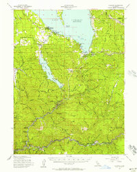
 1979 Canyondam1979 Print · USGSLake Almanor and the rugged Plumas County canyons come into focus in the late 1970s during a period of active mountain industry. Genealogists and researchers can trace old workings at the Goldstripe Mine, locate the cemetery near Almanor, or follow the Western Pacific rail line.3 unique versions available
 - 1989 Map of Lake Almanor, 1990 Print
 1989 Lake Almanor1990 Print · USGSUpper Plumas and Tehama counties appear here in the late eighties as a landscape of timber, volcanic peaks, and high-country reservoirs. Genealogists and historians can trace settlements from Chester and Westwood to mountain outposts like Mineral and Jonesville.2 unique versions available
 - 1994 Map of Canyondam, 1997 Print
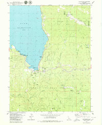
 1994 Canyondam1997 Print · USGSThe northern Sierra Nevada meets Lake Almanor in the 1990s, revealing a landscape of high-country timber and gold mining. Trace historic operations like the Goldstripe Mine, find the remote Dyer Mtn Lookout, or locate the lakeside Cem.2 unique versions available
 - 2012 Map of Canyondam, 2012 Print
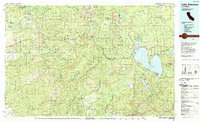
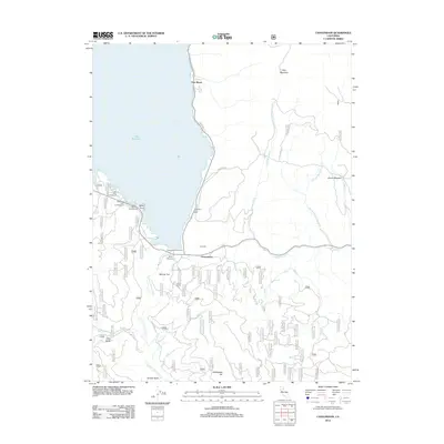 2012 Canyondam2012 Print · USGSCovers Canyon Dam, including East Shore, Lassen County, and other nearby areas
 - 2015 Map of Canyondam, 2015 Print
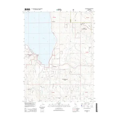 2015 Canyondam2015 Print · USGSCovers Canyon Dam, including East Shore, Lassen County, and other nearby areas
 - 2018 Map of Canyondam, 2018 Print
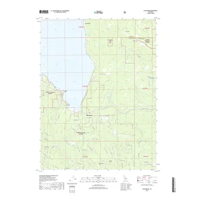 2018 Canyondam2018 Print · USGSCovers Canyon Dam, including East Shore, Lassen County, and other nearby areas
 - 2022 Map of Canyondam, 2022 Print
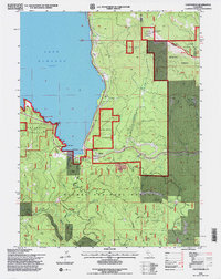
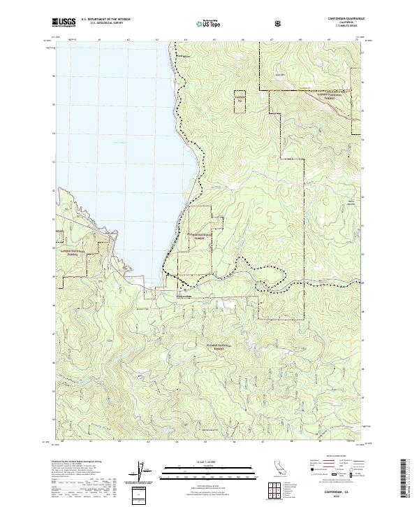 2022 Canyondam2022 Print · USGSThe Lake Almanor shoreline and the rugged forest boundary of Plumas and Lassen counties are captured here in recent years. Researchers can trace the drainage of the N Fork Feather River and locate family landmarks like Hauns Meadow and Skinner Flat.
End of results
Showing maps 1-16 of 16
Top cities near Canyon Dam
- Westwood historical maps
- Chester historical maps
- Hamilton Branch historical maps
- Clear Creek historical maps
Frequently asked questions
- What are the different types of historical maps available for Canyon Dam?
- What is the oldest map of Canyon Dam?
- Where can I purchase historical maps of Canyon Dam for my home or office?
- Where can I download high-res historical maps of Canyon Dam?
- Are there historical topographic maps available for Canyon Dam?
- Is there historical aerial imagery available for Canyon Dam?
- Where are historical maps of Canyon Dam sourced from?