Old Maps of Warner Valley, Plumas County for Genealogy
Trace your family roots with 12 historic maps of Warner Valley. These high-res maps reveal old neighborhoods, homesites, landmarks, and streets — helping you uncover where your ancestors lived and how the area evolved over time.
- Explore historic neighborhoods: Identify where your relatives may have lived in the 1800s or 1900s.
- Compare maps over time: Trace the changes in streets, buildings, and landmarks for multi-generational research.
- Perfect for genealogy & ancestry research: Used by family historians and researchers to map out lineage and migration.
These maps are an incredible resource for exploring your personal connection to Warner Valley's past.
Warner Valley, Plumas County maps
(12)- 1886 Map of Lassen Peak
 1886 Lassen Peak1886 Print · USGSCovers Warner Valley, including Burney, Westwood, and other nearby areas
 - 1892 Map of Lassen Peak
 1892 Lassen Peak1892 Print · USGSCovers Warner Valley, including Burney, Westwood, and other nearby areas
 - 1894 Map of Lassen Peak
 1894 Lassen Peak1894 Print · USGSCovers Warner Valley, including Burney, Westwood, and other nearby areas8 unique versions available
 - 1955 Map of Westwood, 1959 Print
 1955 Westwood1959 Print · USGSCovers Warner Valley, including Susanville, Susanville, and other nearby areas
 - 1956 Map of Mt. Harkness, 1958 Print
 1956 Mt. Harkness1958 Print · USGSCovers Warner Valley, including Childs Meadows, Deer Creek, and other nearby areas4 unique versions available
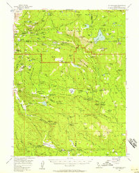
 - 1958 Map of Westwood
 1958 Westwood1958 Print · USGSCovers Warner Valley, including Susanville, Susanville, and other nearby areas
 - 1959 Map of Westwood
 1959 Westwood1959 Print · USGSCovers Warner Valley, including Susanville, Susanville, and other nearby areas
 - 1962 Map of Susanville, 1965 Print
 1962 Susanville1965 Print · USGSCovers Warner Valley, including Susanville, Susanville, and other nearby areas2 unique versions available
 - 1968 Map of Susanville
 1968 Susanville1968 Print · USGSCovers Warner Valley, including Susanville, Susanville, and other nearby areas
 - 1985 Map of Stover Mountain
 1985 Stover Mountain1985 Print · USGSCovers Warner Valley, including Saint Bernard, Tehama County, and other nearby areas
 - 1989 Map of Lake Almanor, 1990 Print
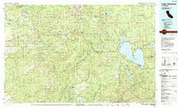 1989 Lake Almanor1990 Print · USGSCovers Warner Valley, including Westwood, Chester, and other nearby areas2 unique versions available
 - 1995 Map of Stover Mountain, 1998 Print
 1995 Stover Mountain1998 Print · USGSCovers Warner Valley, including Saint Bernard, Tehama County, and other nearby areas
End of results
Showing maps 1-12 of 12
Frequently asked questions
- What are the different types of historical maps available for Warner Valley?
- What is the oldest map of Warner Valley?
- Where can I purchase historical maps of Warner Valley for my home or office?
- Where can I download high-res historical maps of Warner Valley?
- Are there historical topographic maps available for Warner Valley?
- Is there historical aerial imagery available for Warner Valley?
- Where are historical maps of Warner Valley sourced from?