Old Maps of Glen Avon, Jurupa Valley for Hiking & Exploration
Hike through history with 50 historic maps of Glen Avon. Explore old trails, ghost towns, and forgotten backroads — perfect for outdoor adventurers and local explorers.
- Rediscover forgotten places: Map out old mining camps, roads, and footpaths that no longer exist on modern maps.
- Layer with modern tools: Combine with LiDAR or satellite views to plan hikes through historical terrain.
- Made for exploration: Popular among hikers, overlanders, and local history lovers.
Use these maps to find adventure and explore the hidden past of Glen Avon.
Glen Avon, Jurupa Valley maps
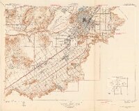
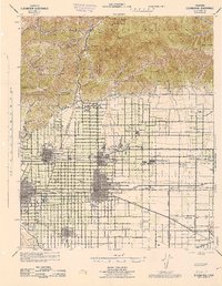
(50)- 1896 Map of San Bernardino
 1896 San Bernardino1896 Print · USGSSan Bernardino and Colton emerge as vital rail junctions during the late nineteenth-century boom. Genealogists and historians can trace early citrus-belt settlements like Rosena, Mound City, and Bloomington alongside the historic Gage Canal.
 - 1897 Map of Cucamonga
 1897 Cucamonga1897 Print · USGSIn the late nineteenth century, the Inland Empire was a rapidly emerging rail and citrus hub defined by major land grants. Genealogists and researchers can trace the early footprints of Cucamonga, Ontario, and Pomona alongside the Narrow Gauge and Southern Pacific lines.
 - 1898 Map of San Bernardino
 1898 San Bernardino1898 Print · USGSThe San Bernardino valley was a critical railroad junction in the late nineteenth century, defined by rapid irrigation and mountain access. Researchers can trace the early footprints of Colton and Rialto, alongside local landmarks like Glen Helen Ranch and the industrial Quarry at Declezville.
 - 1900 Map of Cucamonga
 1900 Cucamonga1900 Print · USGSSan Bernardino and Los Angeles Counties are shown here during the late nineteenth-century citrus boom, before urban sprawl merged these distinct agricultural colonies. Trace early rail lines through Ioamosa, Claremont, and Chino, or locate the isolated Toll House and Power House in the northern canyons.
 - 1901 Map of Southern California Sheet No. 1
 1901 Southern California Sheet No. 11901 Print · USGSGreater Los Angeles at the dawn of the twentieth century is a landscape of growing citrus towns and a burgeoning rail network. Genealogists and historians can trace the early gridded streets of Hollywood and Pasadena or locate landmarks like Bear Lake and the Cahuilla Indian Reservation.6 unique versions available
 - 1901 Map of San Bernardino
 1901 San Bernardino1901 Print · USGSThe San Bernardino valley thrived as a railway and agricultural crossroads in the late nineteenth century. Genealogists and historians can trace early citrus-belt settlements like Rialto and Colton, or locate landmarks such as Arrowhead Springs and Glen Helen Ranch.8 unique versions available
 - 1901 Map of Elsinore
 1901 Elsinore1901 Print · USGSRiverside and the Alessandro Valley are shown here during a peak of early mining and rail expansion. Genealogists and historians can trace the Southern California RR through Perris or locate the Alberhill Coal Mine and Indian School.8 unique versions available
 - 1901 Map of Riverside
 1901 Riverside1901 Print · USGSRiverside and its surrounding rancho lands are seen here at the start of the 1900s as irrigation canals and railroads transformed the valley. Researchers can trace the early city grid and find rural landmarks like the Cajalco Tin Mine, Casa Blanca, and Arlington.6 unique versions available
 - 1903 Map of Cucamonga
 1903 Cucamonga1903 Print · USGSThe Inland Empire is shown at a pivotal moment of agricultural expansion in the early twentieth century, when irrigation was transforming the valley. Trace the early rail networks of the Southern Pacific and the Santa Fe through citrus-growing centers like Ontario, Cucamonga, and Ioamosa.11 unique versions available
 - 1904 Map of Southern California Sheet No. 1, 1905 Print
 1904 Southern California Sheet No. 11905 Print · USGSSouthern California at the dawn of the twentieth century shows a landscape of citrus groves and coastal towns connected by rail. Genealogists and historians can trace early settlements like San Juan Capistrano, find remote sites like the Rose Mine, and study the original water systems of the Santa Ana River.2 unique versions available
 - 1942 Map of San Bernardino
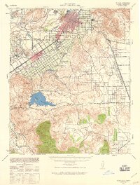
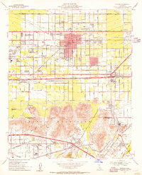
 1942 San Bernardino1942 Print · USGSThe San Bernardino Valley flourished as a railroad and citrus hub during the early years of the war. Researchers can trace the extensive tracks of the Atchison Topeka and Santa Fe, the National Orange Show grounds, and local landmarks like the Loma Linda Sanatorium.
 - 1942 Map of Riverside and Vicinity
 1942 Riverside and Vicinity1942 Print · USGSRiverside and its surrounding citrus lands are captured here during the early years of the war, showing a dense network of railroads and institutional grounds. Genealogists can trace family sites near the County Farm, Sherman Institute, or the Arlington Sta rail junction.2 unique versions available
 - 1942 Map of Riverside, 1959 Print
 1942 Riverside1959 Print · USGSDuring the early years of the war, the Riverside area balanced its citrus heritage with major military and water projects. Researchers can trace the layout of Camp Haan, family ranchlands like Lawless Ranch, and the Cajalco Tin Mine.2 unique versions available
 - 1943 Map of Fontana
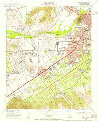
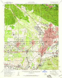
 1943 Fontana1943 Print · USGSThe Inland Empire is shown here in the early 1940s, revealing a landscape defined by industrial expansion and extensive rail corridors. Trace the growth of Fontana and Rialto through early landmarks like the South Fontana Sta, Glen Avon Ch, and the numerous Quarries of the Jurupa Mountains.3 unique versions available
 - 1943 Map of Riverside
 1943 Riverside1943 Print · USGSRiverside and its surrounding ranches are captured here during the Second World War as the region transformed into a major military and citrus hub. Researchers can trace family ranch boundaries like Wagonwheel Ranch or locate institutional landmarks like the Sherman Institute and Camp Haan.
 - 1944 Map of Cucamonga
 1944 Cucamonga1944 Print · USGSThe San Gabriel Valley and Inland Empire are shown here during the mid-forties, capturing the peak of the region's citrus era and rail-based transit. Researchers can trace early campus layouts at Pomona College or locate vanished landmarks like the Monta Vista Resort and Padua Hills Theater.
 - 1947 Map of Santa Ana, 1949 Print
 1947 Santa Ana1949 Print · USGSSouthern California is depicted here in the late forties, showing the expansion of the Inland Empire and the Orange County coast. Researchers can trace the early layout of Palm Springs or locate long-standing tribal lands like the Pala Indian Reservation and Rincon Indian Res.
 - 1949 Map of Santa Ana
 1949 Santa Ana1949 Print · USGSSouthern California underwent a profound transformation in the late 1940s as military installations and citrus groves shared the landscape. Researchers can trace early coastal growth at Laguna Beach, military history at Camp Pendleton, and the rail corridors of the Pacific Electric.
 - 1953 Map of San Bernardino
 1953 San Bernardino1953 Print · USGSSouthern California underwent massive post-war growth as suburban sprawl reached the foothills of the San Bernardino Mountains. Genealogists and historians can trace the rail-and-road roots of the Inland Empire through the Union Pacific RR and Lake Arrowhead resorts.2 unique versions available
 - 1953 Map of Fontana, 1955 Print
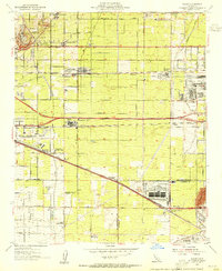
 1953 Fontana1955 Print · USGSThe Inland Empire industrial corridor comes alive in this mid-century survey as the Kaiser Steel Plant and sprawling rail networks reshape the valley. Genealogists and local historians can trace the foundations of Fontana through its neighborhood landmarks, from Bloomington Sch to the Crestmore Quarry.2 unique versions available
 - 1953 Map of Riverside West, 1955 Print
 1953 Riverside West1955 Print · USGSRiverside during the early fifties reveals a landscape shaped by historic land grants and a burgeoning citrus and rail economy. Genealogists and researchers can locate family sites near Olivewood Cem, the Sherman Indian Institute, and the Arlington Station rail yard.2 unique versions available
 - 1953 Map of Guasti, 1955 Print
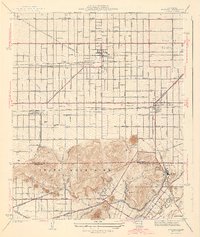
 1953 Guasti1955 Print · USGSSan Bernardino and Riverside Counties are shown here during the post-war industrial boom, where vineyards and heavy industry collide. Genealogists and historians can trace the development of Cucamonga and Guasti alongside the Kaiser Steel Plant.2 unique versions available
 - 1954 Map of San Bernardino, 1959 Print
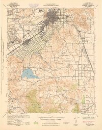
 1954 San Bernardino1959 Print · USGSSan Bernardino and the booming valley floor are shown in the mid-fifties as the citrus groves began giving way to suburban and industrial growth. Researchers can trace family roots through Waterman Gardens, find small regional hubs like Miro-Fontana Airport, or locate the historic Agua Mansa Cem.2 unique versions available
 - 1954 Map of Ontario, 1959 Print
 1954 Ontario1959 Print · USGSThe Pomona Valley in the mid-fifties is captured here as a sprawling network of citrus-era settlements and rising post-war industry. Genealogists and local researchers can trace the early footprints of the Claremont Associated Colleges, the Steel Plant, and Ontario International Airport.5 unique versions available
 - 1956 Map of San Bernardino
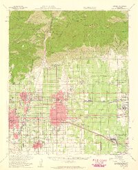
 1956 San Bernardino1956 Print · USGSSouthern California's Inland Empire and High Desert come into focus in the mid-fifties as agriculture gives way to suburban and military growth. Trace early rail lines like the Pacific Electric or find remote landmarks like Camp Rock Mine and George AFB.
Showing maps 1-25 of 50
Frequently asked questions
- What are the different types of historical maps available for Glen Avon?
- What is the oldest map of Glen Avon?
- Where can I purchase historical maps of Glen Avon for my home or office?
- Where can I download high-res historical maps of Glen Avon?
- Are there historical topographic maps available for Glen Avon?
- Is there historical aerial imagery available for Glen Avon?
- Where are historical maps of Glen Avon sourced from?