Old Maps of La Sierra Acres, Riverside for Metal Detecting
Plan your next treasure hunt with 23 historic maps of La Sierra Acres. Find old homesites, ghost towns, trails, and gathering spots that may be lost to time — perfect for identifying promising metal detecting locations.
- Locate forgotten sites: Uncover places like long-lost settlements, abandoned rail lines, or gathering spots.
- Plan better hunts: Use map overlays combined with LiDAR or satellite views to narrow in on historically rich areas.
- Made for detectorists: Thousands of hobbyists use these maps to discover relics, coins, and hidden history.
Use these historic maps to boost your research and find new opportunities beneath the surface of La Sierra Acres.
La Sierra Acres, Riverside maps
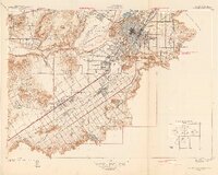
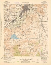
(23)- 1901 Map of Southern California Sheet No. 1
 1901 Southern California Sheet No. 11901 Print · USGSCovers La Sierra Acres, including Los Angeles, Long Beach, and other nearby areas11 unique versions available
 - 1901 Map of Elsinore
 1901 Elsinore1901 Print · USGSCovers La Sierra Acres, including Riverside, Moreno Valley, and other nearby areas8 unique versions available
 - 1901 Map of Riverside
 1901 Riverside1901 Print · USGSCovers La Sierra Acres, including Riverside, Moreno Valley, and other nearby areas6 unique versions available
 - 1902 Map of Corona
 1902 Corona1902 Print · USGSCovers La Sierra Acres, including Anaheim, Santa Ana, and other nearby areas7 unique versions available
 - 1904 Map of Southern California Sheet No. 1, 1905 Print
 1904 Southern California Sheet No. 11905 Print · USGSCovers La Sierra Acres, including Los Angeles, Long Beach, and other nearby areas3 unique versions available
 - 1942 Map of Corona and Vicinity
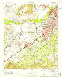
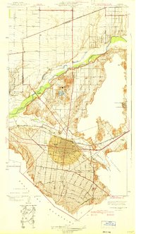 1942 Corona and Vicinity1942 Print · USGSCovers La Sierra Acres, including Riverside, Ontario, and other nearby areas
 - 1942 Map of Riverside and Vicinity
 1942 Riverside and Vicinity1942 Print · USGSCovers La Sierra Acres, including Riverside, Moreno Valley, and other nearby areas2 unique versions available
 - 1942 Map of Corona, 1947 Print
 1942 Corona1947 Print · USGSCovers La Sierra Acres, including Anaheim, Riverside, and other nearby areas2 unique versions available
 - 1942 Map of Riverside, 1959 Print
 1942 Riverside1959 Print · USGSCovers La Sierra Acres, including Riverside, Moreno Valley, and other nearby areas2 unique versions available
 - 1943 Map of Corona
 1943 Corona1943 Print · USGSCovers La Sierra Acres, including Anaheim, Riverside, and other nearby areas
 - 1943 Map of Riverside
 1943 Riverside1943 Print · USGSCovers La Sierra Acres, including Riverside, Moreno Valley, and other nearby areas
 - 1947 Map of Santa Ana, 1949 Print
 1947 Santa Ana1949 Print · USGSCovers La Sierra Acres, including San Diego, Anaheim, and other nearby areas
 - 1949 Map of Santa Ana
 1949 Santa Ana1949 Print · USGSCovers La Sierra Acres, including San Diego, Anaheim, and other nearby areas
 - 1953 Map of Riverside West, 1955 Print
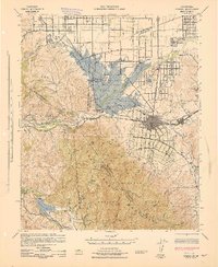
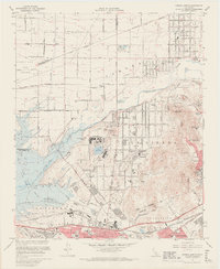
 1953 Riverside West1955 Print · USGSCovers La Sierra Acres, including Riverside, Jurupa Valley, and other nearby areas2 unique versions available
 - 1954 Map of Corona North, 1955 Print
 1954 Corona North1955 Print · USGSCovers La Sierra Acres, including Riverside, Ontario, and other nearby areas2 unique versions available
 - 1956 Map of Santa Ana
 1956 Santa Ana1956 Print · USGSCovers La Sierra Acres, including San Diego, Anaheim, and other nearby areas
 - 1959 Map of Santa Ana, 1971 Print
 1959 Santa Ana1971 Print · USGSCovers La Sierra Acres, including San Diego, Anaheim, and other nearby areas3 unique versions available
 - 1960 Map of Santa Ana
 1960 Santa Ana1960 Print · USGSCovers La Sierra Acres, including San Diego, Anaheim, and other nearby areas2 unique versions available
 - 1965 Map of Santa Ana
 1965 Santa Ana1965 Print · USGSCovers La Sierra Acres, including San Diego, Anaheim, and other nearby areas
 - 1967 Map of Corona North, 1969 Print
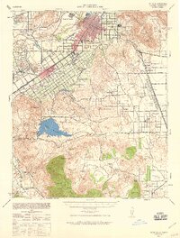
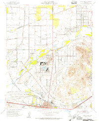
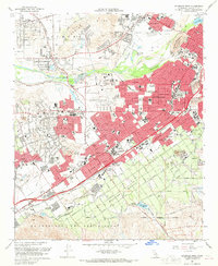
 1967 Corona North1969 Print · USGSCovers La Sierra Acres, including Riverside, Ontario, and other nearby areas6 unique versions available
 - 1967 Map of Riverside West, 1969 Print
 1967 Riverside West1969 Print · USGSCovers La Sierra Acres, including Riverside, Jurupa Valley, and other nearby areas4 unique versions available
 - 1975 Map of Corona North, 1979 Print
 1975 Corona North1979 Print · USGSCovers La Sierra Acres, including Riverside, Ontario, and other nearby areas
 - 1983 Map of Santa Ana
 1983 Santa Ana1983 Print · USGSCovers La Sierra Acres, including Anaheim, Santa Ana, and other nearby areas
End of results
Showing maps 1-23 of 23
Frequently asked questions
- What are the different types of historical maps available for La Sierra Acres?
- What is the oldest map of La Sierra Acres?
- Where can I purchase historical maps of La Sierra Acres for my home or office?
- Where can I download high-res historical maps of La Sierra Acres?
- Are there historical topographic maps available for La Sierra Acres?
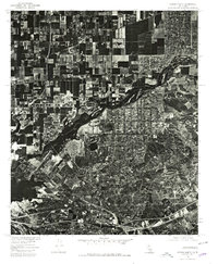
- Is there historical aerial imagery available for La Sierra Acres?
- Where are historical maps of La Sierra Acres sourced from?