Old Maps of Southwest Industrial Park, Fontana for Hiking & Exploration
Hike through history with 26 historic maps of Southwest Industrial Park. Explore old trails, ghost towns, and forgotten backroads — perfect for outdoor adventurers and local explorers.
- Rediscover forgotten places: Map out old mining camps, roads, and footpaths that no longer exist on modern maps.
- Layer with modern tools: Combine with LiDAR or satellite views to plan hikes through historical terrain.
- Made for exploration: Popular among hikers, overlanders, and local history lovers.
Use these maps to find adventure and explore the hidden past of Southwest Industrial Park.
Southwest Industrial Park, Fontana maps
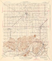
(26)- 1896 Map of San Bernardino
 1896 San Bernardino1896 Print · USGSCovers Southwest Industrial Park, including Riverside, Fontana, and other nearby areas
 - 1897 Map of Cucamonga
 1897 Cucamonga1897 Print · USGSCovers Southwest Industrial Park, including Fontana, Ontario, and other nearby areas
 - 1898 Map of San Bernardino
 1898 San Bernardino1898 Print · USGSCovers Southwest Industrial Park, including Riverside, Fontana, and other nearby areas
 - 1900 Map of Cucamonga
 1900 Cucamonga1900 Print · USGSCovers Southwest Industrial Park, including Fontana, Ontario, and other nearby areas
 - 1901 Map of Southern California Sheet No. 1
 1901 Southern California Sheet No. 11901 Print · USGSCovers Southwest Industrial Park, including Los Angeles, Long Beach, and other nearby areas6 unique versions available
 - 1901 Map of San Bernardino
 1901 San Bernardino1901 Print · USGSCovers Southwest Industrial Park, including Riverside, Fontana, and other nearby areas8 unique versions available
 - 1903 Map of Cucamonga
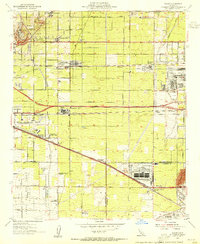
 1903 Cucamonga1903 Print · USGSCovers Southwest Industrial Park, including Fontana, Ontario, and other nearby areas11 unique versions available
 - 1904 Map of Southern California Sheet No. 1, 1905 Print
 1904 Southern California Sheet No. 11905 Print · USGSCovers Southwest Industrial Park, including Los Angeles, Long Beach, and other nearby areas2 unique versions available
 - 1942 Map of San Bernardino
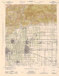
 1942 San Bernardino1942 Print · USGSCovers Southwest Industrial Park, including Riverside, Fontana, and other nearby areas
 - 1943 Map of Fontana
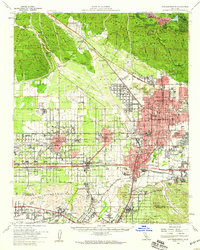
 1943 Fontana1943 Print · USGSCovers Southwest Industrial Park, including Riverside, Fontana, and other nearby areas3 unique versions available
 - 1944 Map of Cucamonga
 1944 Cucamonga1944 Print · USGSCovers Southwest Industrial Park, including Fontana, Ontario, and other nearby areas
 - 1953 Map of San Bernardino
 1953 San Bernardino1953 Print · USGSCovers Southwest Industrial Park, including Riverside, Fontana, and other nearby areas2 unique versions available
 - 1953 Map of Fontana, 1955 Print
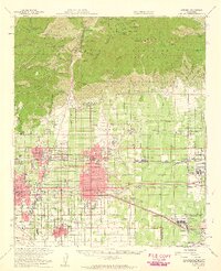
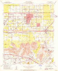 1953 Fontana1955 Print · USGSCovers Southwest Industrial Park, including Riverside, Fontana, and other nearby areas2 unique versions available
 - 1953 Map of Guasti, 1955 Print
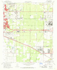
 1953 Guasti1955 Print · USGSCovers Southwest Industrial Park, including Fontana, Ontario, and other nearby areas2 unique versions available
 - 1954 Map of San Bernardino, 1959 Print
 1954 San Bernardino1959 Print · USGSCovers Southwest Industrial Park, including Riverside, Fontana, and other nearby areas2 unique versions available
 - 1954 Map of Ontario, 1959 Print
 1954 Ontario1959 Print · USGSCovers Southwest Industrial Park, including Fontana, Ontario, and other nearby areas5 unique versions available
 - 1956 Map of San Bernardino
 1956 San Bernardino1956 Print · USGSCovers Southwest Industrial Park, including Riverside, Fontana, and other nearby areas
 - 1957 Map of San Bernardino
 1957 San Bernardino1957 Print · USGSCovers Southwest Industrial Park, including Riverside, Fontana, and other nearby areas
 - 1958 Map of San Bernardino, 1975 Print
 1958 San Bernardino1975 Print · USGSCovers Southwest Industrial Park, including Riverside, Fontana, and other nearby areas
 - 1959 Map of San Bernardino
 1959 San Bernardino1959 Print · USGSCovers Southwest Industrial Park, including Riverside, Fontana, and other nearby areas
 - 1966 Map of San Bernardino
 1966 San Bernardino1966 Print · USGSCovers Southwest Industrial Park, including Riverside, Fontana, and other nearby areas
 - 1966 Map of Guasti, 1969 Print
 1966 Guasti1969 Print · USGSCovers Southwest Industrial Park, including Fontana, Ontario, and other nearby areas4 unique versions available
 - 1967 Map of Fontana, 1969 Print
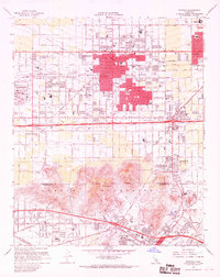 1967 Fontana1969 Print · USGSCovers Southwest Industrial Park, including Riverside, Fontana, and other nearby areas5 unique versions available
 - 1982 Map of San Bernardino, 1983 Print
 1982 San Bernardino1983 Print · USGSCovers Southwest Industrial Park, including Riverside, Fontana, and other nearby areas
 - 2021 Map of Guasti, 2021 Print
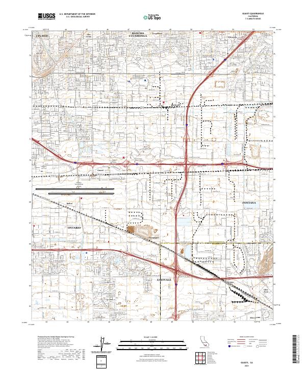 2021 Guasti2021 Print · USGSCovers Southwest Industrial Park, including Fontana, Ontario, and other nearby areas
Showing maps 1-25 of 26
Frequently asked questions
- What are the different types of historical maps available for Southwest Industrial Park?
- What is the oldest map of Southwest Industrial Park?
- Where can I purchase historical maps of Southwest Industrial Park for my home or office?
- Where can I download high-res historical maps of Southwest Industrial Park?
- Are there historical topographic maps available for Southwest Industrial Park?
- Is there historical aerial imagery available for Southwest Industrial Park?
- Where are historical maps of Southwest Industrial Park sourced from?