Old Maps of Summit Heights, Fontana for Genealogy
Trace your family roots with 20 historic maps of Summit Heights. These high-res maps reveal old neighborhoods, homesites, landmarks, and streets — helping you uncover where your ancestors lived and how the area evolved over time.
- Explore historic neighborhoods: Identify where your relatives may have lived in the 1800s or 1900s.
- Compare maps over time: Trace the changes in streets, buildings, and landmarks for multi-generational research.
- Perfect for genealogy & ancestry research: Used by family historians and researchers to map out lineage and migration.
These maps are an incredible resource for exploring your personal connection to Summit Heights's past.
Summit Heights, Fontana maps
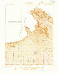
(20)- 1896 Map of San Bernardino
 1896 San Bernardino1896 Print · USGSCovers Summit Heights, including Riverside, Fontana, and other nearby areas
 - 1898 Map of San Bernardino
 1898 San Bernardino1898 Print · USGSCovers Summit Heights, including Riverside, Fontana, and other nearby areas
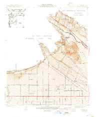
 - 1901 Map of Southern California Sheet No. 1
 1901 Southern California Sheet No. 11901 Print · USGSCovers Summit Heights, including Los Angeles, Long Beach, and other nearby areas6 unique versions available
 - 1901 Map of San Bernardino
 1901 San Bernardino1901 Print · USGSCovers Summit Heights, including Riverside, Fontana, and other nearby areas8 unique versions available
 - 1904 Map of Southern California Sheet No. 1, 1905 Print
 1904 Southern California Sheet No. 11905 Print · USGSCovers Summit Heights, including Los Angeles, Long Beach, and other nearby areas2 unique versions available
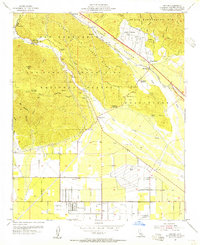
 - 1936 Map of Devore
 1936 Devore1936 Print · USGSCovers Summit Heights, including Fontana, Rancho Cucamonga, and other nearby areas
 - 1941 Map of Devore
 1941 Devore1941 Print · USGSCovers Summit Heights, including Fontana, Rancho Cucamonga, and other nearby areas2 unique versions available
 - 1942 Map of San Bernardino
 1942 San Bernardino1942 Print · USGSCovers Summit Heights, including Riverside, Fontana, and other nearby areas
 - 1953 Map of San Bernardino
 1953 San Bernardino1953 Print · USGSCovers Summit Heights, including Riverside, Fontana, and other nearby areas2 unique versions available
 - 1954 Map of Devore, 1955 Print
 1954 Devore1955 Print · USGSCovers Summit Heights, including Fontana, Rancho Cucamonga, and other nearby areas2 unique versions available
 - 1954 Map of San Bernardino, 1959 Print
 1954 San Bernardino1959 Print · USGSCovers Summit Heights, including Riverside, Fontana, and other nearby areas2 unique versions available
 - 1956 Map of San Bernardino
 1956 San Bernardino1956 Print · USGSCovers Summit Heights, including Riverside, Fontana, and other nearby areas
 - 1957 Map of San Bernardino
 1957 San Bernardino1957 Print · USGSCovers Summit Heights, including Riverside, Fontana, and other nearby areas
 - 1958 Map of San Bernardino, 1975 Print
 1958 San Bernardino1975 Print · USGSCovers Summit Heights, including Riverside, Fontana, and other nearby areas
 - 1959 Map of San Bernardino
 1959 San Bernardino1959 Print · USGSCovers Summit Heights, including Riverside, Fontana, and other nearby areas
 - 1966 Map of San Bernardino
 1966 San Bernardino1966 Print · USGSCovers Summit Heights, including Riverside, Fontana, and other nearby areas
 - 1966 Map of Devore, 1968 Print
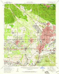
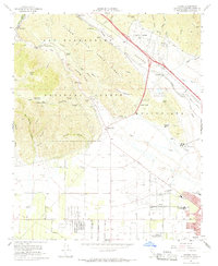 1966 Devore1968 Print · USGSCovers Summit Heights, including Fontana, Rancho Cucamonga, and other nearby areas6 unique versions available
 - 1982 Map of San Bernardino, 1983 Print
 1982 San Bernardino1983 Print · USGSCovers Summit Heights, including Riverside, Fontana, and other nearby areas
 - 1996 Map of Devore, 1999 Print
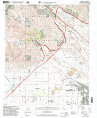 1996 Devore1999 Print · USGSCovers Summit Heights, including Fontana, Rancho Cucamonga, and other nearby areas
 - 2021 Map of Devore, 2021 Print
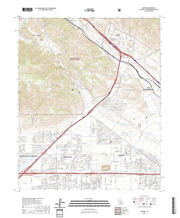 2021 Devore2021 Print · USGSCovers Summit Heights, including Fontana, Rancho Cucamonga, and other nearby areas
End of results
Showing maps 1-20 of 20
Frequently asked questions
- What are the different types of historical maps available for Summit Heights?
- What is the oldest map of Summit Heights?
- Where can I purchase historical maps of Summit Heights for my home or office?
- Where can I download high-res historical maps of Summit Heights?
- Are there historical topographic maps available for Summit Heights?
- Is there historical aerial imagery available for Summit Heights?
- Where are historical maps of Summit Heights sourced from?