Old Maps of Landers, Homestead Valley for Metal Detecting
Plan your next treasure hunt with 13 historic maps of Landers. Find old homesites, ghost towns, trails, and gathering spots that may be lost to time — perfect for identifying promising metal detecting locations.
- Locate forgotten sites: Uncover places like long-lost settlements, abandoned rail lines, or gathering spots.
- Plan better hunts: Use map overlays combined with LiDAR or satellite views to narrow in on historically rich areas.
- Made for detectorists: Thousands of hobbyists use these maps to discover relics, coins, and hidden history.
Use these historic maps to boost your research and find new opportunities beneath the surface of Landers.
Landers, Homestead Valley maps
(13)- 1953 Map of San Bernardino
 1953 San Bernardino1953 Print · USGSSouthern California underwent massive post-war growth as suburban sprawl reached the foothills of the San Bernardino Mountains. Genealogists and historians can trace the rail-and-road roots of the Inland Empire through the Union Pacific RR and Lake Arrowhead resorts.2 unique versions available
 - 1955 Map of Emerson Lake, 1956 Print
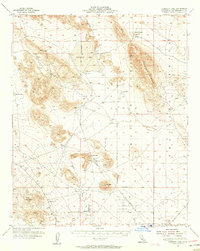 1955 Emerson Lake1956 Print · USGSThe California high desert is revealed in the mid-fifties through its mining outposts and early airstrips near the Naval Reservation Bdy. Locate old mineral claims like the Blue Ribbon Mine or trace the early development of Landers and the area around Giant Rock.3 unique versions available
 - 1956 Map of San Bernardino
 1956 San Bernardino1956 Print · USGSSouthern California's Inland Empire and High Desert come into focus in the mid-fifties as agriculture gives way to suburban and military growth. Trace early rail lines like the Pacific Electric or find remote landmarks like Camp Rock Mine and George AFB.
 - 1957 Map of San Bernardino
 1957 San Bernardino1957 Print · USGSSouthern California's Inland Empire and High Desert met during the postwar expansion of the late fifties. Genealogists and historians can trace the growth of San Bernardino and Redlands alongside remote landmarks like Edwards AFB and the Camp Rock Mine.
 - 1958 Map of San Bernardino, 1975 Print
 1958 San Bernardino1975 Print · USGSSouthern California’s Inland Empire and High Desert come into focus during the mid-century boom, showing the rise of suburbs and massive military installations. Researchers can trace the rail networks of the Union Pacific RR or locate landmarks like Norton AFB and Big Bear Lake.
 - 1959 Map of San Bernardino
 1959 San Bernardino1959 Print · USGSSouthern California underwent a massive transformation in the late fifties as suburban growth and military power reshaped the desert and valley. Researchers can trace the legacy of the Union Pacific Railroad and locate early footprints of Joshua Tree National Monument and Edwards Air Force Base.
 - 1966 Map of San Bernardino
 1966 San Bernardino1966 Print · USGSThe San Bernardino Valley and Mojave Desert met during a period of massive military and suburban growth in the mid-sixties. Genealogists and historians can trace the development of Edwards Air Force Base, old desert mines like the Bagdad Chase Mine, and mountain communities near Big Bear Lake.
 - 1972 Map of Landers, 1976 Print
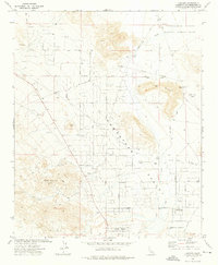 1972 Landers1976 Print · USGSThe High Desert community of Landers comes into focus in the early 1970s as a growing rural enclave. Researchers can trace the layout of Homestead Valley, its pioneer airstrips at Giant Rock Airport, and named desert tracks like Happy Trail.2 unique versions available
 - 1982 Map of Big Bear Lake, 1996 Print
 1982 Big Bear Lake1996 Print · USGSThe San Bernardino Mountains meet the high Mojave desert in the early eighties, showing a landscape defined by mountain resorts and desert basins. Trace the historic Belleville (Site), the rail lines of the Atchison Topeka and Santa Fe, and old mining works like the Gold Belt Mine.
 - 2012 Map of Landers, 2012 Print
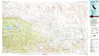
 2012 Landers2012 Print · USGSCovers Landers, including Homestead Valley, San Bernardino County, and other nearby areas
 - 2015 Map of Landers, 2015 Print
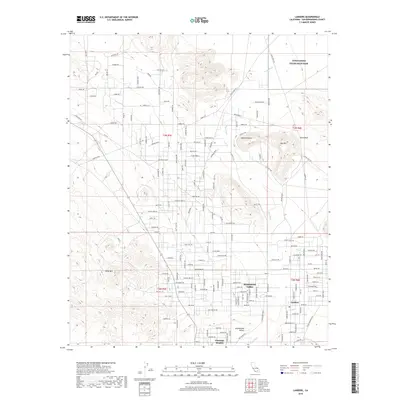
 2015 Landers2015 Print · USGSCovers Landers, including Homestead Valley, San Bernardino County, and other nearby areas
 - 2018 Map of Landers, 2018 Print
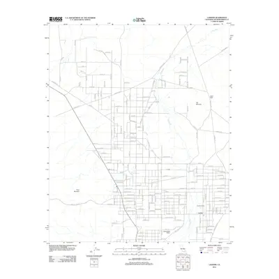
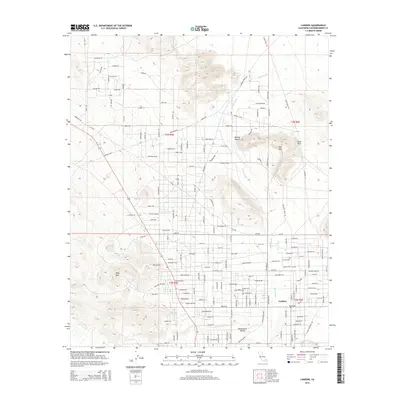
 2018 Landers2018 Print · USGSCovers Landers, including Homestead Valley, San Bernardino County, and other nearby areas
 - 2021 Map of Landers, 2021 Print
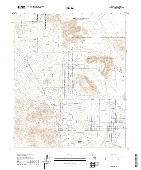 2021 Landers2021 Print · USGSThe unincorporated desert communities of the High Desert come into focus during this early 2020s survey. Genealogists and local historians can trace family-named roads and landmarks like Homestead Valley, Giant Rock, and the historic Old Woman Springs Rd.
End of results
Showing maps 1-13 of 13
Top cities near Landers
Frequently asked questions
- What are the different types of historical maps available for Landers?
- What is the oldest map of Landers?
- Where can I purchase historical maps of Landers for my home or office?
- Where can I download high-res historical maps of Landers?
- Are there historical topographic maps available for Landers?
- Is there historical aerial imagery available for Landers?
- Where are historical maps of Landers sourced from?