1990s Maps of Morongo Valley, California
Explore 2 historic maps of Morongo Valley from the 1990s. These maps offer a rare glimpse into what life looked like during the 1990s — showing old roads, neighborhoods, homes, and landmarks that have changed or disappeared over time.
Whether you're researching your family's past, planning a metal detecting trip, or studying how Morongo Valley's landscape evolved across the 1990s, these high-resolution maps are a powerful tool for exploring the history of this region.
- Focus on a specific era: All maps on this page are from the 1990s, giving you a focused view of this time period.
- See what’s changed: Compare century-old streets, trails, and buildings to today's modern landscape using overlays and satellite layers.
- Research with precision: Use these maps for genealogy, historical research, land use analysis, or educational projects.
- View, download, or print: Maps are fully viewable online in high resolution, and can be downloaded or printed for your own records.
Start exploring Morongo Valley's history through authentic maps from the 1990s. This is your window into the past.
Morongo Valley, CA maps
(2)- 1996 Map of Catclaw Flat, 1999 Print
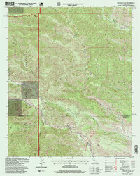 1996 Catclaw Flat1999 Print · USGSThe high desert canyons along the San Bernardino and Riverside county line are documented here in the mid-nineties. Trace the route of the Pacific Crest National Scenic Trail as it passes landmarks like Walker Landing and Catclaw Flat.
 - 1997 Map of Morongo Valley, 2002 Print
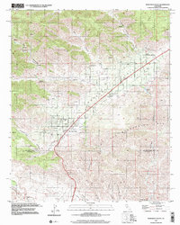 1997 Morongo Valley2002 Print · USGSThe Morongo Valley high desert comes into sharp focus during the late nineties, showing the area's development between the San Bernardino Mountains and Coachella Valley. Researchers can trace local landmarks like Covington Park, the Colorado River Aqueduct, and ranch sites like Pierce Ranch.
End of results
Showing maps 1-2 of 2
Top cities near Morongo Valley
- Cathedral City historical maps
- Palm Springs historical maps
- Desert Hot Springs historical maps
- Yucca Valley historical maps
Top neighborhoods of Morongo Valley
Frequently asked questions
- What are the different types of historical maps available for Morongo Valley?
- What is the oldest map of Morongo Valley?
- Where can I purchase historical maps of Morongo Valley for my home or office?
- Where can I download high-res historical maps of Morongo Valley?
- Are there historical topographic maps available for Morongo Valley?
- Is there historical aerial imagery available for Morongo Valley?
- Where are historical maps of Morongo Valley sourced from?