Old Maps of Cockatoo Grove, Chula Vista for Metal Detecting
Plan your next treasure hunt with these historic maps of Cockatoo Grove. Find old homesites, ghost towns, trails, and gathering spots that may be lost to time — perfect for identifying promising metal detecting locations.
- Locate forgotten sites: Uncover places like long-lost settlements, abandoned rail lines, or gathering spots.
- Plan better hunts: Use map overlays combined with LiDAR or satellite views to narrow in on historically rich areas.
- Made for detectorists: Thousands of hobbyists use these maps to discover relics, coins, and hidden history.
Use these historic maps to boost your research and find new opportunities beneath the surface of Cockatoo Grove.
Cockatoo Grove, Chula Vista maps
- 1903 Map of Cuyamaca
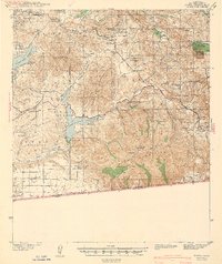
 1903 Cuyamaca1903 Print · USGSInland San Diego County at the turn of the century reveals a landscape defined by new water infrastructure and rail lines. Genealogists and historians can trace early settlements like Lakeside, Dulzura, and the remote Honey Springs Ranch along the international border.6 unique versions available
 - 1904 Map of Southern California Sheet No. 2
 1904 Southern California Sheet No. 21904 Print · USGSSouthern California during the early 1900s shows the transition from vast ranchos to coastal rail towns. Genealogists and researchers can trace the Southern California R.R. through Oceanside, explore old land grants like Mission Viejo, and locate early settlements from Fallbrook to Julian.5 unique versions available
 - 1943 Map of Jamul
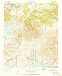
 1943 Jamul1943 Print · USGSSouthern San Diego County ranching and water history is captured here at the start of the 1940s. Genealogists and local historians can trace family holdings like Ivanhoe Ranch and Otay Ranch alongside community landmarks such as Dulzura Sch and the Camp Minnewawa CCC camp.
 - 1950 Map of San Diego, 1954 Print
 1950 San Diego1954 Print · USGSCoastal San Diego and the Baja California border region come alive in this mid-century survey. Trace the early layout of National City and Chula Vista, or locate historic landmarks like the San Diego and Arizona Eastern RR and Fort Rosecrans.
 - 1954 Map of San Diego
 1954 San Diego1954 Print · USGSSan Diego and the northern reaches of Baja California are captured here during a decade of rapid post-war growth and military expansion. Researchers can trace the mid-century shoreline of Mission Beach, find established tribal lands like Capitan Grande Indian Reservation, and follow the border crossing into Tijuana.
 - 1955 Map of San Diego
 1955 San Diego1955 Print · USGSSouthern California underwent massive growth in the post-war years, as suburban development pushed into the canyons and foothills. Researchers can trace the mid-century infrastructure of Lindbergh Field, the Otay River, and numerous sites like Lemon Grove.
 - 1955 Map of Jamul Mountains, 1956 Print
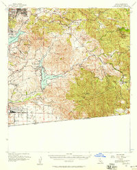
 1955 Jamul Mountains1956 Print · USGSSan Diego County's inland valleys and peaks are captured here in the mid-fifties, showing the rural character of the region before modern suburban growth. You can trace historic landholdings like Monte Vista Ranch or locate the old La Mesa Airport and The Oaks School.5 unique versions available
 - 1955 Map of Jamul, 1958 Print
 1955 Jamul1958 Print · USGSThe San Diego backcountry in the mid-fifties shows a landscape of expansive cattle ranches and growing military infrastructure. Genealogists and historians can trace the foundations of Jamul and Dulzura or locate family-named sites like Daley Ranch and the Indian Church.3 unique versions available
 - 1958 Map of San Diego, 1961 Print
 1958 San Diego1961 Print · USGSSan Diego and its inland mountain ranges are captured here in the late fifties as coastal suburbs began to climb the mesas. Researchers can trace the mid-century footprint of Miramar Naval Air Station, the winding San Diego & Arizona Eastern Ry, and local landmarks like Cabrillo Nat Mon.4 unique versions available
 - 1979 Map of El Cajon
 1979 El Cajon1979 Print · USGSSouthern San Diego County and its mountain-to-desert transition are captured here in the late seventies. Researchers can trace the winding San Diego & Arizona Eastern RR, locate rural settlements like Jacumba, and explore the sprawling Cleveland National Forest.2 unique versions available
 - 1994 Map of Jamul Mountains, 1998 Print
 1994 Jamul Mountains1998 Print · USGSSan Diego’s eastern expansion is clearly visible in the mid-1990s as suburban neighborhoods meet the rugged foothills of the Jamul Mountains. Researchers can trace the development of Chula Vista and Spring Valley alongside legacy sites like Fenton Ranch and the Steele Canyon Bridge.
 - 2012 Map of Jamul Mountains, 2012 Print
 2012 Jamul Mountains2012 Print · USGSCovers Cockatoo Grove, including San Diego, Chula Vista, and other nearby areas
 - 2015 Map of Jamul Mountains, 2015 Print
 2015 Jamul Mountains2015 Print · USGSCovers Cockatoo Grove, including San Diego, Chula Vista, and other nearby areas
 - 2018 Map of Jamul Mountains, 2018 Print
 2018 Jamul Mountains2018 Print · USGSCovers Cockatoo Grove, including San Diego, Chula Vista, and other nearby areas
 - 2021 Map of Jamul Mountains, 2021 Print
 2021 Jamul Mountains2021 Print · USGSSan Diego's eastern suburbs and interior canyons are captured here during a period of modern expansion. Researchers can trace the development of Spring Valley and Chula Vista alongside landmarks like Upper Otay Lake and Southwestern College.
End of results
Showing maps 1-15
Frequently asked questions
- What are the different types of historical maps available for Cockatoo Grove?
- What is the oldest map of Cockatoo Grove?
- Where can I purchase historical maps of Cockatoo Grove for my home or office?
- Where can I download high-res historical maps of Cockatoo Grove?
- Are there historical topographic maps available for Cockatoo Grove?
- Is there historical aerial imagery available for Cockatoo Grove?
- Where are historical maps of Cockatoo Grove sourced from?