Old Maps of Seventh College at the Village, San Diego for Hiking & Exploration
Hike through history with 12 historic maps of Seventh College at the Village. Explore old trails, ghost towns, and forgotten backroads — perfect for outdoor adventurers and local explorers.
- Rediscover forgotten places: Map out old mining camps, roads, and footpaths that no longer exist on modern maps.
- Layer with modern tools: Combine with LiDAR or satellite views to plan hikes through historical terrain.
- Made for exploration: Popular among hikers, overlanders, and local history lovers.
Use these maps to find adventure and explore the hidden past of Seventh College at the Village.
Seventh College at the Village, San Diego maps
(12)- 1903 Map of La Jolla
 1903 La Jolla1903 Print · USGSCovers Seventh College at the Village, including San Diego, El Cajon, and other nearby areas9 unique versions available
 - 1904 Map of Southern California Sheet No. 2
 1904 Southern California Sheet No. 21904 Print · USGSCovers Seventh College at the Village, including Tijuana, San Diego, and other nearby areas5 unique versions available
 - 1930 Map of La Jolla, 1955 Print
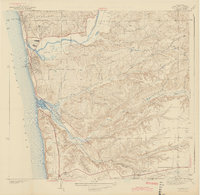
 1930 La Jolla1955 Print · USGSCovers Seventh College at the Village, including San Diego, El Cajon, and other nearby areas2 unique versions available
 - 1943 Map of Del Mar
 1943 Del Mar1943 Print · USGSCovers Seventh College at the Village, including San Diego, Solana Beach, and other nearby areas2 unique versions available
 - 1950 Map of San Diego, 1954 Print
 1950 San Diego1954 Print · USGSCovers Seventh College at the Village, including Tijuana, San Diego, and other nearby areas
 - 1953 Map of Del Mar, 1954 Print
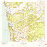 1953 Del Mar1954 Print · USGSCovers Seventh College at the Village, including San Diego, Encinitas, and other nearby areas3 unique versions available
 - 1954 Map of San Diego
 1954 San Diego1954 Print · USGSCovers Seventh College at the Village, including Tijuana, San Diego, and other nearby areas
 - 1955 Map of San Diego
 1955 San Diego1955 Print · USGSCovers Seventh College at the Village, including Tijuana, San Diego, and other nearby areas
 - 1958 Map of San Diego, 1961 Print
 1958 San Diego1961 Print · USGSCovers Seventh College at the Village, including Tijuana, San Diego, and other nearby areas4 unique versions available
 - 1967 Map of Del Mar, 1970 Print
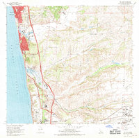 1967 Del Mar1970 Print · USGSCovers Seventh College at the Village, including San Diego, Encinitas, and other nearby areas3 unique versions available
 - 1979 Map of San Diego, 1980 Print
 1979 San Diego1980 Print · USGSCovers Seventh College at the Village, including Tijuana, San Diego, and other nearby areas3 unique versions available
 - 1994 Map of Del Mar, 2000 Print
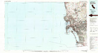
 1994 Del Mar2000 Print · USGSCovers Seventh College at the Village, including San Diego, Encinitas, and other nearby areas
End of results
Showing maps 1-12 of 12
Frequently asked questions
- What are the different types of historical maps available for Seventh College at the Village?
- What is the oldest map of Seventh College at the Village?
- Where can I purchase historical maps of Seventh College at the Village for my home or office?
- Where can I download high-res historical maps of Seventh College at the Village?
- Are there historical topographic maps available for Seventh College at the Village?
- Is there historical aerial imagery available for Seventh College at the Village?
- Where are historical maps of Seventh College at the Village sourced from?