Old Maps of Stallion Oaks, California for Hiking & Exploration
Hike through history with 17 historic maps of Stallion Oaks. Explore old trails, ghost towns, and forgotten backroads — perfect for outdoor adventurers and local explorers.
- Rediscover forgotten places: Map out old mining camps, roads, and footpaths that no longer exist on modern maps.
- Layer with modern tools: Combine with LiDAR or satellite views to plan hikes through historical terrain.
- Made for exploration: Popular among hikers, overlanders, and local history lovers.
Use these maps to find adventure and explore the hidden past of Stallion Oaks.
Stallion Oaks, CA maps
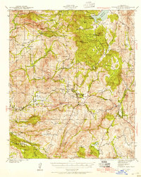
(17)- 1903 Map of Cuyamaca
 1903 Cuyamaca1903 Print · USGSInland San Diego County at the turn of the century reveals a landscape defined by new water infrastructure and rail lines. Genealogists and historians can trace early settlements like Lakeside, Dulzura, and the remote Honey Springs Ranch along the international border.6 unique versions available
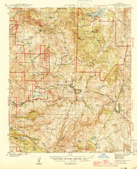
 - 1904 Map of Southern California Sheet No. 2
 1904 Southern California Sheet No. 21904 Print · USGSSouthern California during the early 1900s shows the transition from vast ranchos to coastal rail towns. Genealogists and researchers can trace the Southern California R.R. through Oceanside, explore old land grants like Mission Viejo, and locate early settlements from Fallbrook to Julian.5 unique versions available
 - 1942 Map of Cuyamaca Peak, 1954 Print
 1942 Cuyamaca Peak1954 Print · USGSSan Diego County’s backcountry comes alive in the early 1940s, showing the high mountain ranching and reservation lands before modern development. Researchers can trace the footprints of Anahuac Sch, Burney Ranch, and the Viejas Indian Reservation.2 unique versions available
 - 1944 Map of Cuyamaca Peak
 1944 Cuyamaca Peak1944 Print · USGSSan Diego’s high country in the early 1940s is shown as a network of cattle ranches and mountain settlements. Researchers can locate early schools and family landmarks like Anahuac Sch, Burney Ranch, and the Cuyamaca Lodge.2 unique versions available
 - 1950 Map of San Diego, 1954 Print
 1950 San Diego1954 Print · USGSCoastal San Diego and the Baja California border region come alive in this mid-century survey. Trace the early layout of National City and Chula Vista, or locate historic landmarks like the San Diego and Arizona Eastern RR and Fort Rosecrans.
 - 1954 Map of Cuyamaca Peak
 1954 Cuyamaca Peak1954 Print · USGSThe San Diego backcountry in the mid-fifties is a rugged network of cattle ranches and mountain preserves. Trace the development of Hulburd Grove and Alpine, or locate local landmarks like Anahuac Sch and the Oriflamme Mine tucked in the canyons.
 - 1954 Map of San Diego
 1954 San Diego1954 Print · USGSSan Diego and the northern reaches of Baja California are captured here during a decade of rapid post-war growth and military expansion. Researchers can trace the mid-century shoreline of Mission Beach, find established tribal lands like Capitan Grande Indian Reservation, and follow the border crossing into Tijuana.
 - 1955 Map of San Diego
 1955 San Diego1955 Print · USGSSouthern California underwent massive growth in the post-war years, as suburban development pushed into the canyons and foothills. Researchers can trace the mid-century infrastructure of Lindbergh Field, the Otay River, and numerous sites like Lemon Grove.
 - 1958 Map of San Diego, 1961 Print
 1958 San Diego1961 Print · USGSSan Diego and its inland mountain ranges are captured here in the late fifties as coastal suburbs began to climb the mesas. Researchers can trace the mid-century footprint of Miramar Naval Air Station, the winding San Diego & Arizona Eastern Ry, and local landmarks like Cabrillo Nat Mon.4 unique versions available
 - 1960 Map of Viejas Mountain, 1961 Print
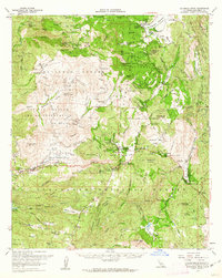
 1960 Viejas Mountain1961 Print · USGSThe Viejas Valley and surrounding San Diego County highlands are documented here during the early sixties, showing a landscape of tribal lands and national forest. Genealogists and local historians can trace family locations at The Willows, Lyster Ranch, and Kearchoffer Flat.5 unique versions available
 - 1960 Map of Cuyamaca Peak, 1962 Print
 1960 Cuyamaca Peak1962 Print · USGSThe San Diego backcountry comes into focus in the early sixties, showing the mountain communities and expansive parklands of the Cuyamaca region. Genealogists and hikers can trace old homesteads like Burney Ranch and historical sites such as Stonewall Mine or the Cuyamaca Lodge.2 unique versions available
 - 1979 Map of El Cajon
 1979 El Cajon1979 Print · USGSSouthern San Diego County and its mountain-to-desert transition are captured here in the late seventies. Researchers can trace the winding San Diego & Arizona Eastern RR, locate rural settlements like Jacumba, and explore the sprawling Cleveland National Forest.2 unique versions available
 - 1997 Map of Viejas Mountain, 2000 Print
 1997 Viejas Mountain2000 Print · USGSSan Diego County’s interior foothills are captured here in the late 1990s, where traditional ranching meets forest preservation. Genealogists and local historians can trace family-named sites like Lyster Ranch, Glen Lonely, and the old Descanso Mine.
 - 2012 Map of Viejas Mountain, 2012 Print
 2012 Viejas Mountain2012 Print · USGSCovers Stallion Oaks, including Little Ewiiaapaayp, Viejas, and other nearby areas
 - 2015 Map of Viejas Mountain, 2015 Print
 2015 Viejas Mountain2015 Print · USGSCovers Stallion Oaks, including Little Ewiiaapaayp, Viejas, and other nearby areas
 - 2018 Map of Viejas Mountain, 2018 Print
 2018 Viejas Mountain2018 Print · USGSCovers Stallion Oaks, including Little Ewiiaapaayp, Viejas, and other nearby areas
 - 2021 Map of Viejas Mountain, 2021 Print
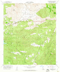
 2021 Viejas Mountain2021 Print · USGSSan Diego County's high country is captured here in the early twenty-first century, showing the remote communities and rugged peaks of the Peninsular Ranges. Researchers can locate historic sites like Hulburd Grove, trace the course of the Sweetwater River, and find the high-altitude On the Rocks Airport.
End of results
Showing maps 1-17 of 17
Top cities near Stallion Oaks
- Alpine historical maps
- San Diego Country Estates historical maps
- Harbison Canyon historical maps
- Julian historical maps
- Pine Valley historical maps
- Descanso historical maps
See more
Frequently asked questions
- What are the different types of historical maps available for Stallion Oaks?
- What is the oldest map of Stallion Oaks?
- Where can I purchase historical maps of Stallion Oaks for my home or office?
- Where can I download high-res historical maps of Stallion Oaks?
- Are there historical topographic maps available for Stallion Oaks?
- Is there historical aerial imagery available for Stallion Oaks?
- Where are historical maps of Stallion Oaks sourced from?