Old Maps of Warner Springs, California for Hiking & Exploration
Hike through history with 21 historic maps of Warner Springs. Explore old trails, ghost towns, and forgotten backroads — perfect for outdoor adventurers and local explorers.
- Rediscover forgotten places: Map out old mining camps, roads, and footpaths that no longer exist on modern maps.
- Layer with modern tools: Combine with LiDAR or satellite views to plan hikes through historical terrain.
- Made for exploration: Popular among hikers, overlanders, and local history lovers.
Use these maps to find adventure and explore the hidden past of Warner Springs.
Warner Springs, CA maps
(21)- 1903 Map of Ramona
 1903 Ramona1903 Print · USGSSan Diego County's high country and interior valleys are captured here at the start of the twentieth century, during a time of mountain ranching and early gold mining. Researchers can trace the early footprints of Julian, Ramona, and Mesa Grande, alongside the boundaries of the San Jacinto Forest Reserve.6 unique versions available
 - 1904 Map of Southern California Sheet No. 2
 1904 Southern California Sheet No. 21904 Print · USGSSouthern California during the early 1900s shows the transition from vast ranchos to coastal rail towns. Genealogists and researchers can trace the Southern California R.R. through Oceanside, explore old land grants like Mission Viejo, and locate early settlements from Fallbrook to Julian.5 unique versions available
 - 1939 Map of Warner Springs, 1956 Print
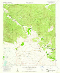
 1939 Warner Springs1956 Print · USGSIn the high backcountry of San Diego and Riverside counties just before the 1940s, this area shows a landscape of cattle ranges and mountain outposts. Genealogists and researchers can trace early settlements and trails including Holcomb Village, Warner Springs, and the historic Deadman Hole spring.
 - 1943 Map of Warner Springs
 1943 Warner Springs1943 Print · USGSSan Diego County's high country is captured here during the early war years, showing the ranching and tribal lands before modern expansion. Researchers can trace the old routes through Chihuahua Valley or locate early outposts like Emerys Service and Warner Springs.
 - 1947 Map of Santa Ana, 1949 Print
 1947 Santa Ana1949 Print · USGSSouthern California is depicted here in the late forties, showing the expansion of the Inland Empire and the Orange County coast. Researchers can trace the early layout of Palm Springs or locate long-standing tribal lands like the Pala Indian Reservation and Rincon Indian Res.
 - 1947 Map of Warner Springs, 1952 Print
 1947 Warner Springs1952 Print · USGSThe high back-country of San Diego and Riverside counties is captured here just after the war, centered on the waters of Lake Henshaw. Researchers can trace the old paths of the Halfway Truck Trail or locate remote outposts like Holcomb Village and Emery's Service.
 - 1949 Map of Santa Ana
 1949 Santa Ana1949 Print · USGSSouthern California underwent a profound transformation in the late 1940s as military installations and citrus groves shared the landscape. Researchers can trace early coastal growth at Laguna Beach, military history at Camp Pendleton, and the rail corridors of the Pacific Electric.
 - 1952 Map of Warner Springs
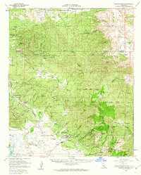
 1952 Warner Springs1952 Print · USGSThe high back-country of northern San Diego County is captured here in the early fifties, showing the mountain valleys before modern expansion. Researchers can trace remote settlements and desert outposts like San Ignacio, Combs Camp, and the legendary Warner Springs near the shores of Lake Henshaw.
 - 1956 Map of Santa Ana
 1956 Santa Ana1956 Print · USGSSouthern California underwent massive mid-century transformation as suburban growth met major military and water projects. Trace the postwar expansion of Santa Ana and Riverside, the layout of Camp Pendleton, and the path of the Colorado River Aqueduct.
 - 1958 Map of Warner Springs, 1988 Print
 1958 Warner Springs1988 Print · USGSWarner Springs and the high-desert valleys of San Diego County are captured here during a period of transition in the late twentieth century. Genealogists and local historians can locate the Warner Union School, old burial grounds at the Cem, and historic waypoints like Deadman Hole or Sunshine Summit.
 - 1959 Map of Warner Springs, 1961 Print
 1959 Warner Springs1961 Print · USGSWarner Springs and the San Jose Valley are documented here in the late fifties, showing a remote landscape of historic ranchos and military training grounds. Researchers can find old properties like Chamberlain Ranch, the grounds of the U S Navy Survival Training School, and the local Cem.4 unique versions available
 - 1959 Map of Santa Ana, 1971 Print
 1959 Santa Ana1971 Print · USGSSouthern California is captured in a decade of transformation, from the Orange County coast to the desert floor. Researchers can trace the mid-century footprints of Camp Pendleton, March Air Force Base, and the original Ortega Highway.3 unique versions available
 - 1960 Map of Santa Ana
 1960 Santa Ana1960 Print · USGSSouthern California's coastal plains and inland deserts meet in this mid-century survey of the burgeoning Orange and Riverside county corridors. Researchers can trace the layout of early freeway systems, find tribal lands like the Soboba Indian Reservation, and locate military landmarks such as March Field.2 unique versions available
 - 1960 Map of Warner Springs, 1962 Print
 1960 Warner Springs1962 Print · USGSWarner Springs and the San Diego back country appear here in the early sixties, a landscape of cattle ranges and mountain outposts. Researchers can trace the Survival Training School (US Navy), the remote village of San Ignacio, and the historic Warner Hot Spring.2 unique versions available
 - 1965 Map of Santa Ana
 1965 Santa Ana1965 Print · USGSSouthern California is captured in a decade of rapid growth, showing the coastal expansion from Santa Ana down to Oceanside. Genealogists and historians can trace the mid-century development of places like Garden Grove or the rural reaches of Escondido and the Palomar Observatory.
 - 1982 Map of Borrego Valley, 1983 Print
 1982 Borrego Valley1983 Print · USGSThe high desert and coastal mountains of San Diego County come together in the early eighties. Researchers can trace the boundaries of the Los Coyotes Indian Reservation or locate the Desert Queen Mine and Palomar Observatory.2 unique versions available
 - 1997 Map of Warner Springs, 2000 Print
 1997 Warner Springs2000 Print · USGSSan Diego County in the late nineties is depicted here through its expansive land grants and the Cleveland National Forest. Genealogists and researchers can trace the Pacific Crest National Scenic Trail, the Warner Union School, and a Cem near Warner Springs.
 - 2012 Map of Warner Springs, 2012 Print
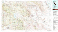
 2012 Warner Springs2012 Print · USGSCovers Warner Springs, including Holcomb Village, San Diego County, and other nearby areas
 - 2015 Map of Warner Springs, 2015 Print
 2015 Warner Springs2015 Print · USGSCovers Warner Springs, including Holcomb Village, San Diego County, and other nearby areas
 - 2018 Map of Warner Springs, 2018 Print
 2018 Warner Springs2018 Print · USGSCovers Warner Springs, including Holcomb Village, San Diego County, and other nearby areas
 - 2021 Map of Warner Springs, 2021 Print
 2021 Warner Springs2021 Print · USGSWarner Springs and the surrounding San Diego backcountry are documented here in the early twenty-first century. Researchers can trace the path of the Pacific Crest National Scenic Trl past historic landmarks like Deadman Hole and the Warner Hot Spring.
End of results
Showing maps 1-21 of 21
Top cities near Warner Springs
Frequently asked questions
- What are the different types of historical maps available for Warner Springs?
- What is the oldest map of Warner Springs?
- Where can I purchase historical maps of Warner Springs for my home or office?
- Where can I download high-res historical maps of Warner Springs?
- Are there historical topographic maps available for Warner Springs?
- Is there historical aerial imagery available for Warner Springs?
- Where are historical maps of Warner Springs sourced from?