Old Maps of Terminous, California
Explore 16 old maps of Terminous, spanning from 1894 to today. These high-resolution historic maps reveal how streets, neighborhoods, landmarks, and natural features evolved over time — perfect for genealogy, metal detecting, research, and local history exploration.
What you can do with these maps:
- See how Terminous changed over time: Compare historical maps to modern-day views to trace roads, homesites, rail lines & more.
- View detailed metadata: Each map includes creators, publishers, year, scale, and archive source.
- Overlay maps with satellite & LiDAR: Visualize the past alongside modern tools to explore terrain & human change.
- Trusted historical sources: Maps sourced from the USGS, Library of Congress, and other archives.
- Access maps your way: View online, download high-res files, or order prints for personal or research use.
Start exploring old maps of Terminous to uncover forgotten places, hidden landmarks, and the deep history beneath your feet.
Terminous, CA maps
(16)- 1894 Map of Lodi
 1894 Lodi1894 Print · USGSThe northern Central Valley and Sierra foothills come alive in the late nineteenth century as railroads reshape the landscape. Local historians can trace early transit hubs like Lodi and Galt alongside rural landmarks like Alabama House and Michigan Bar.3 unique versions available
 - 1910 Map of Headreach
 1910 Headreach1910 Print · USGSThe California Delta's intricate waterway network is revealed in this 1910 survey, showcasing the early landscape of San Joaquin County. Trace the river economy through landings like Terminous and Headreach Landing or the winding paths of Potato Slough and White Slough.2 unique versions available
 - 1939 Map of Lodi, 1957 Print
 1939 Lodi1957 Print · USGSThe San Joaquin Delta during the late 1930s shows a landscape of reclaimed islands and a bustling rail-and-river economy. Genealogists and historians can trace old rural school districts like Ray District Sch and landmarks such as the New Hope Migratory Labor Camp.2 unique versions available
 - 1942 Map of Lodi
 1942 Lodi1942 Print · USGSThe San Joaquin delta region thrives as a complex network of reclaimed islands and sloughs in the early 1940s. Genealogists and historians can trace the foundations of local society through Thornton Migratory Labor Camp, Liberty School, and the busy Mokelumne River landings.
 - 1947 Map of Sacramento, 1948 Print
 1947 Sacramento1948 Print · USGSThe Sacramento Valley meets the high Sierra during a period of post-war expansion. Trace the historic river delta islands like Grand Island or locate early airfield footprints at McClellan Air Force Base and Mather Air Force Base.2 unique versions available
 - 1948 Map of Sacramento, 1951 Print
 1948 Sacramento1951 Print · USGSPost-war Northern California comes alive in this regional survey, capturing the era of expansion between the Central Valley and the High Sierra. Researchers can trace the rail networks of the Central California Traction and Sacramento Northern RR or locate landmarks like the State Capitol and University of California Davis.
 - 1952 Map of Terminous, 1953 Print
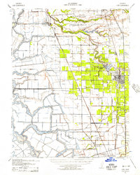
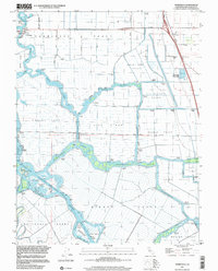
 1952 Terminous1953 Print · USGSThe California Delta’s intricate water-and-tract system is captured here in the early fifties, showing a landscape shaped by reclaimed land and river transport. Researchers can trace the legacy of delta farming and infrastructure through features like Terminous, the Western Pacific line, and the Venice School.3 unique versions available
 - 1956 Map of Sacramento
 1956 Sacramento1956 Print · USGSMid-century California unfolds from the delta to the high Sierra, capturing a landscape of growing valley cities and burgeoning military airbases. Genealogists and historians can trace the rail lines and river towns from Woodland to Lodi, or explore the foothill settlements of Placerville and Jackson.2 unique versions available
 - 1957 Map of Sacramento, 1966 Print
 1957 Sacramento1966 Print · USGSIn the mid-twentieth century, the California heartland was a hub of river transport, rail lines, and military airbases. Genealogists and historians can trace the development of Gold Country towns like Angels Camp and Sonora or follow the path of the Southern Pacific RR through the growing suburbs of Sacramento.4 unique versions available
 - 1978 Map of Terminous
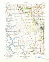
 1978 Terminous1978 Print · USGSThe San Joaquin Delta in the late seventies is a complex network of island tracts and deep-water shipping lanes. Genealogists and historians can trace local landmarks like the Venice King Sch, the settlement of Terminous, and the Paradise Point landing.2 unique versions available
 - 1993 Map of Lodi, 1994 Print
 1993 Lodi1994 Print · USGSNorthern California's delta country and the growing Central Valley corridors are captured here in the early nineties. Genealogists and historians can trace the intricate island tracts, old railroad lines like the Sacramento Northern RR, and established local landmarks including the Lodi Memorial Cemetery and University of the Pacific.2 unique versions available
 - 1997 Map of Terminous, 2002 Print
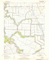
 1997 Terminous2002 Print · USGSThe California Delta's intricate network of reclaimed lands and channels is captured here in the late nineties. Genealogists and researchers can trace local landmarks like Terminous, the Venice King Sch, and family-named lands such as the Rindge Tract.
 - 2012 Map of Terminous, 2012 Print
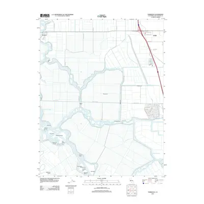 2012 Terminous2012 Print · USGSCovers Terminous, including Stockton, Lodi, and other nearby areas
 - 2015 Map of Terminous, 2015 Print
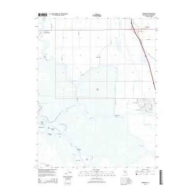 2015 Terminous2015 Print · USGSCovers Terminous, including Stockton, Lodi, and other nearby areas
 - 2018 Map of Terminous, 2018 Print
 2018 Terminous2018 Print · USGSCovers Terminous, including Stockton, Lodi, and other nearby areas
 - 2021 Map of Terminous, 2021 Print
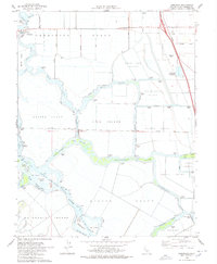
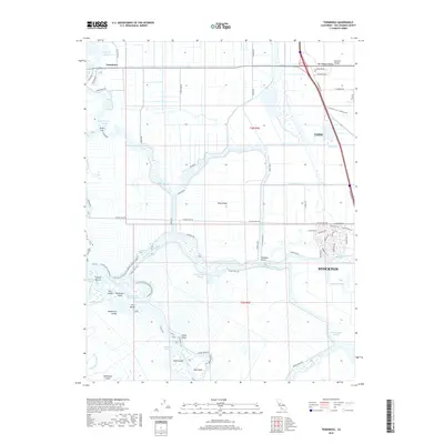
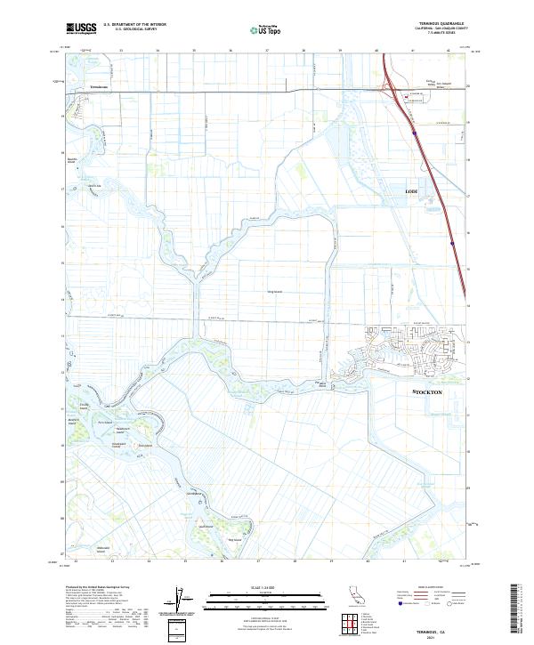 2021 Terminous2021 Print · USGSThe San Joaquin Delta at the start of the 2020s shows a complex web of islands and industrial waterways. Researchers can trace the levee-lined borders of Bouldin Island and King Island or locate points like Paradise Point and Terminous.
End of results
Showing maps 1-16 of 16
Top cities near Terminous
- Stockton historical maps
- Lodi historical maps
- Brentwood historical maps
- Oakley historical maps
- Galt historical maps
- Discovery Bay historical maps
See more
Frequently asked questions
- What are the different types of historical maps available for Terminous?
- What is the oldest map of Terminous?
- Where can I purchase historical maps of Terminous for my home or office?
- Where can I download high-res historical maps of Terminous?
- Are there historical topographic maps available for Terminous?
- Is there historical aerial imagery available for Terminous?
- Where are historical maps of Terminous sourced from?