Old Maps of Pedro Valley, Pacifica for Genealogy
Trace your family roots with 22 historic maps of Pedro Valley. These high-res maps reveal old neighborhoods, homesites, landmarks, and streets — helping you uncover where your ancestors lived and how the area evolved over time.
- Explore historic neighborhoods: Identify where your relatives may have lived in the 1800s or 1900s.
- Compare maps over time: Trace the changes in streets, buildings, and landmarks for multi-generational research.
- Perfect for genealogy & ancestry research: Used by family historians and researchers to map out lineage and migration.
These maps are an incredible resource for exploring your personal connection to Pedro Valley's past.
Pedro Valley, Pacifica maps
(22)- 1892 Map of San Mateo
 1892 San Mateo1892 Print · USGSCovers Pedro Valley, including San Francisco, Oakland, and other nearby areas
 - 1896 Map of San Mateo
 1896 San Mateo1896 Print · USGSCovers Pedro Valley, including San Francisco, Oakland, and other nearby areas
 - 1899 Map of San Mateo
 1899 San Mateo1899 Print · USGSCovers Pedro Valley, including San Francisco, Oakland, and other nearby areas6 unique versions available
 - 1915 Map of San Mateo
 1915 San Mateo1915 Print · USGSCovers Pedro Valley, including San Francisco, Oakland, and other nearby areas6 unique versions available
 - 1939 Map of San Mateo, 1956 Print
 1939 San Mateo1956 Print · USGSCovers Pedro Valley, including San Francisco, Oakland, and other nearby areas3 unique versions available
 - 1943 Map of San Mateo
 1943 San Mateo1943 Print · USGSCovers Pedro Valley, including San Francisco, Oakland, and other nearby areas
 - 1947 Map of San Francisco, 1948 Print
 1947 San Francisco1948 Print · USGSCovers Pedro Valley, including San Jose, San Francisco, and other nearby areas
 - 1948 Map of San Francisco, 1951 Print
 1948 San Francisco1951 Print · USGSCovers Pedro Valley, including San Jose, San Francisco, and other nearby areas
 - 1949 Map of Montara Mountain
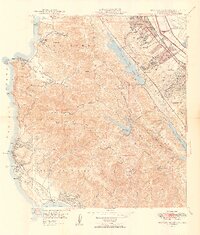 1949 Montara Mountain1949 Print · USGSCovers Pedro Valley, including San Bruno, Pacifica, and other nearby areas3 unique versions available
 - 1955 Map of San Francisco
 1955 San Francisco1955 Print · USGSCovers Pedro Valley, including San Jose, San Francisco, and other nearby areas
 - 1956 Map of San Francisco
 1956 San Francisco1956 Print · USGSCovers Pedro Valley, including San Jose, San Francisco, and other nearby areas4 unique versions available
 - 1956 Map of Montara Mountain, 1957 Print
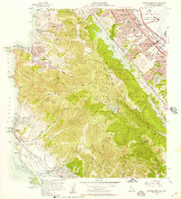 1956 Montara Mountain1957 Print · USGSCovers Pedro Valley, including San Bruno, Pacifica, and other nearby areas5 unique versions available
 - 1957 Map of San Francisco
 1957 San Francisco1957 Print · USGSCovers Pedro Valley, including San Jose, San Francisco, and other nearby areas
 - 1960 Map of San Francisco
 1960 San Francisco1960 Print · USGSCovers Pedro Valley, including San Jose, San Francisco, and other nearby areas
 - 1961 Map of San Francisco
 1961 San Francisco1961 Print · USGSCovers Pedro Valley, including San Jose, San Francisco, and other nearby areas
 - 1964 Map of San Francisco
 1964 San Francisco1964 Print · USGSCovers Pedro Valley, including San Jose, San Francisco, and other nearby areas
 - 1971 Map of San Francisco
 1971 San Francisco1971 Print · USGSCovers Pedro Valley, including San Jose, San Francisco, and other nearby areas
 - 1978 Map of San Francisco, 1979 Print
 1978 San Francisco1979 Print · USGSCovers Pedro Valley, including San Francisco, Oakland, and other nearby areas2 unique versions available
 - 1985 Map of San Francisco, 1989 Print
 1985 San Francisco1989 Print · USGSCovers Pedro Valley, including San Jose, San Francisco, and other nearby areas
 - 1993 Map of Montara Mountain, 1997 Print
 1993 Montara Mountain1997 Print · USGSCovers Pedro Valley, including San Bruno, Pacifica, and other nearby areas
 - 1997 Map of Montara Mountain, 1999 Print
 1997 Montara Mountain1999 Print · USGSCovers Pedro Valley, including San Bruno, Pacifica, and other nearby areas
 - 2022 Map of Montara Mountain, 2022 Print
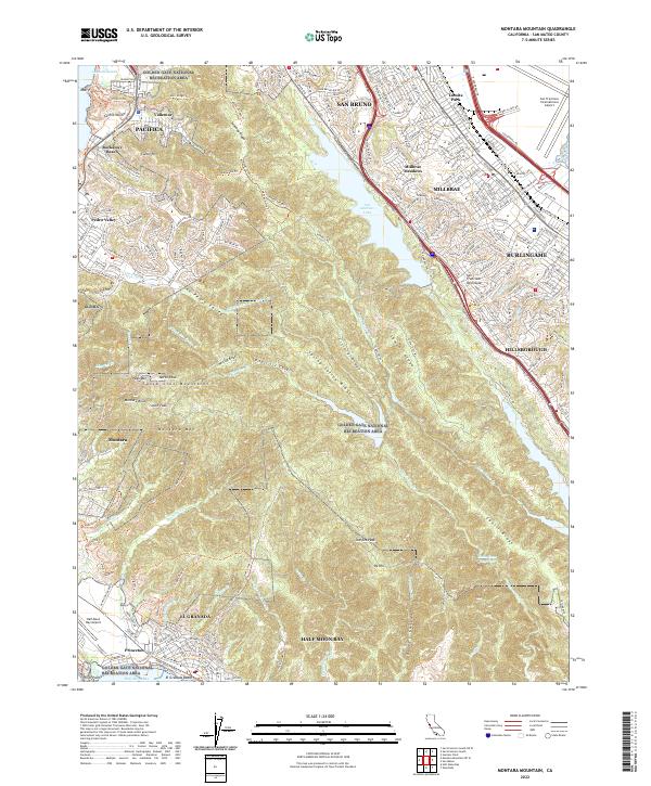 2022 Montara Mountain2022 Print · USGSCovers Pedro Valley, including San Bruno, Pacifica, and other nearby areas
End of results
Showing maps 1-22 of 22
Frequently asked questions
- What are the different types of historical maps available for Pedro Valley?
- What is the oldest map of Pedro Valley?
- Where can I purchase historical maps of Pedro Valley for my home or office?
- Where can I download high-res historical maps of Pedro Valley?
- Are there historical topographic maps available for Pedro Valley?
- Is there historical aerial imagery available for Pedro Valley?
- Where are historical maps of Pedro Valley sourced from?