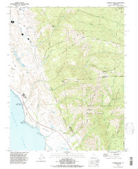
1990s Maps of Whitehouse Canyon, California
Explore 2 historic maps of Whitehouse Canyon from the 1990s. These maps offer a rare glimpse into what life looked like during the 1990s — showing old roads, neighborhoods, homes, and landmarks that have changed or disappeared over time.
Whether you're researching your family's past, planning a metal detecting trip, or studying how Whitehouse Canyon's landscape evolved across the 1990s, these high-resolution maps are a powerful tool for exploring the history of this region.
- Focus on a specific era: All maps on this page are from the 1990s, giving you a focused view of this time period.
- See what’s changed: Compare century-old streets, trails, and buildings to today's modern landscape using overlays and satellite layers.
- Research with precision: Use these maps for genealogy, historical research, land use analysis, or educational projects.
- View, download, or print: Maps are fully viewable online in high resolution, and can be downloaded or printed for your own records.
Start exploring Whitehouse Canyon's history through authentic maps from the 1990s. This is your window into the past.
Whitehouse Canyon, CA maps
(2)- 1991 Map of Franklin Point, 1995 Print
 1991 Franklin Point1995 Print · USGSThe San Mateo coast in the early nineties displays a landscape of rugged state reserves and ancient redwood forests. Genealogists and historians can locate Pescadero High Sch, the Cemetery near Cascade Creek, and remote landmarks like Chalk Mtn.2 unique versions available
 - 1998 Map of Franklin Point, 2002 Print
 1998 Franklin Point2002 Print · USGSThe San Mateo and Santa Cruz coastlines meet in the 1990s at the rugged Punta del Año Nuevo headlands. Genealogists and historians can trace the remote Cemetery near Cascade Creek or locate landmarks like Chalk Mtn and the Sandy Point Guard Station.
End of results
Showing maps 1-2 of 2
Top cities near Whitehouse Canyon
- Mountain View historical maps
- Palo Alto historical maps
- Santa Cruz historical maps
- Cupertino historical maps
- Saratoga historical maps
- Los Altos historical maps
See more
Frequently asked questions
- What are the different types of historical maps available for Whitehouse Canyon?
- What is the oldest map of Whitehouse Canyon?
- Where can I purchase historical maps of Whitehouse Canyon for my home or office?
- Where can I download high-res historical maps of Whitehouse Canyon?
- Are there historical topographic maps available for Whitehouse Canyon?
- Is there historical aerial imagery available for Whitehouse Canyon?
- Where are historical maps of Whitehouse Canyon sourced from?