Old Maps of Mitchell Place, California for Genealogy
Trace your family roots with 10 historic maps of Mitchell Place. These high-res maps reveal old neighborhoods, homesites, landmarks, and streets — helping you uncover where your ancestors lived and how the area evolved over time.
- Explore historic neighborhoods: Identify where your relatives may have lived in the 1800s or 1900s.
- Compare maps over time: Trace the changes in streets, buildings, and landmarks for multi-generational research.
- Perfect for genealogy & ancestry research: Used by family historians and researchers to map out lineage and migration.
These maps are an incredible resource for exploring your personal connection to Mitchell Place's past.
Mitchell Place, CA maps
(10)- 1952 Map of Paskenta, 1953 Print
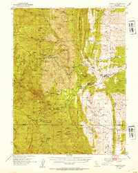 1952 Paskenta1953 Print · USGSThe foothills of Tehama and Glenn counties come to life in this mid-century survey of the Mendocino National Forest borderlands. Genealogists and local historians can trace family holdings like the Scribner Ranch and Cushman Ranch, or find the old Lowrey Sch.3 unique versions available
 - 1957 Map of Ukiah, 1966 Print
 1957 Ukiah1966 Print · USGSNorthern California's diverse terrain comes into focus in the mid-1950s, from the rugged timberlands of the Jackson State Forest to the productive Sacramento Valley. Genealogists and historians can trace the rail lines of the Northwestern Pacific or locate early valley settlements like Arbuckle and Paskenta.3 unique versions available
 - 1960 Map of Ukiah
 1960 Ukiah1960 Print · USGSNorthern California during the late fifties reveals a landscape of deep timber forests and valley agriculture before modern expansion. Trace the historic rail lines of the California Western RR and the Northwestern Pacific RR through settlements like Fort Bragg and Ukiah.2 unique versions available
 - 1967 Map of Riley Ridge, 1970 Print
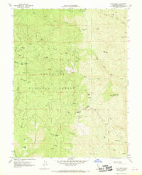 1967 Riley Ridge1970 Print · USGSTehama County's high forest interior is captured here in the late sixties, showing a landscape shaped by early mountain homesteads and remote mining operations. Genealogists and hikers can locate family landmarks like Steuben Place, the Kleinsorge Mine, and the Eagle Rock Lookout Tower.2 unique versions available
 - 1987 Map of Willows, 1988 Print
 1987 Willows1988 Print · USGSThe northern Sacramento Valley meets the Coast Range in the late eighties, showing a landscape defined by water and transit. Researchers can trace the Southern Pacific railroad past Artois and Corning, or locate family-named landmarks like Larkins Childrens Rancho and Snaden Island.2 unique versions available
 - 1995 Map of Riley Ridge, 2001 Print
 1995 Riley Ridge2001 Print · USGSTehama County's high ridges within the Mendocino National Forest are captured in the mid-nineties, showing a landscape defined by mountain camps and mining history. Researchers can locate remote sites like South Elder Mine, the Riley Cabin site, and Patton Mill.
 - 2012 Map of Riley Ridge, 2012 Print
 2012 Riley Ridge2012 Print · USGSCovers Mitchell Place, including Steuben Place, Pellow Place, and other nearby areas
 - 2015 Map of Riley Ridge, 2015 Print
 2015 Riley Ridge2015 Print · USGSCovers Mitchell Place, including Steuben Place, Pellow Place, and other nearby areas
 - 2018 Map of Riley Ridge, 2018 Print
 2018 Riley Ridge2018 Print · USGSCovers Mitchell Place, including Steuben Place, Pellow Place, and other nearby areas
 - 2021 Map of Riley Ridge, 2021 Print
 2021 Riley Ridge2021 Print · USGSTehama County's high-country terrain is captured here as it appeared in the early 2020s within the Mendocino National Forest. Researchers can trace old forest routes and identify remote landmarks such as Whiskey Saddle, Government Spring, and Beehive Flat.
End of results
Showing maps 1-10 of 10
Top cities near Mitchell Place
Frequently asked questions
- What are the different types of historical maps available for Mitchell Place?
- What is the oldest map of Mitchell Place?
- Where can I purchase historical maps of Mitchell Place for my home or office?
- Where can I download high-res historical maps of Mitchell Place?
- Are there historical topographic maps available for Mitchell Place?
- Is there historical aerial imagery available for Mitchell Place?
- Where are historical maps of Mitchell Place sourced from?