Old Maps of Fairview, California
Explore 17 old maps of Fairview, spanning from 1905 to today. These high-resolution historic maps reveal how streets, neighborhoods, landmarks, and natural features evolved over time — perfect for genealogy, metal detecting, research, and local history exploration.
What you can do with these maps:
- See how Fairview changed over time: Compare historical maps to modern-day views to trace roads, homesites, rail lines & more.
- View detailed metadata: Each map includes creators, publishers, year, scale, and archive source.
- Overlay maps with satellite & LiDAR: Visualize the past alongside modern tools to explore terrain & human change.
- Trusted historical sources: Maps sourced from the USGS, Library of Congress, and other archives.
- Access maps your way: View online, download high-res files, or order prints for personal or research use.
Start exploring old maps of Fairview to uncover forgotten places, hidden landmarks, and the deep history beneath your feet.
Fairview, CA maps
(17)- 1905 Map of Fairview, 1957 Print
 1905 Fairview1957 Print · USGSColusa County at the turn of the century reveals a landscape where the Coast Range foothills meet the valley floor. Researchers can trace the path of the Colusa and Lake railroad and locate old watercourses like Freshwater Creek near the settlement of Fairview.
 - 1906 Map of Kernville, 1955 Print
 1906 Kernville1955 Print · USGSThe Kern River Valley at the turn of the century shows a landscape of mining camps and river settlements before the damming of the river. Genealogists and historians can trace the early locations of Kernville, Isabella, and Weldon, or locate the Big Blue Mine and Bodfish P.O.
 - 1908 Map of Kernville
 1908 Kernville1908 Print · USGSThe southern Sierra Nevada frontier comes to life in this survey of the Kern River Valley at the dawn of the twentieth century. Genealogists and researchers can locate early mining operations at the Big Blue Mine and trace historic settlements like Vaughn Bodfish P.O. and Weldon before mid-century water projects.6 unique versions available
 - 1918 Map of Fairview
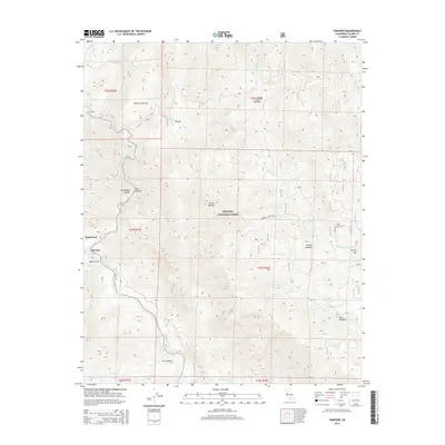
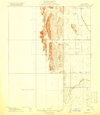 1918 Fairview1918 Print · USGSColusa County's western valley floor comes into focus during the early twentieth century as agriculture and ranching shaped the land. Researchers can trace the winding Freshwater Creek, the settlement at Fairview, and the historic Colusa and Lake road.2 unique versions available
 - 1948 Map of Bakersfield
 1948 Bakersfield1948 Print · USGSBakersfield and the southern San Joaquin Valley appear in the late 1940s, showing a landscape of burgeoning oil towns, rail junctions, and early irrigation canals. Genealogists and historians can trace the foundations of local industry through Gardner Field, the Sunset Railway, and the shores of Buena Vista Lake.2 unique versions available
 - 1955 Map of Bakersfield
 1955 Bakersfield1955 Print · USGSThe southern San Joaquin Valley in the mid-fifties shows an era of massive oil production and industrial irrigation. Trace family roots in Allensworth, the oil fields of Oildale, or the shorelines of Tulare Lake and Buena Vista Lake.
 - 1956 Map of Bakersfield
 1956 Bakersfield1956 Print · USGSThe southern San Joaquin Valley and High Sierra come alive in the mid-fifties, showing the region's complex agricultural and rail networks. Genealogists and historians can trace family roots in towns like Bakersfield, Taft, and Delano, or locate early infrastructure along the Sunset Railway.
 - 1956 Map of Kernville, 1960 Print
 1956 Kernville1960 Print · USGSThe Kern River corridor and the southern Sierra wilderness are captured here in the mid-1950s as a hub for mining and recreation. Genealogists and researchers can locate old sites like Kernville, the Fairview Mine, and many remote camps including Camp Kernville.3 unique versions available
 - 1960 Map of Bakersfield
 1960 Bakersfield1960 Print · USGSThe Southern San Joaquin Valley at mid-century reveals a complex landscape of petroleum development and massive irrigation projects. Researchers can trace the rail lines of the Southern Pacific, explore oil-era landmarks like Oil City, and locate early settlements including Allensworth and Pixley.2 unique versions available
 - 1962 Map of Bakersfield, 1969 Print
 1962 Bakersfield1969 Print · USGSThe Southern San Joaquin Valley is shown in the 1960s as a bustling intersection of petroleum production, irrigation agriculture, and mountain recreation. Researchers can trace the rail lines of the Southern Pacific through the valley or locate early desert developments like California City and Tehachapi.4 unique versions available
 - 1966 Map of Bakersfield
 1966 Bakersfield1966 Print · USGSThe southern San Joaquin Valley in the mid-sixties reveals a massive industrial and agricultural landscape shaped by water and oil. Genealogists and historians can trace the growth of Bakersfield and Oildale, or locate remote airfields like Minter Field and Mojave-Kern County No. 7 Airport.
 - 1978 Map of Isabella Lake, 1994 Print
 1978 Isabella Lake1994 Print · USGSKern County's high country and the central reservoir system are detailed here during the late seventies. Researchers can trace historical sites like Havilah and Long Tom Mine, or explore the development around Isabella Lake and Wofford Heights.2 unique versions available
 - 1987 Map of Fairview
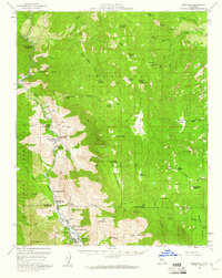
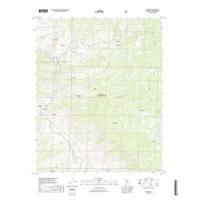
 1987 Fairview1987 Print · USGSTulare County's mountain landscape is captured in the late twentieth century as it serves as a recreation hub within the Sequoia National Forest. Researchers can locate historic sites like the Fairview Mine, the early Fairview settlement, and landmarks like Packsaddle Cave.4 unique versions available
 - 2012 Map of Fairview, 2012 Print
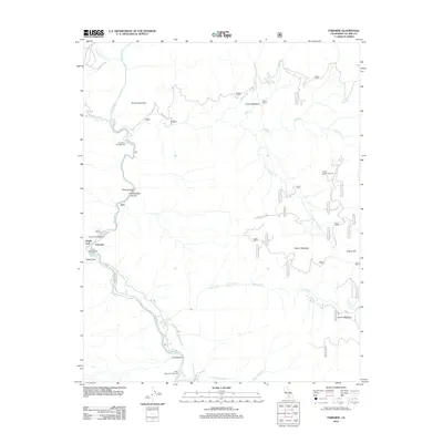 2012 Fairview2012 Print · USGSCovers Fairview, including Roads End, Tulare County, and other nearby areas
 - 2015 Map of Fairview, 2015 Print
 2015 Fairview2015 Print · USGSCovers Fairview, including Roads End, Tulare County, and other nearby areas
 - 2018 Map of Fairview, 2018 Print
 2018 Fairview2018 Print · USGSCovers Fairview, including Roads End, Tulare County, and other nearby areas
 - 2022 Map of Fairview, 2022 Print
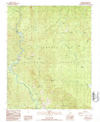
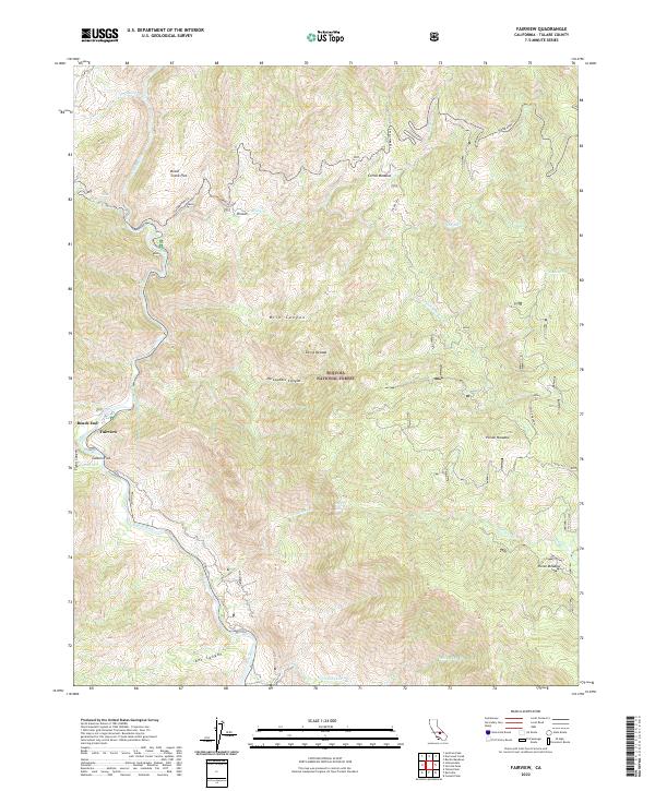 2022 Fairview2022 Print · USGSThe southern Sierra Nevada and the Sequoia National Forest are captured here in the early 2020s, centered on the Kern River valley. Researchers can trace the layout of Fairview, identify high-country features like Poison Meadow, and locate South Creek Falls.
End of results
Showing maps 1-17 of 17
Frequently asked questions
- What are the different types of historical maps available for Fairview?
- What is the oldest map of Fairview?
- Where can I purchase historical maps of Fairview for my home or office?
- Where can I download high-res historical maps of Fairview?
- Are there historical topographic maps available for Fairview?
- Is there historical aerial imagery available for Fairview?
- Where are historical maps of Fairview sourced from?