1920s Maps of Sierra Woods, Farmersville
Explore 1 historic maps of Sierra Woods from the 1920s. These maps offer a rare glimpse into what life looked like during the 1920s — showing old roads, neighborhoods, homes, and landmarks that have changed or disappeared over time.
Whether you're researching your family's past, planning a metal detecting trip, or studying how Sierra Woods's landscape evolved across the 1920s, these high-resolution maps are a powerful tool for exploring the history of this region.
- Focus on a specific era: All maps on this page are from the 1920s, giving you a focused view of this time period.
- See what’s changed: Compare century-old streets, trails, and buildings to today's modern landscape using overlays and satellite layers.
- Research with precision: Use these maps for genealogy, historical research, land use analysis, or educational projects.
- View, download, or print: Maps are fully viewable online in high resolution, and can be downloaded or printed for your own records.
Start exploring Sierra Woods's history through authentic maps from the 1920s. This is your window into the past.
Sierra Woods, Farmersville maps
(1)- 1926 Map of Exeter
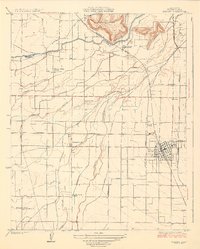 1926 Exeter1926 Print · USGSTulare County's citrus and grape heartland is captured in the mid-twenties as an intricate web of irrigation and electric rail. Genealogists and researchers can trace rural life through family-named landmarks like Mineral King Ranch and several country schools including Deep Creek School and Outside Creek School.3 unique versions available
End of results
Showing maps 1-1 of 1
Frequently asked questions
- What are the different types of historical maps available for Sierra Woods?
- What is the oldest map of Sierra Woods?
- Where can I purchase historical maps of Sierra Woods for my home or office?
- Where can I download high-res historical maps of Sierra Woods?
- Are there historical topographic maps available for Sierra Woods?
- Is there historical aerial imagery available for Sierra Woods?
- Where are historical maps of Sierra Woods sourced from?