Old Maps of Lemon Cove, California for Hiking & Exploration
Hike through history with 22 historic maps of Lemon Cove. Explore old trails, ghost towns, and forgotten backroads — perfect for outdoor adventurers and local explorers.
- Rediscover forgotten places: Map out old mining camps, roads, and footpaths that no longer exist on modern maps.
- Layer with modern tools: Combine with LiDAR or satellite views to plan hikes through historical terrain.
- Made for exploration: Popular among hikers, overlanders, and local history lovers.
Use these maps to find adventure and explore the hidden past of Lemon Cove.
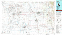
Lemon Cove, CA maps
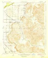
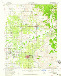
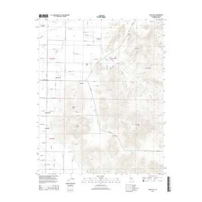
(22)- 1925 Map of Rocky Hill
 1925 Rocky Hill1925 Print · USGSTulare County in the mid-1920s reveals a sophisticated network of irrigation and electric rail servicing the eastern San Joaquin Valley. Researchers can trace early school sites like Lindcove School and the infrastructure of the Visalia Electric and Sides Siding.
 - 1927 Map of Rocky Hill
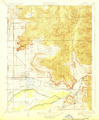
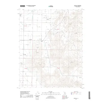
 1927 Rocky Hill1927 Print · USGSIn the late 1920s, this Tulare County landscape shows the intricate marriage of irrigation and rail that built the valley's citrus belt. Genealogists and historians can trace the exact locations of the Lind Cove School, the Merryman station, and the path of the Visalia Electric railroad.3 unique versions available
 - 1928 Map of Lemon Cove
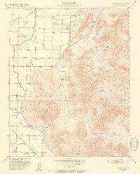
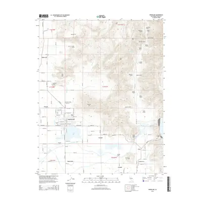
 1928 Lemon Cove1928 Print · USGSAgricultural Tulare County comes alive in the late 1920s, showing a network of citrus groves and irrigation. Trace local history through the Visalia Electric rail lines, Naranjo School, and the early layout of Lemon Cove.
 - 1948 Map of Fresno
 1948 Fresno1948 Print · USGSThe San Joaquin Valley and the High Sierra met during a period of rapid post-war growth and industrial expansion. Genealogists and researchers can trace family lines through small rail towns like Calwa City, find early aviation sites at Fresno-Chandler, or locate the Fresno Copper Mine.
 - 1951 Map of Rocky Hill, 1952 Print
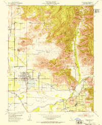
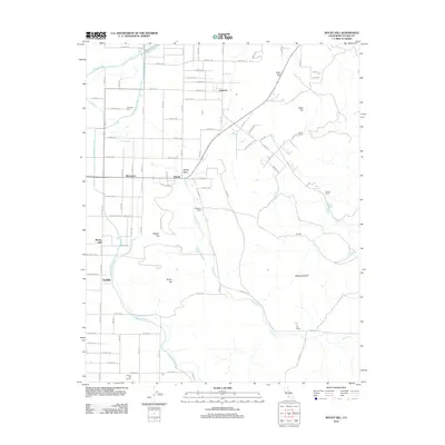
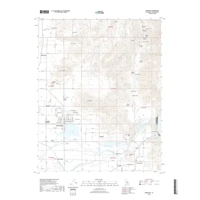
 1951 Rocky Hill1952 Print · USGSThe foothills of the Sierra Nevada meet the San Joaquin Valley in the early 1950s, revealing a landscape of intensive irrigation and rail transport. Researchers can locate the Dumtah Indian site, the Hamilton Cemetery, and several family ranches.5 unique versions available
 - 1952 Map of Woodlake, 1953 Print
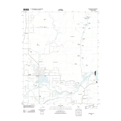
 1952 Woodlake1953 Print · USGSAgricultural growth and transit networks define this Tulare County landscape in the early fifties. Genealogists can trace family holdings and community hubs from Woodlake to Lemoncove, including the Antelope Cem and several rural schools like Sequoia Union Sch.4 unique versions available
 - 1952 Map of Exeter, 1959 Print
 1952 Exeter1959 Print · USGSMid-century Tulare County is defined by its massive irrigation networks and citrus towns. Trace the rail-and-canal economy through Exeter and Woodlake, finding old sites like Linnel PO and the Sequoia State Fish Hatchery.2 unique versions available
 - 1955 Map of Fresno
 1955 Fresno1955 Print · USGSThe Central Valley and High Sierra meet in this mid-fifties study of California’s agricultural and wilderness heart. Researchers can trace the rail-side growth of Sanger, Selma, and Reedley or locate high-altitude landmarks like Mt Whitney and Hume Lake.
 - 1956 Map of Fresno
 1956 Fresno1956 Print · USGSThe Central Valley and High Sierra meet in this mid-fifties survey of a rapidly developing California interior. Researchers can trace the rail-and-water networks of Visalia, the footprint of Tulare Lake, and the remote heights of Sequoia National Park.
 - 1958 Map of Fresno
 1958 Fresno1958 Print · USGSThe Central Valley and High Sierra meet in this mid-century survey of the California heartland. Researchers can trace the rail-and-road network connecting Fresno and Visalia or locate high-country landmarks like Mt Whitney and Sequoia National Park.
 - 1960 Map of Fresno
 1960 Fresno1960 Print · USGSThe San Joaquin Valley's mid-century agricultural boom meets the high peaks of the Sierra Nevada in this detailed survey. Genealogists and historians can trace the rail-driven growth of Fresno, Tulare, and Visalia or locate family roots in smaller towns like Raisin City and Calwa City.2 unique versions available
 - 1962 Map of Fresno, 1968 Print
 1962 Fresno1968 Print · USGSThe Central Valley and High Sierra meet in this mid-century survey, capturing the region's massive irrigation systems and mountain wilderness. Researchers can trace the rail corridors of the Southern Pacific and locate landmarks like the Tulare Lake Bed and Mount Whitney.3 unique versions available
 - 1966 Map of Fresno
 1966 Fresno1966 Print · USGSCentral California in the mid-1960s showcases a high-production agricultural valley rising into the granite peaks of the High Sierra. Researchers can trace irrigation networks, rail spurs like the Southern Pacific, and landmarks from Mount Whitney to the Lemoore Naval Air Station.
 - 1993 Map of Visalia
 1993 Visalia1993 Print · USGSThe San Joaquin Valley comes alive in the early nineties, showing a landscape defined by the Tulare Lake Bed and its vast network of canals. Trace family roots and local history near Santa Rosa Rancheria, Pixley Nat Wildlife Ref, and the Tulare Co Fairgrounds.2 unique versions available
 - 2012 Map of Woodlake, 2012 Print
 2012 Woodlake2012 Print · USGSCovers Lemon Cove, including Woodlake, Saint Johns, and other nearby areas
 - 2012 Map of Rocky Hill, 2012 Print
 2012 Rocky Hill2012 Print · USGSCovers Lemon Cove, including Tooleville, Lindcove, and other nearby areas
 - 2015 Map of Woodlake, 2015 Print
 2015 Woodlake2015 Print · USGSCovers Lemon Cove, including Woodlake, Saint Johns, and other nearby areas
 - 2015 Map of Rocky Hill, 2015 Print
 2015 Rocky Hill2015 Print · USGSCovers Lemon Cove, including Tooleville, Lindcove, and other nearby areas
 - 2018 Map of Rocky Hill, 2018 Print
 2018 Rocky Hill2018 Print · USGSCovers Lemon Cove, including Tooleville, Lindcove, and other nearby areas
 - 2018 Map of Woodlake, 2018 Print
 2018 Woodlake2018 Print · USGSCovers Lemon Cove, including Woodlake, Saint Johns, and other nearby areas
 - 2021 Map of Rocky Hill, 2021 Print
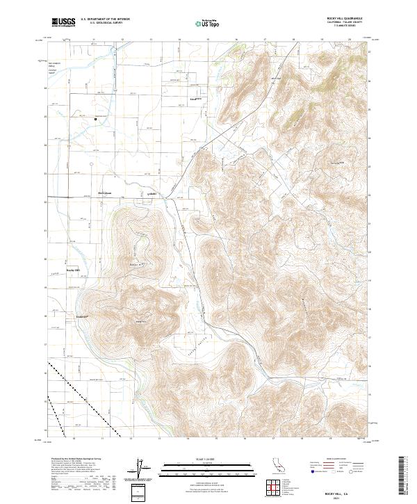 2021 Rocky Hill2021 Print · USGSTulare County sits at the edge of the great valley and the Sierra foothills in the early twenty-first century. Genealogists and hikers can trace the irrigation network of the Friant-Kern Canal or locate local landmarks like Hamilton Cem and Tooleville.
 - 2021 Map of Woodlake, 2021 Print
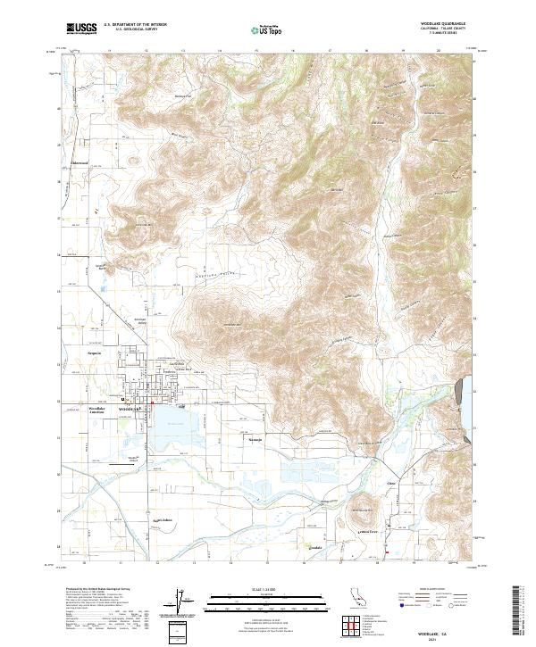 2021 Woodlake2021 Print · USGSWoodlake and the Kaweah River foothills are shown in detail during the early 2020s. Researchers can trace water infrastructure from Bravo Lake to the Friant-Kern Canal and locate family sites near Antelope Cem and Elderwood.
End of results
Showing maps 1-22 of 22
Top cities near Lemon Cove
- Visalia historical maps
- Exeter historical maps
- Lindsay historical maps
- Farmersville historical maps
- Woodlake historical maps
- Ivanhoe historical maps
See more
Top neighborhoods of Lemon Cove
Frequently asked questions
- What are the different types of historical maps available for Lemon Cove?
- What is the oldest map of Lemon Cove?
- Where can I purchase historical maps of Lemon Cove for my home or office?
- Where can I download high-res historical maps of Lemon Cove?
- Are there historical topographic maps available for Lemon Cove?
- Is there historical aerial imagery available for Lemon Cove?
- Where are historical maps of Lemon Cove sourced from?