Old Maps of Country Village, Aurora
Explore 15 old maps of Country Village, spanning from 1890 to today. These high-resolution historic maps reveal how streets, neighborhoods, landmarks, and natural features evolved over time — perfect for genealogy, metal detecting, research, and local history exploration.
What you can do with these maps:
- See how Country Village changed over time: Compare historical maps to modern-day views to trace roads, homesites, rail lines & more.
- View detailed metadata: Each map includes creators, publishers, year, scale, and archive source.
- Overlay maps with satellite & LiDAR: Visualize the past alongside modern tools to explore terrain & human change.
- Trusted historical sources: Maps sourced from the USGS, Library of Congress, and other archives.
- Access maps your way: View online, download high-res files, or order prints for personal or research use.
Start exploring old maps of Country Village to uncover forgotten places, hidden landmarks, and the deep history beneath your feet.
Country Village, Aurora maps
(15)- 1890 Map of East Denver
 1890 East Denver1890 Print · USGSDenver and the surrounding plains are captured in the late frontier era as a complex web of irrigation canals and iron rails. Researchers can trace early water systems like the High Line Ditch or locate early settlements such as Parker's and Scranton.
 - 1940 Map of Piney Creek
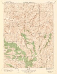
 1940 Piney Creek1940 Print · USGSThe High Plains of the late Depression era come to life here as the tri-county borders of Arapahoe, Douglas, and Elbert converge. Researchers can trace the rugged drainage patterns of Piney Creek, Sulphur Gulch, and Coal Creek before the landscape was altered by modern development.
 - 1942 Map of Piney Creek
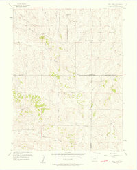
 1942 Piney Creek1942 Print · USGSThe Colorado high plains southeast of Denver appear as a quiet rural landscape in the early 1940s, just as modern infrastructure began to take shape. Genealogists and historians can trace the early drainage and road networks along Piney Creek, Sulphur Gulch, and Coal Creek.2 unique versions available
 - 1953 Map of Denver, 1964 Print
 1953 Denver1964 Print · USGSDenver and the Colorado Front Range are captured here during a decade of post-war growth and military expansion. Researchers can trace the sprawling rail lines of the Union Pacific, locate the State Capitol, and explore historic mountain mining hubs like Central City.6 unique versions available
 - 1957 Map of Denver
 1957 Denver1957 Print · USGSDenver and the Colorado Front Range are seen here during a mid-century period of intense military and urban expansion. Trace the footprints of the Rocky Mountain Arsenal, the early United States Air Force Academy, and the Lowry AF Base.
 - 1957 Map of Piney Creek, 1958 Print
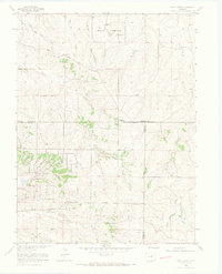
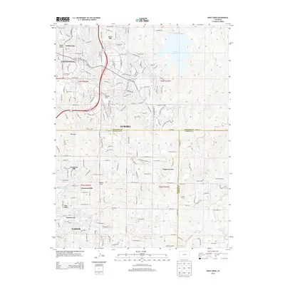
 1957 Piney Creek1958 Print · USGSThe high plains southeast of Denver appear here in the mid-fifties, dominated by the Lowry Air Force Base Bombing Range. Researchers can trace the historic Smoky Hill Road and locate a rural Cem near Sulphur Gulch.3 unique versions available
 - 1958 Map of Denver
 1958 Denver1958 Print · USGSDenver and the Colorado Front Range are captured here during the mid-century suburban boom. Trace the footprints of military installations like Buckley Air Force Base alongside the established rail networks of the Colorado & Southern Ry.
 - 1960 Map of Denver
 1960 Denver1960 Print · USGSDenver and the Colorado Front Range are seen here at a pivotal moment of postwar expansion into the plains and foothills. Researchers can trace the mid-century rail network of the Denver & Rio Grande Western RR and locate historic institutional landmarks like Buckley Field and the Colorado School of Mines.
 - 1966 Map of Piney Creek, 1967 Print
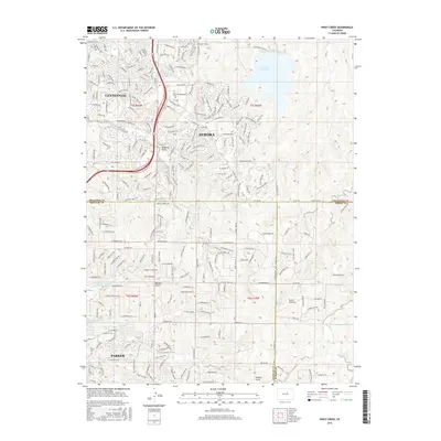
 1966 Piney Creek1967 Print · USGSArapahoe County underwent significant infrastructure planning in the mid-1960s as high plains ranching began to meet modern utility needs. Researchers can trace the Military Reservation, an old Cem, and the route of Smoky Hill Road.6 unique versions available
 - 1981 Map of Denver East
 1981 Denver East1981 Print · USGSEastern Colorado comes alive in the early eighties as the Front Range urban corridor pushes into the plains. Genealogists and historians can trace the growth of Aurora and Brighton alongside the historic Union Pacific line and the massive Rocky Mountain Arsenal.2 unique versions available
 - 2010 Map of Piney Creek, 2010 Print
 2010 Piney Creek2010 Print · USGSCovers Country Village, including Aurora, Centennial, and other nearby areas
 - 2013 Map of Piney Creek, 2013 Print
 2013 Piney Creek2013 Print · USGSCovers Country Village, including Aurora, Centennial, and other nearby areas
 - 2016 Map of Piney Creek, 2016 Print
 2016 Piney Creek2016 Print · USGSCovers Country Village, including Aurora, Centennial, and other nearby areas
 - 2019 Map of Piney Creek, 2019 Print
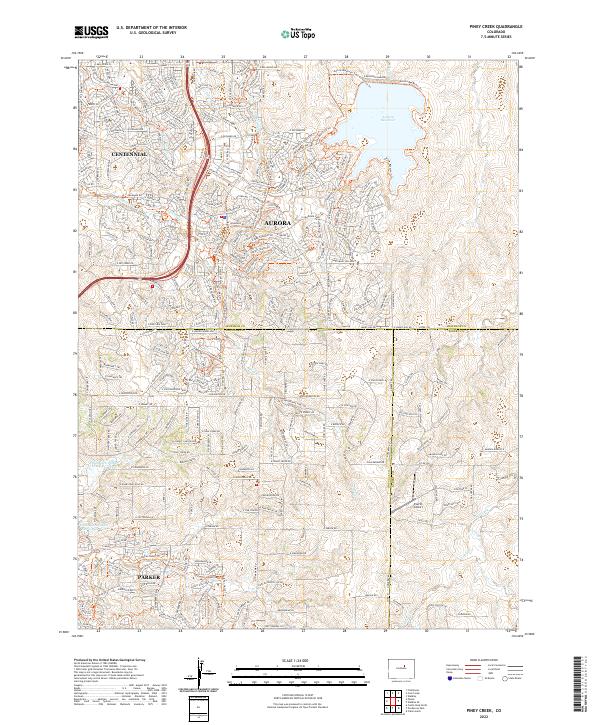
 2019 Piney Creek2019 Print · USGSCovers Country Village, including Aurora, Centennial, and other nearby areas
 - 2022 Map of Piney Creek, 2022 Print
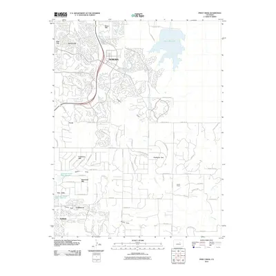
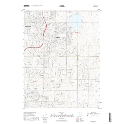
 2022 Piney Creek2022 Print · USGSThe suburbs of South Metro Denver were expanding rapidly across the Colorado Piedmont in the early 2020s. Researchers can trace the modern interface of development and landscape through the Aurora Reservoir, the Everitt Airport, and the Piney Creek Trl.
End of results
Showing maps 1-15 of 15
Frequently asked questions
- What are the different types of historical maps available for Country Village?
- What is the oldest map of Country Village?
- Where can I purchase historical maps of Country Village for my home or office?
- Where can I download high-res historical maps of Country Village?
- Are there historical topographic maps available for Country Village?
- Is there historical aerial imagery available for Country Village?
- Where are historical maps of Country Village sourced from?