1910s Maps of Buckingham Campground, Colorado
Explore 2 historic maps of Buckingham Campground from the 1910s. These maps offer a rare glimpse into what life looked like during the 1910s — showing old roads, neighborhoods, homes, and landmarks that have changed or disappeared over time.
Whether you're researching your family's past, planning a metal detecting trip, or studying how Buckingham Campground's landscape evolved across the 1910s, these high-resolution maps are a powerful tool for exploring the history of this region.
- Focus on a specific era: All maps on this page are from the 1910s, giving you a focused view of this time period.
- See what’s changed: Compare century-old streets, trails, and buildings to today's modern landscape using overlays and satellite layers.
- Research with precision: Use these maps for genealogy, historical research, land use analysis, or educational projects.
- View, download, or print: Maps are fully viewable online in high resolution, and can be downloaded or printed for your own records.
Start exploring Buckingham Campground's history through authentic maps from the 1910s. This is your window into the past.
Buckingham Campground, CO maps
(2)- 1910 Map of Central City, 1957 Print
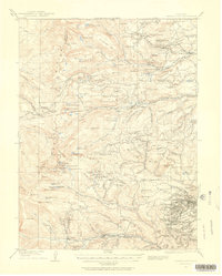 1910 Central City1957 Print · USGSThe Colorado high country at the start of the century reveals a landscape defined by mining booms and engineering marvels. Trace the intricate rail networks of the Colorado Southern RR or locate family roots in the historic camps of Nevadaville and Central City.2 unique versions available
 - 1912 Map of Central City
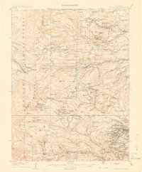 1912 Central City1912 Print · USGSThe Colorado Front Range mining districts were in full operation during this era of deep-shaft extraction and mountain railroading. Researchers can trace the industrial footprint of Central City, locate the Boulder County Mine, and follow the path of the Colorado and Southern RR through the gulches.4 unique versions available
End of results
Showing maps 1-2 of 2
Top cities near Buckingham Campground
- Nederland historical maps
- Fraser historical maps
- Tabernash historical maps
- Ward historical maps
- Black Hawk historical maps
Frequently asked questions
- What are the different types of historical maps available for Buckingham Campground?
- What is the oldest map of Buckingham Campground?
- Where can I purchase historical maps of Buckingham Campground for my home or office?
- Where can I download high-res historical maps of Buckingham Campground?
- Are there historical topographic maps available for Buckingham Campground?
- Is there historical aerial imagery available for Buckingham Campground?
- Where are historical maps of Buckingham Campground sourced from?