Old Maps of Buena Vista, Colorado for Genealogy
Trace your family roots with 20 historic maps of Buena Vista. These high-res maps reveal old neighborhoods, homesites, landmarks, and streets — helping you uncover where your ancestors lived and how the area evolved over time.
- Explore historic neighborhoods: Identify where your relatives may have lived in the 1800s or 1900s.
- Compare maps over time: Trace the changes in streets, buildings, and landmarks for multi-generational research.
- Perfect for genealogy & ancestry research: Used by family historians and researchers to map out lineage and migration.
These maps are an incredible resource for exploring your personal connection to Buena Vista's past.
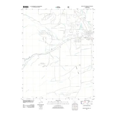
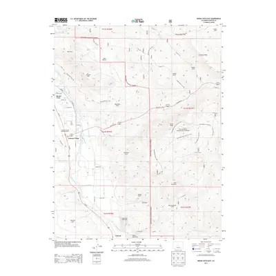
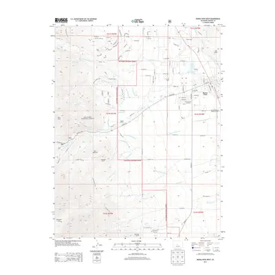
Buena Vista, CO maps
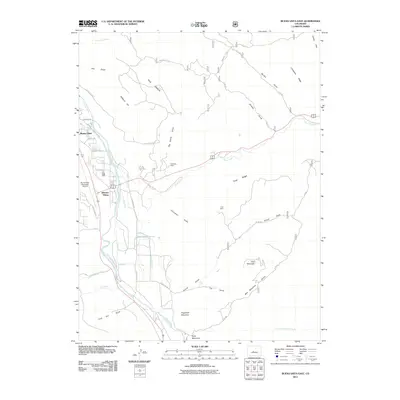
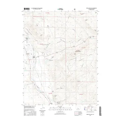
(20)- 1955 Map of Buena Vista, 1957 Print
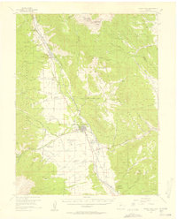 1955 Buena Vista1957 Print · USGSThe Upper Arkansas River Valley is captured here in the mid-fifties as it balances ranching, transit, and state institutions. Genealogists and historians can locate the Mt Olivet Cemetery, the Little Annie Mine, and rural schools like the Pine Creek School.8 unique versions available
 - 1956 Map of Montrose, 1963 Print
 1956 Montrose1963 Print · USGSThe Colorado western slope in the late fifties and early sixties shows a landscape defined by the Denver & Rio Grande Western RR and the Gunnison River. Trace the development of Blue Mesa Reservoir or locate high-country sites like the Bachelor Mine.3 unique versions available
 - 1959 Map of Montrose
 1959 Montrose1959 Print · USGSWestern Colorado in the late fifties is defined by the high peaks and river valleys of the Southern Rockies. Genealogists and historians can trace the paths of the Denver & Rio Grande Western RR or locate mountain settlements like Crawford, Lazear, and Doyleville.
 - 1960 Map of Montrose
 1960 Montrose1960 Print · USGSThe Colorado high country in the mid-fifties is captured here during a period of steady ranching and persistent mining. Researchers can trace the path of the Denver & Rio Grande Western RR or locate small settlements like Somerset, Maher, and Sargent.2 unique versions available
 - 1968 Map of Montrose
 1968 Montrose1968 Print · USGSThe Western Slope and Continental Divide meet in the late sixties, showing the vital river valleys and high-mountain mining districts. Trace the historic route of the Denver and Rio Grande Western RR or locate small settlements like Sargents and Powderhorn.
 - 1982 Map of Buena Vista West, 1983 Print
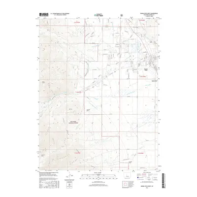
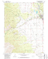 1982 Buena Vista West1983 Print · USGSBuena Vista is documented here in the early 1980s as a thriving mountain hub between the river and the peaks. Researchers can trace historic family sites at Mt Olivet Cem, locate the Cottonwood Hot Springs, or follow the Old Railroad Grade north along the river.4 unique versions available
 - 1983 Map of Buena Vista East
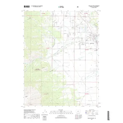
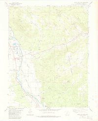 1983 Buena Vista East1983 Print · USGSUpper Arkansas Valley life in the early eighties is centered around the river and rail lines between Buena Vista and Nathrop. Researchers can trace industrial and civic history at the State Reformatory, the Nellie Bly Mine, and the Old Railroad Grade.2 unique versions available
 - 1984 Map of Gunnison
 1984 Gunnison1984 Print · USGSHigh mountain passes and historic mining districts define this mid-eighties record of the central Colorado Rockies. Genealogists and historians can trace the foundations of Gunnison and Crested Butte or locate remote sites like St Elmo, Tincup, and Hancock.2 unique versions available
 - 1994 Map of Buena Vista East, 1998 Print
 1994 Buena Vista East1998 Print · USGSThe Arkansas River valley during the late twentieth century reveals a landscape defined by irrigation and high-altitude mining. Researchers can trace historic water routes like the Helena Ditch and find industrial landmarks from Johnson Village to the Triad Mine.
 - 1994 Map of Buena Vista West, 1998 Print
 1994 Buena Vista West1998 Print · USGSBuena Vista and the Chaffee County high country are captured here in the mid-1990s as the town expanded toward the mountains. Researchers can trace historic water rights via the Mary Ditch, locate the Mt Olivet Cem, or explore mining history at the Latchaw Mine.
 - 2011 Map of Buena Vista East, 2011 Print
 2011 Buena Vista East2011 Print · USGSCovers Buena Vista, including Johnson Village, Chaffee County, and other nearby areas
 - 2011 Map of Buena Vista West, 2011 Print
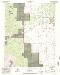
 2011 Buena Vista West2011 Print · USGSCovers Buena Vista, including Chaffee County, United States, and other nearby areas
 - 2013 Map of Buena Vista East, 2013 Print
 2013 Buena Vista East2013 Print · USGSCovers Buena Vista, including Johnson Village, Chaffee County, and other nearby areas
 - 2013 Map of Buena Vista West, 2013 Print
 2013 Buena Vista West2013 Print · USGSCovers Buena Vista, including Chaffee County, United States, and other nearby areas
 - 2016 Map of Buena Vista East, 2016 Print
 2016 Buena Vista East2016 Print · USGSCovers Buena Vista, including Johnson Village, Chaffee County, and other nearby areas
 - 2016 Map of Buena Vista West, 2016 Print
 2016 Buena Vista West2016 Print · USGSCovers Buena Vista, including Chaffee County, United States, and other nearby areas
 - 2019 Map of Buena Vista West, 2019 Print
 2019 Buena Vista West2019 Print · USGSCovers Buena Vista, including Chaffee County, United States, and other nearby areas
 - 2019 Map of Buena Vista East, 2019 Print
 2019 Buena Vista East2019 Print · USGSCovers Buena Vista, including Johnson Village, Chaffee County, and other nearby areas
 - 2022 Map of Buena Vista East, 2022 Print
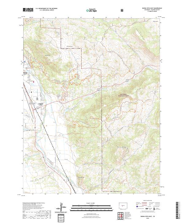 2022 Buena Vista East2022 Print · USGSThe Arkansas River valley east of Buena Vista comes into sharp focus during the early twenty-first century. Researchers can trace the complex irrigation systems of Helena Ditch or follow forest trails near Sugarloaf Mtn and Johnson Village.
 - 2022 Map of Buena Vista West, 2022 Print
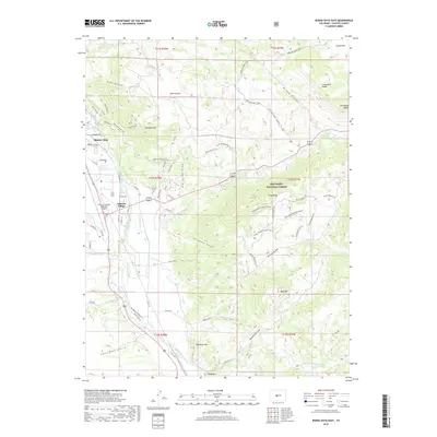
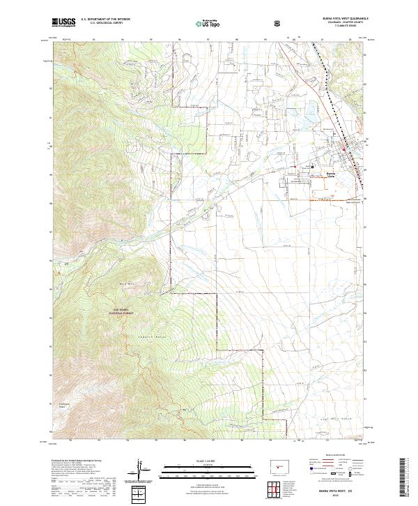 2022 Buena Vista West2022 Print · USGSThe high Sawatch Range meets the Arkansas River valley in this detailed Chaffee County study from the early 2020s. Genealogists and local historians can trace the irrigation network of McKenna Ditch, locate Mount Olivet Cem, and explore the layout of Buena Vista.
End of results
Showing maps 1-20 of 20
Top cities near Buena Vista
Top neighborhoods of Buena Vista
Frequently asked questions
- What are the different types of historical maps available for Buena Vista?
- What is the oldest map of Buena Vista?
- Where can I purchase historical maps of Buena Vista for my home or office?
- Where can I download high-res historical maps of Buena Vista?
- Are there historical topographic maps available for Buena Vista?
- Is there historical aerial imagery available for Buena Vista?
- Where are historical maps of Buena Vista sourced from?