1940s Maps of Ponderosa Park, Colorado
Explore 1 historic maps of Ponderosa Park from the 1940s. These maps offer a rare glimpse into what life looked like during the 1940s — showing old roads, neighborhoods, homes, and landmarks that have changed or disappeared over time.
Whether you're researching your family's past, planning a metal detecting trip, or studying how Ponderosa Park's landscape evolved across the 1940s, these high-resolution maps are a powerful tool for exploring the history of this region.
- Focus on a specific era: All maps on this page are from the 1940s, giving you a focused view of this time period.
- See what’s changed: Compare century-old streets, trails, and buildings to today's modern landscape using overlays and satellite layers.
- Research with precision: Use these maps for genealogy, historical research, land use analysis, or educational projects.
- View, download, or print: Maps are fully viewable online in high resolution, and can be downloaded or printed for your own records.
Start exploring Ponderosa Park's history through authentic maps from the 1940s. This is your window into the past.
Ponderosa Park, CO maps
(1)- 1945 Map of Elizabeth
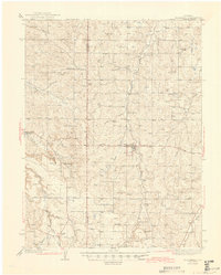 1945 Elizabeth1945 Print · USGSThe ranching and mining country along the Douglas and Elbert county line comes to life in this mid-century survey. Genealogists can trace family landmarks like the Idelweiss Ranch, Miller Cem, and the notable Site of Gold Discovery by Russell.2 unique versions available
End of results
Showing maps 1-1 of 1
Top cities near Ponderosa Park
- Aurora historical maps
- Centennial historical maps
- Castle Rock historical maps
- Parker historical maps
- Greenwood Village historical maps
- Lone Tree historical maps
See more
Frequently asked questions
- What are the different types of historical maps available for Ponderosa Park?
- What is the oldest map of Ponderosa Park?
- Where can I purchase historical maps of Ponderosa Park for my home or office?
- Where can I download high-res historical maps of Ponderosa Park?
- Are there historical topographic maps available for Ponderosa Park?
- Is there historical aerial imagery available for Ponderosa Park?
- Where are historical maps of Ponderosa Park sourced from?