Old Maps of Howardsville, Colorado
Explore 18 old maps of Howardsville, spanning from 1897 to today. These high-resolution historic maps reveal how streets, neighborhoods, landmarks, and natural features evolved over time — perfect for genealogy, metal detecting, research, and local history exploration.
What you can do with these maps:
- See how Howardsville changed over time: Compare historical maps to modern-day views to trace roads, homesites, rail lines & more.
- View detailed metadata: Each map includes creators, publishers, year, scale, and archive source.
- Overlay maps with satellite & LiDAR: Visualize the past alongside modern tools to explore terrain & human change.
- Trusted historical sources: Maps sourced from the USGS, Library of Congress, and other archives.
- Access maps your way: View online, download high-res files, or order prints for personal or research use.
Start exploring old maps of Howardsville to uncover forgotten places, hidden landmarks, and the deep history beneath your feet.
Howardsville, CO maps
(18)- 1897 Map of Silverton
 1897 Silverton1897 Print · USGSSilverton and its surrounding mining camps are captured at their industrial peak in the mid-1890s. Trace the intricate rail networks like the Silverton and Red Mountain R.R. and locate family-named operations like the Yankee Girl Mine or Stoiber Smelter.2 unique versions available
 - 1901 Map of Silverton, 1957 Print
 1901 Silverton1957 Print · USGSSilverton was the bustling center of the San Juan silver boom when these mountain railroads were at their peak. Genealogists and historians can trace the high-altitude rail lines to remote camps like Animas Forks, Guston, and Red Mountain.
 - 1902 Map of Silverton
 1902 Silverton1902 Print · USGSSilverton and its surrounding high-country mining camps are captured here during the peak of the San Juan mountain silver boom. Genealogists and industrial historians can trace the paths of the Silverton Northern R.R. to remote outposts like Animas Forks, Eureka, and the Sunnyside Mill.4 unique versions available
 - 1945 Map of Durango
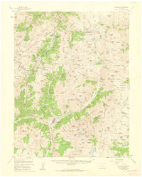
 1945 Durango1945 Print · USGSSouthwest Colorado and Northern New Mexico at mid-century are defined by the high peaks of the San Juan Range and the tribal lands of the Southern Ute. Genealogists and historians can trace the paths of the D & R G W RR and locate local landmarks like Animas City and the Blanco Basin School.3 unique versions available
 - 1953 Map of Durango, 1963 Print
 1953 Durango1963 Print · USGSThe high peaks of the San Juan Mountains and the Colorado mining country are shown here as they appeared in the early fifties. Genealogists and local historians can trace the rail lines of the D & R G W RR and locate historic mining camps like Silverton, Ouray, and Old Ophir.
 - 1954 Map of Durango
 1954 Durango1954 Print · USGSSouthern Colorado in the mid-1950s was defined by high-altitude mining towns and the expansion of water storage in the San Luis Valley. Trace the narrow-gauge Denver & Rio Grande Western RR as it connects Durango to mountain outposts like Silverton and Creede.2 unique versions available
 - 1955 Map of Howardsville, 1957 Print
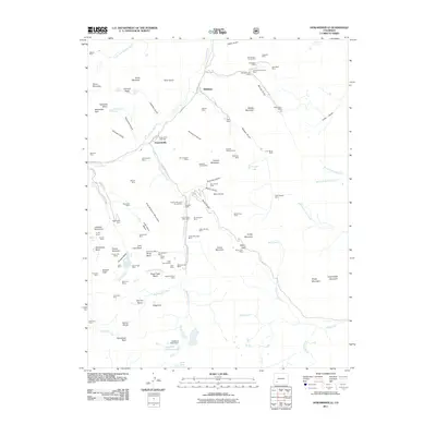
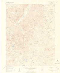 1955 Howardsville1957 Print · USGSThe San Juan high country in the mid-1950s reveals a landscape still thick with the infrastructure of the mining boom. Researchers can trace the path of numerous aerial tramways connecting the Animas River valley to storied sites like the Old Hundred Mine and Silver Lake Mine.8 unique versions available
 - 1955 Map of Silverton, 1960 Print
 1955 Silverton1960 Print · USGSSilverton and the high San Juans are shown at a peak of mid-century mining activity, linked by rail and the mountain-hugging Million Dollar Highway. Researchers can trace historic claims and infrastructure from the Mayflower Mill to the remote Eureka and Howardsville town sites.3 unique versions available
 - 1961 Map of Durango
 1961 Durango1961 Print · USGSThe high San Juan country in the early sixties is shown here as a network of historic mining towns and early reservoir projects. Genealogists and researchers can trace the Denver & Rio Grande Western RR as it connects Durango, Silverton, and Arboles.
 - 1963 Map of Durango
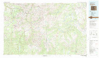
 1963 Durango1963 Print · USGSThe San Juan Mountains and San Luis Valley are captured here in the early 1950s as mining, rail, and tribal lands shaped the region. Researchers can trace the Denver & Rio Grande Western RR through high-country towns like Telluride and Silverton, or locate landmarks such as the Asiatic Mine.
 - 1966 Map of Durango
 1966 Durango1966 Print · USGSSouthwestern Colorado and the New Mexico borderlands are shown here in the mid-1960s, a time when the narrow-gauge rail network still tied the high peaks to the valley floor. Researchers can trace the Denver & Rio Grande Western Railroad between settlements like Silverton, Antonito, and Pagosa Springs.2 unique versions available
 - 1982 Map of Silverton, 1983 Print
 1982 Silverton1983 Print · USGSThe San Juan Mountains were entering a new era in the early eighties as mining heritage met growing wilderness preservation. Researchers can trace historic claims and mountain rail routes through Silverton, Telluride, and the high-altitude Sunnyside Mine.3 unique versions available
 - 2001 Map of Howardsville, 2005 Print
 2001 Howardsville2005 Print · USGSThe high San Juan Mountains are shown here at the turn of the millennium, documenting a landscape where historic mining claims meet federal wilderness. Researchers can trace the legacy of the silver boom through numerous sites like the Old Hundred Mine, Howardsville Cem, and the Pride of the West Mill.
 - 2011 Map of Howardsville, 2011 Print
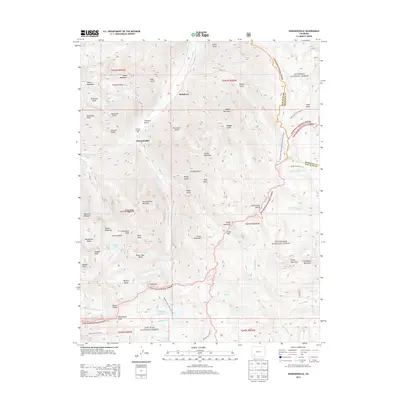
 2011 Howardsville2011 Print · USGSCovers Howardsville, including Middleton, San Juan County, and other nearby areas
 - 2013 Map of Howardsville, 2013 Print
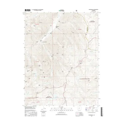
 2013 Howardsville2013 Print · USGSCovers Howardsville, including Middleton, San Juan County, and other nearby areas
 - 2016 Map of Howardsville, 2016 Print
 2016 Howardsville2016 Print · USGSCovers Howardsville, including Middleton, San Juan County, and other nearby areas
 - 2019 Map of Howardsville, 2019 Print
 2019 Howardsville2019 Print · USGSCovers Howardsville, including Middleton, San Juan County, and other nearby areas
 - 2022 Map of Howardsville, 2022 Print
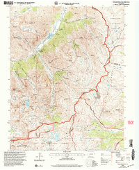
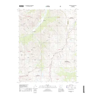
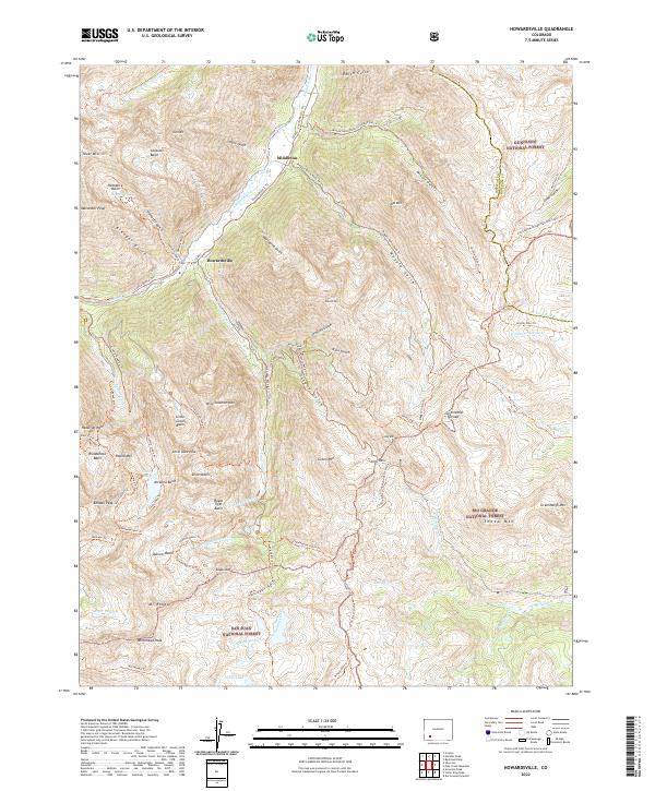 2022 Howardsville2022 Print · USGSThe high San Juan peaks and headwaters of the Animas River are mapped here in the modern era. Local history researchers can trace the old road networks through Howardsville and Middleton or locate remote alpine landmarks like Silver Lake and Stony Pass.
End of results
Showing maps 1-18 of 18
Top cities near Howardsville
Frequently asked questions
- What are the different types of historical maps available for Howardsville?
- What is the oldest map of Howardsville?
- Where can I purchase historical maps of Howardsville for my home or office?
- Where can I download high-res historical maps of Howardsville?
- Are there historical topographic maps available for Howardsville?
- Is there historical aerial imagery available for Howardsville?
- Where are historical maps of Howardsville sourced from?